Aragats, Aragatsotn
Coordinates: 40°29′19″N 44°21′16″E / 40.48861°N 44.35444°E
| Aragats Արագած | |
|---|---|
 Aragats | |
| Coordinates: 40°29′19″N 44°21′16″E / 40.48861°N 44.35444°E | |
| Country | Armenia |
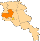
| Marz (Province) | Aragatsotn |
| Population (2008) | |
| • Total | 2,940 |
| Time zone | UTC+4 ( ) |
Aragats (Armenian: Արագած); known as Ghaznafar until 1948, is a village in the eastern part of the Aragatsotn Province of Armenia.
See also
References
- Aragats, Aragatsotn at GEOnet Names Server
- World Gazetteer: Armenia – World-Gazetteer.com
- Report of the results of the 2001 Armenian Census, National Statistical Service of the Republic of Armenia
- Kiesling, Rediscovering Armenia, p. 21, available online at the US embassy to Armenia's website
This article is issued from
Wikipedia.
The text is licensed under Creative Commons - Attribution - Sharealike.
Additional terms may apply for the media files.