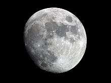
Apianus (crater)
 Lunar Orbiter 4 image | |
| Coordinates | 26°54′S 7°54′E / 26.9°S 7.9°ECoordinates: 26°54′S 7°54′E / 26.9°S 7.9°E |
|---|---|
| Diameter | 63.44 km |
| Depth | 2.08 km |
| Colongitude | 356° at sunrise |
| Eponym | Petrus Apianus |
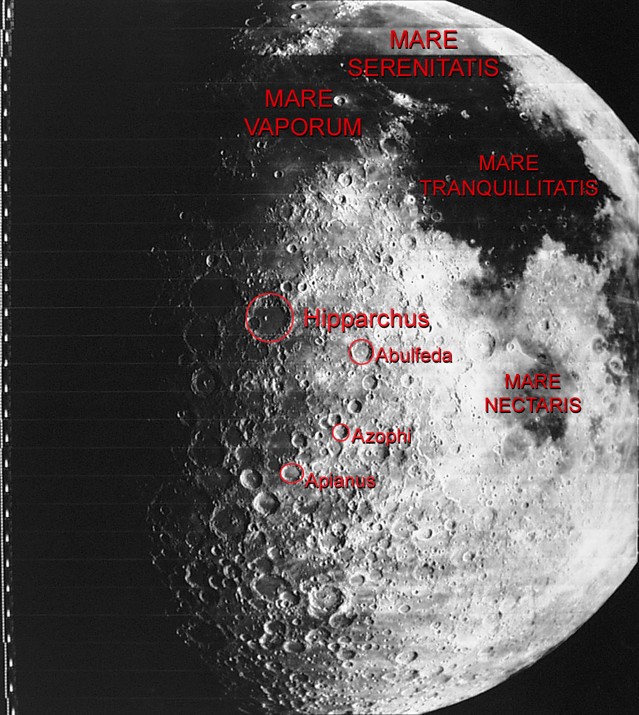
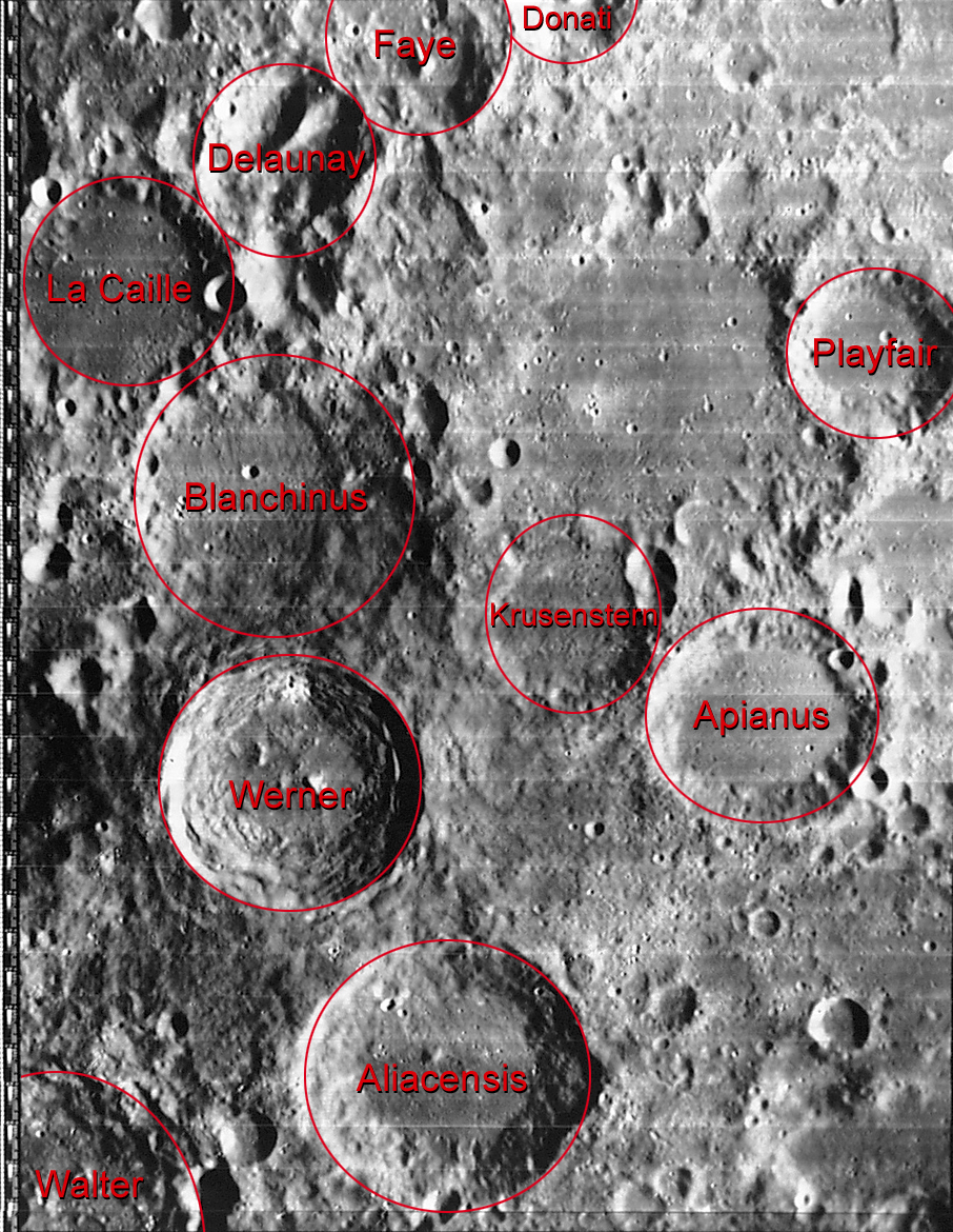
Apianus is a lunar impact crater that is located on the rugged south-central highlands of the Moon.[1] It is located to the northeast of the crater Aliacensis, and to the northwest of Poisson, further north is Playfair. The worn crater Krusenstern is attached to the west-northwestern rim.
Description
The outer wall of the crater has been worn and eroded by subsequent impacts, and a pair of small craterlets overlay the rim to the southeast and northeast. The central crater is 63 kilometers in diameter and 2,080 meters deep.[2] The craterlet on the southeast rim, Apianus B, is a member of a cluster of co-joined craterlets that includes Apianus T and Apianus U. The interior floor of the central crater is relatively smooth and lacks a central peak, although the surface appears somewhat convex. Only a few tiny craterlets mark the surface.[3]
A variety of other nearby craters and craterlets belong to Apianus.
The crater is from the Nectarian period, 3.92 to 3.85 billion years ago.[2]
Names
Apianus is named after 16th century German mathematician and astronomer Petrus Apianus.,[2] it was given its name by Giovanni Riccioli, whose 1651 nomenclature system has become standardized.[4][5] The name applies as official international standard since 1935 and is registered at the International Astronomical Union (IAU).[6] Earlier lunar cartographers had given the feature different names. Michael van Langren's 1645 map calls it "Lennoxis" after a Duke of Lennox of the early 17th century.[7][8] And Johannes Hevelius called it "Cydises Mons" of the ancient world.[9][10]
Satellite craters

By convention these features are identified on lunar maps by placing the letter on the side of the crater midpoint that is closest to Apianus.[11]
| Apianus | Latitude | Longitude | Diameter | Ref |
|---|---|---|---|---|
| A | 25.7° S | 6.6° E | 13.11 km | WGPSN |
| B | 27.4° S | 9.0° E | 10.21 km | WGPSN |
| C | 28.1° S | 10.5° E | 19.64 km | WGPSN |
| D | 26.1° S | 10.7° E | 33.66 km | WGPSN |
| E | 28.8° S | 8.2° E | 8.39 km | WGPSN |
| F | 28.1° S | 6.4° E | 5.39 km | WGPSN |
| G | 28.1° S | 7.7° E | 4.02 km | WGPSN |
| H | 28.1° S | 8.7° E | 6.57 km | WGPSN |
| J | 26.3° S | 8.6° E | 6.71 km | WGPSN |
| K | 27.4° S | 9.3° E | 6.44 km | WGPSN |
| L | 29.1° S | 10.9° E | 4.67 km | WGPSN |
| M | 24.7° S | 10.3° E | 6.98 km | WGPSN |
| N | 28.8° S | 9.9° E | 3.46 km | WGPSN |
| P | 25.2° S | 9.2° E | 41.59 km | WGPSN |
| R | 25.7° S | 8.9° E | 13.1 km | WGPSN |
| S | 25.6° S | 8.5° E | 23.96 km | WGPSN |
| T | 27.7° S | 9.5° E | 11.52 km | WGPSN |
| U | 27.9° S | 9.0° E | 16.82 km | WGPSN |
| V | 25.3° S | 10.5° E | 3.2 km | WGPSN |
| W | 25.5° S | 7.4° E | 9.68 km | WGPSN |
| X | 28.3° S | 7.1° E | 3.1 km | WGPSN |
See also
- 19139 Apian, asteroid
References
- ↑ "Apianus (crater)". Gazetteer of Planetary Nomenclature. USGS Astrogeology Research Program.
- 1 2 3 Autostar Suite Astronomer Edition. CD-ROM. Meade, April 2006.
- ↑ Rükl, Antonín (1990). Atlas of the Moon. Kalmbach Books. ISBN 0-913135-17-8.
- ↑ Ewen A. Whitaker, Mapping and Naming the Moon (Cambridge University Press, 1999), p.61.
- ↑ Riccioli map of the Moon (1651)
- ↑ M. A. Blagg; K. Müller; W. H. Wesley; S. A. Saunder; J. H. G. Franz (1935). Named Lunar Formations. London: Percy Lund, Humphries & Co. Ltd.
- ↑ Ewen A. Whitaker, Mapping and Naming the Moon (Cambridge University Press, 1999), p. 198.
- ↑ Langrenus map of the Moon (1645)
- ↑ Ewen A. Whitaker, Mapping and Naming the Moon (Cambridge University Press, 1999), p. 204.
- ↑ Hevelius map of the Moon (1647)
- ↑ Bussey, B.; Spudis, P. (2004). The Clementine Atlas of the Moon. New York: Cambridge University Press. ISBN 0-521-81528-2.
External links
| Wikimedia Commons has media related to Apianus (crater). |
- Crater Apianus in the Gazetteer of Planetary Nomenclature of the Astrogeology Research Program of the United States Geological Survey
- Crater Apianus: Lunar Map LAC-95 of the Aeronautical Chart and Information Center of the United States Air Force in the Lunar Map Catalog of the Lunar and Planetary Institute
- Crater Apianus: Available Lunar Maps according to the Astrogeology Research Program of the United States Geological Survey
- Crater Apianus in the Digital Lunar Orbiter Photographic Atlas of the Moon of the Lunar and Planetary Institute - Image IV-095-H3
- Crater Apianus in the Digital Lunar Orbiter Photographic Atlas of the Moon of the Lunar and Planetary Institute - Image IV-096-H1
- Crater Apianus in the Digital Lunar Orbiter Photographic Atlas of the Moon of the Lunar and Planetary Institute - Image IV-096-M
- Crater Apianus in the Digital Lunar Orbiter Photographic Atlas of the Moon of the Lunar and Planetary Institute - Image IV-100-H3
- Crater Apianus in the Digital Lunar Orbiter Photographic Atlas of the Moon of the Lunar and Planetary Institute - Image IV-101-H1