Agrippa (crater)
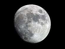
 Lunar Orbiter 4 image | |
| Coordinates | 4°06′N 10°30′E / 4.1°N 10.5°ECoordinates: 4°06′N 10°30′E / 4.1°N 10.5°E |
|---|---|
| Diameter | 46 km (29 mi) |
| Depth | 3.1 km (1.9 mi) |
| Colongitude | 350° at sunrise |
| Eponym | Agrippa |


Agrippa is a lunar impact crater that is located at the southeast edge of the Mare Vaporum. It is located more than 30 kilometres (19 mi) north of the crater Godin, the irregular Tempel lies just to the east and is about 70 km (43 mi) east of Dembowski. To the north and northeast, the rille designated Rima Ariadaeus follows a course to the east-southeast, reaching the western edge of Mare Tranquillitatis. It is named after the 1st century Greek astronomer Agrippa.[1]
Its diameter is 46 km (29 mi) long and is 3,100 metres (10,200 ft; 1.9 mi) deep. Also, the area is more than 1,500 km2 (580 sq mi) and the perimeter is around 150 km (90 mi).
The rim of Agrippa has an unusual shape, resembling the form of a shield with a rounded southern rim and a more angular northern half. The interior is somewhat irregular, with a central rise at the midpoint.[2] The crater is from the Eratosthenian period, which lasted from 3.2 to 1.1 billion years ago.[1]
From that location the Earth would appear in the lunar sky at over 4 degrees from the top and it is seen more than 10 degrees towards the west. Also the sun rises slightly after the Earth is half shined as well as when the sun sets, first before the last quarter and the second after the first quarter.
Satellite craters
By convention these features are identified on lunar maps by placing the letter on the side of the crater midpoint that is closest to Agrippa.[3] Agrippa B is to the north, Agrippa D and G are further west, Agrippa E is nearly northwest which is attached to another satellite crater Agrippa S, Agrippa F is not far to the east and Agrippa H is north-northeast touching the main crater.
| Agrippa | Latitude | Longitude | Diameter | |
|---|---|---|---|---|
| km | mi | |||
| B | 6.2° N | 9.4° E | 4 | 2.5 |
| D | 3.8° N | 6.7° E | 20 | 12.4 |
| E | 5.2° N | 8.5° E | 5 | 3.1 |
| F | 4.4° N | 11.4° E | 6 | 3.7 |
| G | 3.9° N | 6.2° E | 13 | 8.1 |
| H | 4.8° N | 10.7° E | 6 | 3.7 |
| S | 5.3° N | 8.9° E | 32 | 19.9 |
References
- 1 2 Autostar Suite Astronomer Edition. CD-ROM. Meade, April 2006.
- ↑ Rükl, Antonín (1990). Atlas of the Moon. Kalmbach Books. ISBN 0-913135-17-8.
- ↑ Bussey, B.; Spudis, P. (2004). The Clementine Atlas of the Moon. New York: Cambridge University Press. ISBN 0-521-81528-2.
External links
| Wikimedia Commons has media related to Agrippa (crater). |
Other articles
- Wood, Chuck (February 17, 2006). "Wall Stories". Lunar Photo of the Day. Archived from the original on July 3, 2015. , regarding Agrippa and Godin craters
- Wood, Chuck (July 29, 2006). "A Mouth Lover's View of the Moon, depicts pictures drawn in 1872". Lunar Photo of the Day. Archived from the original on June 14, 2011. , regarding Agrippa, Godin, Torricelli and Eratosthenes craters