Aotea Harbour
| Aotea Harbour | |
|---|---|
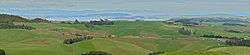 Aotea Harbour and Taranaki (150km away faint towards right) from Houchens Rd, Te Mata | |
 Aotea Harbour | |
| Coordinates: 37°59′S 174°51′E / 37.983°S 174.850°E | |
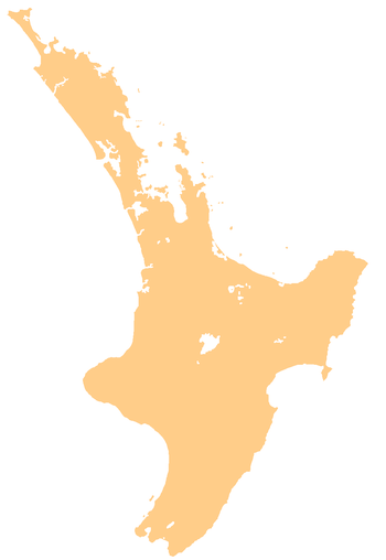
| Country | New Zealand |
| Region | Waikato Region |
| Districts |
Waikato District Otorohanga District |
| Population | |
| • Total | 1,896 (2,013) |
| River sources | Pakoka River |
| Ocean/sea sources | Tasman Sea |
| Basin countries | New Zealand |
| Max. length | 6 km (3.7 mi) |
| Max. width | 6 km (3.7 mi) |
| Surface area | 31.9 km2 (12.3 sq mi) |

Aotea Harbour is a settlement and smallest of three large natural inlets in the Tasman Sea coast of the Waikato region of New Zealand's North Island.[1] It is located between Raglan Harbour to the north and Kawhia Harbour to the south, 30 kilometres southwest of Hamilton. 54% of the area around the harbour is in sheep and beef grazing. Since 1850 native forest cover has declined from 98% to 28%, about 18% managed by the Department of Conservation.[1]
Aotea Harbour is a drowned valley system following the post glacial Aranuian sea level rise of over 100m in the last 14,000 years, but its level may also be influenced by the Makomako and Te Maari faults.[2] It has a high-tide area of 32 km2 (12 sq mi) and a low-tide area of 6 km2 (2.3 sq mi),[3]
Bridal Veil Falls is located on Pakoka River, and Lake Disappear is on Pakihi Stream, both of which flow into Aotea Harbour.
References
- 1 2 http://www.waikatoregion.govt.nz/PageFiles/1188/Shore%20Futures%20Report%20FINAL%20WEB09.pdf
- ↑ Geology of the Raglan-Kawhia Area: Institute of Geological & Nuclear Sciences (N.Z.), Barry Clayton Waterhouse, P. J. White 1994 ISBN 0-478-08837-X
- ↑ "Waikato Regional Council Technical Report 2016/19 - Mapping residence times in west coast estuaries of the Waikato region" (PDF). 2016.
External links
- history, geology, flora, fauna, environment and planning
- 1:50,000 map
- 1864 1:700,000 geology map
- 1925 1:63,360 geology maps - north and south (to enlarge follow the 'original record' link)
- Landcare Research map of original vegetation, etc.
- vegetation around the edge of the harbour
- archaeology map
- large pa site with photos
- 1854 direction for ships finding the harbour
- water quality
- beachcare group planting
- toxic elements are low
- 2,635ha farm northwest of harbour