Anhée
| Anhée | ||
|---|---|---|
| Municipality | ||
 St. Martin's Church | ||
| ||
 Anhée Location in Belgium
Location of Anhée in Namur province  | ||
| Coordinates: 50°19′N 04°53′E / 50.317°N 4.883°ECoordinates: 50°19′N 04°53′E / 50.317°N 4.883°E | ||
| Country | Belgium | |
| Community | French Community | |
| Region | Wallonia | |
| Province | Namur | |
| Arrondissement | Dinant | |
| Government | ||
| • Mayor | Luc Piette | |
| • Governing party/ies | IC | |
| Area | ||
| • Total | 65.67 km2 (25.36 sq mi) | |
| Population (1 January 2017)[1] | ||
| • Total | 7,139 | |
| • Density | 110/km2 (280/sq mi) | |
| Postal codes | 5537 | |
| Area codes | 082 | |
| Website | www.anhee.be | |

Anhée (French pronunciation: [ɑ̃.e] ; Walloon: Anhêye) is a Walloon municipality located in the Belgian province of Namur. It consists of the villages Anhée, Annevoie-Rouillon, Bioul, Denée, Haut-le-Wastia, Sosoye and Warnant.
On 1 January 2006 the municipality had 6,934 inhabitants. The total area is 65.67 km², giving a population density of 106 inhabitants per km².
The village of Bioul contains Vaxelaire Castle (Château Vaxelaire).
.JPG)
Vaxelaire Castle in Bioul
See also
References
- ↑ Population per municipality as of 1 January 2017 (XLS; 397 KB)
External links

- Official website
Places adjacent to Anhée | ||||||||||
|---|---|---|---|---|---|---|---|---|---|---|
| ||||||||||
Municipalities in the Province of Namur | ||
|---|---|---|
| Dinant | 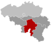 | |
| Namur | ||
| Philippeville | ||
This article is issued from
Wikipedia.
The text is licensed under Creative Commons - Attribution - Sharealike.
Additional terms may apply for the media files.