Yan Ta Khao District
| Yan Ta Khao ย่านตาขาว | |
|---|---|
| Amphoe | |
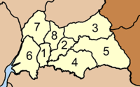
 Amphoe location in Trang Province | |
| Coordinates: 7°23′12″N 99°40′0″E / 7.38667°N 99.66667°ECoordinates: 7°23′12″N 99°40′0″E / 7.38667°N 99.66667°E | |
| Country | Thailand |
| Province | Trang |
| Seat | Yan Ta Khao |
| Area | |
| • Total | 431.1 km2 (166.4 sq mi) |
| Population (2005) | |
| • Total | 61,416 |
| • Density | 142.5/km2 (369/sq mi) |
| Time zone | UTC+7 (ICT) |
| Postal code | 92140 |
| Geocode | 9203 |
Yan Ta Khao (Thai: ย่านตาขาว, pronounced [jâːn tāː kʰǎːw]) is a district (amphoe) of Trang Province, Thailand.
Geography
Neighboring districts are (from the south clockwise) Palian, Kantang, Mueang Trang and Na Yong of Trang Province, Srinagarindra and Kong Ra of Phatthalung Province.
History
The minor district (king amphoe) Yan Ta Khao was created on 1 January 1948 as a subordinate of Kantang District. Originally it consisted of six tambon: Yan Ta Khao, Nong Bo, and Thung Khai were split off from Kantang Ddistrict, Na Chum Het from Mueang Trang District, and Nai Khuan and Phrong Chorakhe from Palian District.[1] It was upgraded to a full district on 5 June 1956.[2]
Administration
The district is divided into eight sub-districts (tambon), which are further subdivided into 65 villages (muban). Yan Ta Khao is a township (thesaban tambon) which covers parts of tambon Yan Ta Khao. There are further eight tambon administrative organizations (TAO).
|
 |
References
- ↑ ประกาศกระทรวงมหาดไทย เรื่อง ยกฐานะตำบลขึ้นเป็นกิ่งอำเภอ (PDF). Royal Gazette (in Thai). 64 (60 ง): 3288–3293. December 9, 1947.
- ↑ พระราชกฤษฎีกาจัดตั้งอำเภอนาทวี อำเภอสะบ้าย้อย อำเภอคำชะอี อำเภอย่านตาขาว อำเภอวัดโบสถ์ อำเภอหนองบัว อำเภอวัฒนานคร อำเภอแสวงหา อำเภอท่าชนะ อำเภอพระพุทธบาท อำเภอโนนสัง อำเภอบำเหน็จณรงค์ อำเภอคอนสวรรค์ อำเภอบ้านโฮ่ง อำเภอคีรีมาศ อำเภอชนแดน อำเภอแม่แจ่ม อำเภอไทรน้อย และอำเภอบ้านแพง พ.ศ. ๒๔๙๙ (PDF). Royal Gazette (in Thai). 73 (46 ก): 657–661. June 5, 1956.
External links