Ku Kaeo District
| Ku Kaeo กู่แก้ว | |
|---|---|
| Amphoe | |
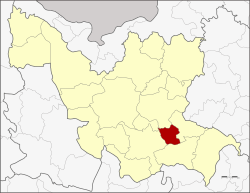 Amphoe location in Udon Thani Province | |
| Coordinates: 17°10′20″N 103°9′11″E / 17.17222°N 103.15306°ECoordinates: 17°10′20″N 103°9′11″E / 17.17222°N 103.15306°E | |
| Country | Thailand |
| Province | Udon Thani |
| Seat | Ban Chit |
| Area | |
| • Total | 181.2 km2 (70.0 sq mi) |
| Population (2005) | |
| • Total | 21,962 |
| • Density | 121.2/km2 (314/sq mi) |
| Time zone | UTC+7 (ICT) |
| Postal code | 41130 |
| Geocode | 4124 |
Ku Kaeo (Thai: กู่แก้ว, pronounced [kùː kɛ̂ːw]) is a district (amphoe) in central Udon Thani Province, northeastern Thailand.
Geography
Neighboring districts are (from the north clockwise) Nong Han, Chai Wan, Si That, Kumphawapi, and Prachaksinlapakhom.
History
The minor district (king amphoe) was established on 30 April 1994 by splitting it from Nong Han District.[1]
On 15 May 2007 all 81 minor districts were upgraded to full districts.[2] On 24 August the upgrade became official.[3]
Administration
The district is divided into four sub-districts (tambon), which are further subdivided into 37 villages (muban). There are no municipal (thesaban) areas, and four tambon administrative organizations (TAO).
| No. | Name | Thai name | Villages | Pop. | |
|---|---|---|---|---|---|
| 1. | Ban Chit | บ้านจีต | 8 | 5,581 | |
| 2. | Non Thong In | โนนทองอินทร์ | 8 | 4,489 | |
| 3. | Kho Yai | ค้อใหญ่ | 6 | 3,634 | |
| 4. | Khon Sai | คอนสาย | 15 | 8,258 |
References
- ↑ ประกาศกระทรวงมหาดไทย เรื่อง แบ่งเขตท้องที่อำเภอหนองหาน จังหวัดอุดรธานี ตั้งเป็นกิ่งอำเภอกู่แก้ว (PDF). Royal Gazette (in Thai). 111 (42 ง): 26. May 26, 1994.
- ↑ แถลงผลการประชุม ครม. ประจำวันที่ 15 พ.ค. 2550 (in Thai). Manager Online.
- ↑ พระราชกฤษฎีกาตั้งอำเภอฆ้องชัย...และอำเภอเหล่าเสือโก้ก พ.ศ. ๒๕๕๐ (PDF). Royal Gazette (in Thai). 124 (46 ก): 14–21. August 24, 2007.
External links
This article is issued from
Wikipedia.
The text is licensed under Creative Commons - Attribution - Sharealike.
Additional terms may apply for the media files.