Nam Yuen District
| Nam Yuen น้ำยืน | |
|---|---|
| District | |
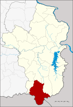 District location in Ubon Ratchathani Province | |
| Coordinates: 14°29′21″N 105°0′3″E / 14.48917°N 105.00083°ECoordinates: 14°29′21″N 105°0′3″E / 14.48917°N 105.00083°E | |
| Country | Thailand |
| Province | Ubon Ratchathani |
| Seat | Si Wichian |
| Area | |
| • Total | 854.5 km2 (329.9 sq mi) |
| Population (2005) | |
| • Total | 67,641 |
| • Density | 79.2/km2 (205/sq mi) |
| Time zone | UTC+7 (ICT) |
| Postal code | 34160 |
| Geocode | 3409 |
Nam Yuen (Thai: น้ำยืน, pronounced [náːm jɯ̄ːn]) is the southernmost district (amphoe) of Ubon Ratchathani Province, northeastern Thailand.
History
A group of people from Det Udom moved to Ban Chanla Na Dom of Champassak during the reign of King Mongkut. Later in 1881 the king of Champassak proposed to King Chulalongkorn to upgrade Ban Chanla Na Dom to Mueang Dom Pradit, under the control of the Champassak Kingdom. When Champask became part of French Indochine, Mueang Dom Pradit was downgraded to be a tambon of Det Udom District. As the area of Det Udom was very large, the governor of Ubon Ratchathani proposed to the government to establish a minor district (king amphoe). This was created on 17 March 1969 by splitting off the four tambons: Song, Ta Kao, Yang, and Dom Pradit.[1] It was upgraded to a full district on 29 March 1974.[2]
Etymology
The name Nam Yuen has two origins: at first the district office was in the area of the village Nam Yuen, as well as the area has three fertile rivers, Bon, Chong and Ta Em, as Nam Yuen in Thai means 'long-lasting water'.
Geography
Neighboring districts are (from the west clockwise) Nam Khun, Det Udom, Na Chaluai of Ubon Ratchathani Province, Champasak of Laos and Preah Vihear of Cambodia.
The Dom Yai River is an important water resource.
The highest summits of the Phanom Dong Rak Range, including Phu Khi Suk (753 m), Phu Khok Yai (693 m), Phu Chep Thong (692 m), Phu Tangok (689 m) and Chong Bok (603 m) are in this district, in the area where the borders of Thailand, Laos, and Cambodia intersect.
Administration
The district is divided into seven sub-districts (tambons), which are further subdivided into 92 villages (mubans). Nam Yuen itself is a township (thesaban tambon) and covers parts of tambons Song and Si Wichian. There are a further seven tambon administrative organizations (TAO).
| No. | Name | Thai name | Villages | Pop. | |
|---|---|---|---|---|---|
| 1. | Song | โซง | 10 | 7,775 | |
| 3. | Yang | ยาง | 12 | 7,548 | |
| 4. | Dom Pradit | โดมประดิษฐ์ | 17 | 15,771 | |
| 6. | Bu Pueai | บุเปือย | 15 | 8,939 | |
| 7. | Si Wichian | สีวิเชียร | 14 | 14,354 | |
| 9. | Yang Yai | ยางใหญ่ | 12 | 6,055 | |
| 11. | Kao Kham | เก่าขาม | 12 | 7,199 |
Missing numbers are tambon which now form District Nam Khun
References
- ↑ ประกาศกระทรวงมหาดไทย เรื่อง แบ่งท้องที่ตั้งเป็นกิ่งอำเภอ (PDF). Royal Gazette (in Thai). 86 (24 ง): 1017. March 25, 1969.
- ↑ พระราชกฤษฎีกาตั้งอำเภอเขาวง อำเภอเชียงม่วน อำเภอดอนตาล อำเภอชาติตระการ อำเภอภูเรือ อำเภอเคียนซา อำเภอน้ำโสม อำเภอหนองวัวซอ และอำเภอน้ำยืน พ.ศ. ๒๕๑๗ (PDF). Royal Gazette (in Thai). 91 (54 ก special issue): 30–33. March 28, 1974.