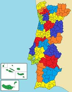
Map showing the location of the Alto Alentejo intermunicipal community (in dark blue)
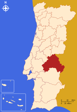
Map showing the location of the Alto Alentejo subregion
The Comunidade Intermunicipal do Alto Alentejo (English: High Alentejo) is an administrative division in Portugal. It was created in 2009.[1] The seat of the intermunicipal community is Portalegre. Alto Alentejo is coterminous with the former Portalegre District. The population in 2011 was 118,506,[2] in an area of 6,084.34 km².[3] Together with Alentejo Central it covers the area of the former Alto Alentejo Province. With Ponte de Sor the intermunicipal community also includes one municipality that lies in the area of the former Ribatejo Province.
Alto Alentejo is also a NUTS3 subregion of Alentejo Region, in Portugal. The subregion Alto Alentejo covers the same area as the intermunicipal community, but including the municipality Mora (Alentejo Central intermunicipal community), and excluding the municipality Sousel. As of 2011, the subregion had a population of 118,410[2] and a total area of 6,249 km².[3]
Municipalities
The CIM Alto Alentejo is composed of 15 municipalities:[4]
| Municipality | Population (2011)[2] | Area (km²)[3] |
| Alter do Chão | 3,562 | 362.07 |
| Arronches | 3,165 | 314.65 |
| Avis | 4,571 | 605.97 |
| Campo Maior | 8,456 | 247.20 |
| Castelo de Vide | 3,407 | 264.91 |
| Crato | 3,708 | 398.07 |
| Elvas | 23,078 | 631.29 |
| Fronteira | 3,410 | 248.60 |
| Gavião | 4,132 | 294.59 |
| Marvão | 3,512 | 154.90 |
| Monforte | 3,329 | 420.25 |
| Nisa | 7,450 | 575.68 |
| Ponte de Sor | 16,722 | 839.71 |
| Portalegre | 24,930 | 447.14 |
| Sousel | 5,074 | 279.32 |
| Total | 118,506 | 6,084.34 |