Alentejo Region
| Alentejo | |
|---|---|
| Region | |
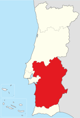 Map showing Alentejo Region in Portugal | |
| Country |
|
| Capital city | Évora |
| Area | |
| • Total | 31,152 km2 (12,028 sq mi) |
| Population (2005) | |
| • Total | 776,585 |
| Time zone | UTC+0 (WET) |
| • Summer (DST) | UTC+1 (WEST) |
| NUTS code | PT18 |
| GDP per capita (PPS) | € 17,200 (2006)[1] |
Alentejo Region is one of the NUTS 2 regions of Portugal. It covers all of the historical Alentejo Province, but the Lezíria do Tejo Subregion also covers areas of the Estremadura Province.
Subregions
- Alto Alentejo Subregion (NUTS 3 region)
- Baixo Alentejo Subregion (NUTS 3 region)
- Alentejo Litoral Subregion (NUTS 3 region)
- Alentejo Central Subregion (NUTS 3 region)
- Lezíria do Tejo Subregion (NUTS 3 region)

- Alentejo Region
 Lezíria do Tejo Subregion
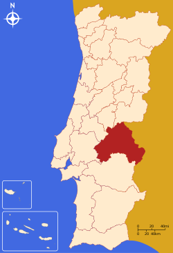 Alto Alentejo Subregion
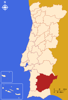 Baixo Alentejo Subregion
 Alentejo Litoral Subregion
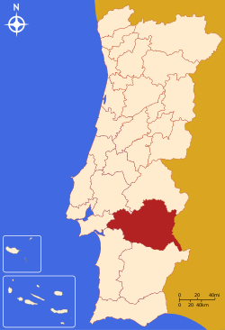 Alentejo Central Subregion
References
- ↑ "GDP per inhabitant in 2006 ranged from 25% of the EU27 average in Nord-Est in Romania to 336% in Inner London" (PDF). Eurostat. Archived from the original (PDF) on 2009-03-25.
| Norte Region |
| ||||
|---|---|---|---|---|---|
| Centro Region |
| ||||
| Lisboa Region |
| ||||
| Alentejo Region |
| ||||
| Algarve Region |
| ||||
| Autonomous Regions | |||||
All these divisions are further subdivided into municipalities and parishes. | |||||
This article is issued from
Wikipedia.
The text is licensed under Creative Commons - Attribution - Sharealike.
Additional terms may apply for the media files.