Allegheny Mountain (West Virginia – Virginia)
| Allegheny Mountain | |
|---|---|
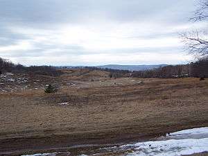 Camp Allegheny battlefield at Top of Allegheny. | |
| Highest point | |
| Peak | Paddy Knob (Pocahontas County, WV and Highland County, VA) |
| Elevation | 4,478 ft (1,365 m) [1] |
| Coordinates | 38°15′56″N 79°47′46″W / 38.26556°N 79.79611°W |
| Geography | |
 Location of Allegheny Mountain in West Virginia | |
| Location | Tamarack Ridge in Highland County, VA |
| Country | United States |
| States | Virginia and West Virginia |
| Counties | |
| Range coordinates | 38°28′47″N 79°41′37″W / 38.47972°N 79.69361°WCoordinates: 38°28′47″N 79°41′37″W / 38.47972°N 79.69361°W [2] |
| Parent range | Allegheny Mountains |
Allegheny Mountain (spelling as Alleghany Mountain in Virginia) is a major mountain ridge in the southern range of the Allegheny Mountains, part of the Appalachian Mountains. It forms the Eastern Continental Divide along part of its course and also serves as part of the Virginia-West Virginia state line.
Elevations of 4,000 feet (1,200 m) are exceeded along much of Allegheny Mountain.
Major peaks
Listed from southwest to northeast:
- Hickory Knob - 3,309 feet (1,009 m)
- Smith Knob
- Chestnut Knob
- High Top (Lookout Tower)
- Chestnut Levels
- Mad Tom
- Mad Sheep - 4,225 feet (1,288 m)
- Paddy Knob - 4,477 feet (1,365 m)
- Bald Knob
- Watering Pond Knob
- Bear Mountain
- Top of Allegheny (site of Camp Allegheny battlefield)
- Tamarack Ridge
- Grassy Knob
Principal gaps
- Rucker Gap
- Ryder Gap
See also
References
- ↑ "Paddy Knob". Geographic Names Information System. United States Geological Survey. 1979-09-28. Retrieved 2009-10-12.
- ↑ Hightown, Virginia-West Virginia quadrangle (Map). 1:24,000. 7.5-Minute Series (Topographic). U.S. Geological Survey. 1994.
This article is issued from
Wikipedia.
The text is licensed under Creative Commons - Attribution - Sharealike.
Additional terms may apply for the media files.