Albion Township, Noble County, Indiana
| Albion Township | |
|---|---|
| Township | |
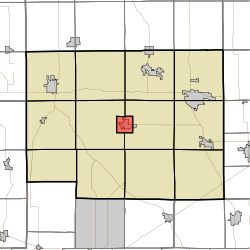 Location in Noble County | |
| Coordinates: 41°23′45″N 85°25′29″W / 41.39583°N 85.42472°WCoordinates: 41°23′45″N 85°25′29″W / 41.39583°N 85.42472°W | |
| Country | United States |
| State |
|
| County | Noble |
| Government | |
| • Type | Indiana township |
| Area | |
| • Total | 3.92 sq mi (10.2 km2) |
| • Land | 3.84 sq mi (9.9 km2) |
| • Water | 0.07 sq mi (0.2 km2) 1.79% |
| Elevation[1] | 955 ft (291 m) |
| Population (2010) | |
| • Total | 2,456 |
| • Density | 639.5/sq mi (246.9/km2) |
| Time zone | UTC-5 (Eastern (EST)) |
| • Summer (DST) | UTC-4 (EDT) |
| ZIP code | 46701 |
| Area code(s) | 260 |
| GNIS feature ID | 453084 |
Albion Township is one of thirteen townships in Noble County, Indiana, United States. As of the 2010 census, its population was 2,456 and it contained 988 housing units.[2]
Geography
According to the 2010 census, the township has a total area of 3.92 square miles (10.2 km2), of which 3.84 square miles (9.9 km2) (or 97.96%) is land and 0.07 square miles (0.18 km2) (or 1.79%) is water.[2]
Cities, towns, villages
- Albion, the county seat (vast majority)
Cemeteries
The township contains Rose Hill Cemetery.
Major highways
Lakes
- Little Lake
Climate
| Climate data for Albion Township, Indiana | |||||||||||||
|---|---|---|---|---|---|---|---|---|---|---|---|---|---|
| Month | Jan | Feb | Mar | Apr | May | Jun | Jul | Aug | Sep | Oct | Nov | Dec | Year |
| Average high °F (°C) | 32.2 (0.1) |
35.4 (1.9) |
45.5 (7.5) |
59.0 (15) |
70.4 (21.3) |
80.2 (26.8) |
84.3 (29.1) |
82.6 (28.1) |
76.0 (24.4) |
64.3 (17.9) |
47.8 (8.8) |
35.5 (1.9) |
59.4 (15.2) |
| Average low °F (°C) | 16.3 (−8.7) |
18.4 (−7.6) |
26.5 (−3.1) |
37.2 (2.9) |
47.0 (8.3) |
57.3 (14.1) |
60.7 (15.9) |
58.8 (14.9) |
52.4 (11.3) |
41.7 (5.4) |
30.9 (−0.6) |
20.8 (−6.2) |
39 (3.9) |
| Average precipitation inches (mm) | 1.9 (48) |
1.4 (36) |
2.3 (58) |
3.0 (76) |
3.2 (81) |
3.7 (94) |
3.3 (84) |
2.9 (74) |
2.9 (74) |
2.8 (71) |
2.4 (61) |
2.1 (53) |
31.9 (810) |
| Source: Weatherbase [3] | |||||||||||||
School districts
- Central Noble Community School Corporation
Political districts
- Indiana's 3rd congressional district
- State House District 52
- State Senate District 13
References
- "Albion Township, Noble County, Indiana". Geographic Names Information System. United States Geological Survey. Retrieved 2009-10-17.
- United States Census Bureau 2008 TIGER/Line Shapefiles
- IndianaMap
- ↑ "US Board on Geographic Names". United States Geological Survey. October 25, 2007. Retrieved 2017-05-09.
- 1 2 "Population, Housing Units, Area, and Density: 2010 - County -- County Subdivision and Place -- 2010 Census Summary File 1". United States Census. Retrieved 2013-05-10.
- ↑ "Weatherbase: Historical Weather for Albion, Indiana". Weatherbase. 2011. Retrieved on November 24, 2011.
External links
- Indiana Township Association
- United Township Association of Indiana
- City-Data.com page for Albion Township
Places adjacent to Albion Township, Noble County, Indiana | ||||||||||
|---|---|---|---|---|---|---|---|---|---|---|
| ||||||||||
Municipalities and communities of Noble County, Indiana, United States | ||
|---|---|---|
| Cities | ||
| Towns | ||
| Townships | ||
| CDP | ||
| Unincorporated communities | ||
| Footnotes | ‡This populated place also has portions in an adjacent county or counties | |
This article is issued from
Wikipedia.
The text is licensed under Creative Commons - Attribution - Sharealike.
Additional terms may apply for the media files.