Al Mahrah Governorate
| Al Mahrah المهرة | |
|---|---|
| Governorate | |
 | |
| Country | Yemen |
| Seat | Al Ghaydah |
| Government | |
| • Governor | Rajeh Said Bakri |
| Area | |
| • Total | 122,500 km2 (47,300 sq mi) |
| Population [1] | |
| • Total | 400,000 |
| • Density | 3.3/km2 (8.5/sq mi) |
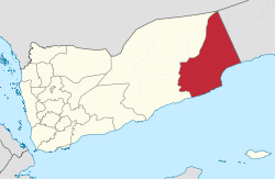
Al Mahrah or Mahra (Arabic: المهرة Al Mahra) is a governorate (muhafazah) of Yemen in the southern Arabian Peninsula. Situated in the area of the former Mahra Sultanate, its capital is Al Ghaydah and it has international borders with Saudi Arabia and Oman.
Governorate Details
Languages and people
A sizeable part of The Al Mahrah population does not speak Arabic as their primary language. Non Arabic speakers primarily speak Mehri or Mahri, a Modern South Arabian language [2] similar to the adjacent Oman Dhofar Governorate. The people that speak Mahri call themselves Mahris and are presumed to be descendants of the ancient people of 'Ad. [3]
Geography
The geography of Al Mahrah is similar to the one of neighboring Dhofar in Oman. Rigid peaks rising to around 1,300 meters and the treacherous Empty Quarter desert lies to the north. Along its coast near the border with Oman, Al Mahrah is affected by the seasonal monsoon, or Khareef. The mountains become water soaked and the atmosphere becomes moist and foggy as vegetation turns the barren coast into lush valleys and forests. Hauf National Park is located in Al Mahrah.
Yemen Civil War
The Al Mahrah Governorate has been a major attraction point for the alleged smuggling of weapons, however, the governorate, has remained out of sight of the civil war in Yemen which began in 2014. [4]
Districts
The Al Mahrah Governorate is divided into ten separate districts. These districts are further divided into sub-districts and then into villages.
References
- ↑ "Statistical Yearbook 2011". Central Statistical Organisation. Retrieved 24 February 2013.
- ↑ "GeoCurrents article". GeoCurrents. Retrieved 6 December 2017.
- ↑ Caton, Steve (2013). Middle East in Focus: Yemen. ABC-CLIO,LLC. ISBN 1598849271.
- ↑ "Middle East Monitor article". Middle East Monitor. Retrieved 6 December 2017.
Places adjacent to Al Mahrah Governorate | ||||||||||
|---|---|---|---|---|---|---|---|---|---|---|
| ||||||||||