Ayta ash Shab
| Ayta ash Shab عيتا الشعب | |
|---|---|
| City | |
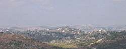 Ayta ash Shab | |
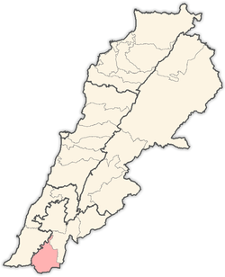
 Ayta ash Shab Location within Lebanon | |
| Coordinates: 33°05′50″N 35°20′04″E / 33.09722°N 35.33444°ECoordinates: 33°05′50″N 35°20′04″E / 33.09722°N 35.33444°E | |
| Grid position | 181/277 PAL |
| Country |
|
| Governorate | Nabatieh Governorate |
| District | Bint Jbeil District |
| Elevation | 650 m (2,130 ft) |
| Time zone | UTC+2 (EET) |
| • Summer (DST) | UTC+3 (EEST) |
| Dialing code | +961 |
Ayta ash Shab (Arabic: عيتا الشعب; also transliterated Ayta al-Sha'b, Ayta a-Shaab, Ayta ash-Shab or Ayta ash Sha'b')[1] is a village located in southern Lebanon, about 1 km northeast of the Israeli border.
History
Ottoman era
In 1596, it was named as a village, 'Ayta Bani Salman in the Ottoman nahiya (subdistrict) of Tibnin under the liwa' (district) of Safad, with a population of 5 Muslim households. The villagers paid a fixed tax of 25% on agricultural products, such as wheat, barley, goats and beehives, in addition to "occasional revenues"; a total of 930 akçe.[2][3]
In 1875 Victor Guérin noted: "The village has taken the place of a small town surrounded by a wall, of which some remains still exist in well-cut stones and a fort measuring forty paces long by twenty-five broad. Beneath this building lies a large cistern vaulted with circular arches, and built of regularly cut stones. It is covered by a platform, on part of which has been built, later on, a little mosque, now falling into ruins. Here one may remark columns which come from an older building, the site of which is marked by a mass of blocks regularly cut, and by mutilated shafts lying upon the ground.
Below the village, the upper slopes of the hill are cultivated in terraces, and planted with vines, fig-trees, pomegranates, olives, and filberts. Here I found several cisterns, a great sepulchral cave, ornamented with arched arcosolia, each surmounting two sarcophagi, contiguous and parallel, a press with two compartments, one square and the other circular, the whole cut in the living rock.
Ascending towards the east, I passed beside an ancient pool half cut in the rock and half built. Not far is an old evergreen oak, one of the most remarkable that I have seen in Palestine, to which the inhabitants offer a kind of worship. It is protected by a little wall which supports the venerable trunk."[4]
In 1881, the Palestine Exploration Fund's Survey of Western Palestine (SWP) described it: A well-built village of stone, situated on hill-top, with figs, olives, and arable land. It contains about 200 Moslems (Guerin says Metawileh), and has water from several cisterns and birket near.[5] "Here are foundations of walls, built with well-dressed stones. Several sarcophagi were observed. On the east, south and west of village there are also two olive-presses and two rock-cut cisterns."[6]
Modern era
During the 2006 Lebanon War 85% of Ayta ash Shab's homes were destroyed, and heavy ground fighting ensued between Israeli forces and Hezbollah.[7] On July 20, one civilian in the village was killed by Israeli fire, and three civilian villagers were killed the next day, also by Israeli fire.[8]
References
- ↑ "The tall mountain of the spur", according to Palmer, 1881, p. 66
- ↑ Hütteroth and Abdulfattah, 1977, p. 180
- ↑ Note that Rhode, 1979, p. 6 writes that the register that Hütteroth and Abdulfattah studied was not from 1595/6, but from 1548/9
- ↑ Guérin, 1880, p. 119; as translated by Conder and Kitchener, 1881, SWP I, p. 219
- ↑ Conder and Kitchener, 1881, SWP I, p. 200
- ↑ Conder and Kitchener, 1881, SWP I, p. 219
- ↑ Rosen, Nir (2007-01-01). "The Mayor, the Martyr, and the Pomegranate Trees". Mother Jones. Retrieved 2016-08-09.
- ↑ HRW, 2007, pp. 107-108
Bibliography
- Conder, C.R.; Kitchener, H.H. (1881). The Survey of Western Palestine: Memoirs of the Topography, Orography, Hydrography, and Archaeology. 1. London: Committee of the Palestine Exploration Fund.
- Guérin, V. (1880). Description Géographique Historique et Archéologique de la Palestine (in French). 3: Galilee, pt. 2. Paris: L'Imprimerie Nationale.
- HRW (2007). Why They Died: Civilian Casualties in Lebanon During the 2006 War. Human Rights Watch.
- Hütteroth, Wolf-Dieter; Abdulfattah, Kamal (1977). Historical Geography of Palestine, Transjordan and Southern Syria in the Late 16th Century. Erlanger Geographische Arbeiten, Sonderband 5. Erlangen, Germany: Vorstand der Fränkischen Geographischen Gesellschaft. ISBN 3-920405-41-2.
- Palmer, E.H. (1881). The Survey of Western Palestine: Arabic and English Name Lists Collected During the Survey by Lieutenants Conder and Kitchener, R. E. Transliterated and Explained by E.H. Palmer. Committee of the Palestine Exploration Fund.
- Rhode, H. (1979). Administration and Population of the Sancak of Safed in the Sixteenth Century. Columbia University.
External links
- Survey of Western Palestine, Map 4: IAA, Wikimedia commons
- Aayta Ech Chaab, Localiban
Capital: Bint Jbeil | ||
| Towns and villages |
|  |
| Notable landmarks | ||
| Other sites | ||