Ain Shams
| Ain Shams عين شمس | |
|---|---|
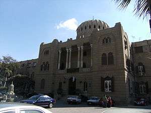 Shalhoub Street (2007) | |
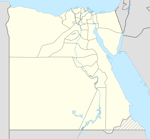 Ain Shams Location in Egypt | |
| Coordinates: 30°07′40″N 31°19′45″E / 30.12778°N 31.32917°E | |
| Country |
|
| Governorate | Cairo Governorate |
| Time zone | UTC+2 (EST) |
Ain, Ayn, or Ein Shams (Arabic: عين شمس, [ʕeːn ʃæms], Coptic: ⲱⲛ ⲡⲉⲧ ⲫⲣⲏ[1]) is a suburb of Cairo, Egypt. The name means "Eye of the Sun" in Arabic, referring to the fact that Ain Shams is built on top of the ancient city of Heliopolis, once the spiritual centre of ancient Egyptian sun-worship. Ain Shams is one of the oldest districts in Cairo and contains many historical sites.
10th-century Jewish biblical commentator, Saadia Gaon, believed that Ain Shams was the location of the biblical Egyptian city of Rameses.[2]
Ain Shams is one of the first areas to have natural gas supplied to all its residents,The Nature Gas was there since 1985.
Gallery
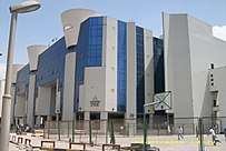 Faculty of Pharmacy in Ain Shams University
 Shalhoub street
See also
External links
| Wikimedia Commons has media related to Ain Shams. |
- Egyptian temple found under Cairo market ABC News, 27 February 2006.
- Parts of King Nakhtanebu I's shrine uncovered in Cairo // Ahram Online, 4 October 2015.
Works cited
- ↑ https://st-takla.org/books/pauline-todary/coptic-language/egyptian.html
- ↑ Saadia Gaon, Judeo-Arabic Translation of Pentateuch (Tafsir), s.v. Exodus 21:37 and Numbers 33:3 ("רעמסס: "עין שמס); Rabbi Saadia Gaon's Commentaries on the Torah (ed. Yosef Qafih), Mossad Harav Kook: Jerusalem 1984, p. 164 (Numbers 33:3) (Hebrew). However, based on the Masoretic vowelization of "Raamses" in different contexts, Avraham Ibn Ezra on Exodus 1:11 and 12:37 suggests that there were actually two cities called Raamses, one a store city and one a distinct Israelite district in or near Goshen as suggested in Genesis 47:11. It seems more probable that the store city of Exodus 1:11 was in central Egypt while the Israelite district was in a region farther northwest.
Districts and suburbs of Greater Cairo | ||||||||||
|---|---|---|---|---|---|---|---|---|---|---|
| Cairo Governorate |
|  | ||||||||
| Giza Governorate |
| |||||||||
| Qalyubia Governorate |
| |||||||||
Coordinates: 30°07′40″N 31°19′45″E / 30.12778°N 31.32917°E
This article is issued from
Wikipedia.
The text is licensed under Creative Commons - Attribution - Sharealike.
Additional terms may apply for the media files.