Porto Alegre, São Tomé and Príncipe
| Porto Alegre | |
|---|---|
| Village | |
 Porto Alegre Location on São Tomé Island | |
| Coordinates: 0°2′N 6°32′E / 0.033°N 6.533°ECoordinates: 0°2′N 6°32′E / 0.033°N 6.533°E | |
| Country |
|
| Province | São Tomé |
| District | Caué |
| Population (2008) | |
| • Total | 525 |
| Time zone | UTC+0 (UTC) |
Porto Alegre (Portuguese for "Happy Port") is a village in Caué District on São Tomé Island in São Tomé and Príncipe. Its population is 525 (2008 est.).[1] The locality Alto Douro lies 2.5 km north of Porto Alegre. The whole locality forms a part of Obo Natural Park. As to the entire south part of the island and the district, its primary language is Angolar creole.
Subdivisions
- Porto Alegre (main)
- Praia Cabana - beach (Portuguese for bell)
- Praia Inhame
- Praia Piscina - beach, a resemblance of a swimming pool
Population history
| Historical population | ||
|---|---|---|
| Year | Pop. | ±% |
| 2001 (census) | 461 | — |
| 2008 (estimate) | 525 | +13.9% |
About the village

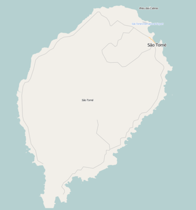
The village is the southernmost on the island and is in the southernmost terminus of the main road (National Route 2) connecting to São Tome through the island's eastern part, distance from the city is over 71 km. Not far is the island's southernmost point at Ponta da Homem de Cabo. 3 km south is the equator at Ilhéu das Rolas which is separated by Canal das Rolas, there is no ferry route with that island from Porto Alegre, it is done at nearby Ponta Baleia. Porto Alegre sits in a small and difficult headland. East is Baía de Iago-Iago (name of Angolan origin) which is 1–2 km. Nearly a kilometer north is Ribeira Salgado.
Agriculture is the dominant industry as well as fishing. Cocoa and coffee has been the dominant crop and covers the whole village's production.
In 1883, Jacinto Carneiro de Sousa Almeira, Viscount Malanza made a couple of cocoa plantations in the area and built Roça de Porto Alegre, a warehouse of the southernmost area of the island. In 1890, the name Porto Alegre was adopted.
A mural dedicating to the area's history with a small 1902 map was put in 2012.
In 2017, a new species of snakes were founded in the subdivision and the beach around Praia Inhame named Naja peroescobari, named it after the 15th century Portuguese explorer Pero Escobar, one of three who discovered the island in 1471.[2]
References
- ↑ INE, Evolução da população São-Tomense por localidades, 2001/2007-08
- ↑ Ceríaco, L.M.P.; Marques, M.P.; Schmitz, A.; Bauer, A.M. (2017). "The "Cobra-preta" of São Tomé Island, Gulf of Guinea, is A New Species of Naja Laurenti, 1768 (Squamata: Elapidae)". 4324 (1). Zootaxa. pp. 121–141. doi:10.11646/zootaxa.4324.1.7.
| Communities | 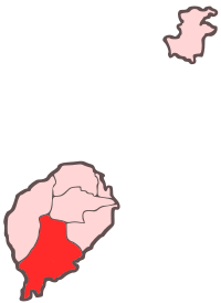 | |
|---|---|---|
| Geographical features |
| |
| Landmarks and hotels | ||
| Culture | ||