Agnes Banks, New South Wales
| Agnes Banks New South Wales | |||||||||||||||
|---|---|---|---|---|---|---|---|---|---|---|---|---|---|---|---|
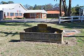 Bills horse trough, Agnes Bank | |||||||||||||||
|
Agnes Banks | |||||||||||||||
| Coordinates | 33°36′55″S 150°42′58″E / 33.61528°S 150.71611°ECoordinates: 33°36′55″S 150°42′58″E / 33.61528°S 150.71611°E | ||||||||||||||
| Population | 911 (2016 census)[1] | ||||||||||||||
| Postcode(s) | 2753 | ||||||||||||||
| Location | 65 km (40 mi) from Sydney CBD | ||||||||||||||
| LGA(s) | |||||||||||||||
| State electorate(s) | |||||||||||||||
| Federal Division(s) | Macquarie | ||||||||||||||
| |||||||||||||||
Agnes Banks is a suburb of Sydney, in the state of New South Wales, Australia. Agnes Banks is 68 kilometres north-west of the Sydney central business district, in the local government areas of the City of Penrith and City of Hawkesbury. It is part of the Greater Western Sydney region.
Agnes Banks is connected to Penrith by Castlereagh Road which runs alongside the Nepean River between Richmond and Penrith. Natural woodlands and sandy deposits make up the higher landscape of this suburb. Agnes Banks is a rural outpost of the City of Penrith which has kept its intrinsic agricultural value and rural lifestyle.
History
This area was settled as early as 1803 by Charles Palmer. He was the first man to receive the free land grants in 1803, he and his wife Mary Anne built the first Farm Slab House in 1803. The 3 chimneys still stand near the corner of Castlereagh Rd and Springwood Rd. The name Agnes Banks comes from Thompson's mother's name, Agnes. The town here was once known as 'Little Richmond'.[2]
Heritage listings
Agnes Banks has a number of heritage-listed sites, including:
- Rickards Avenue: Agnes Bank Natural Area[3]
Demographics
According to the 2016 census of the population, there were 911 residents in Agnes Banks. 83.7% of residents were born in Australia. The other most common countries of birth were England 2.8%, Malta 3.0% and New Zealand 1.1%. 88.1% of residents spoke only English at home. Other languages spoken at home included Maltese 2.6%, Macedonian 1.4% and Greek 0.7%. The most common responses for religious affiliation were Catholic 35.8%), Anglican 19.7% and No Religion 17.7%.[1]
References
- 1 2 Australian Bureau of Statistics (31 October 2012). "Agnes Banks (State Suburb)". 2011 Census QuickStats. Retrieved 28 April 2013.

- ↑ "Penrith City Council - Local Suburb Profiles". Archived from the original on 30 April 2013. Retrieved 5 May 2013.
- ↑ "Natural Area, New South Wales State Heritage Register (NSW SHR) Number H00649". New South Wales State Heritage Register. Office of Environment and Heritage. Retrieved 18 May 2018.
External links
- Lorraine Stacker (2008). "Agnes Banks". Dictionary of Sydney. Retrieved 24 September 2015. [CC-By-SA]