Agios Vasileios, Achaea
| Agios Vasileios Άγιος Βασίλειος | |
|---|---|
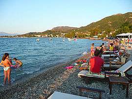 The beach of Agios Vasileios | |
 Agios Vasileios | |
| Coordinates: 38°19′N 21°49′E / 38.317°N 21.817°ECoordinates: 38°19′N 21°49′E / 38.317°N 21.817°E | |
| Country | Greece |
| Administrative region | Western Greece |
| Regional unit | Achaea |
| Municipality | Patras |
| Municipal unit | Rio |
| Elevation | 15 m (49 ft) |
| Community[1] | |
| • Population | 2,662 (2011) |
| Time zone | UTC+2 (EET) |
| • Summer (DST) | UTC+3 (EEST) |
| Postal code | 265 00 |
| Vehicle registration | AX |
Agios Vasileios (Greek: Άγιος Βασίλειος) is a district in the municipal unit of Rio in the northern part of Achaea in the Peloponnese, Greece. It is located on the Gulf of Corinth, 3 km northeast of Rio. The Greek National Road 8A (Patras - Corinth) passes south of the village, and the railway Patras - Corinth passes through it.
Historical population
| Year | Population |
|---|---|
| 1981 | 640 |
| 1991 | 1,491 |
| 2001 | 2,045 |
| 2011 | 2,662 |
See also
References
- ↑ "Απογραφή Πληθυσμού - Κατοικιών 2011. ΜΟΝΙΜΟΣ Πληθυσμός" (in Greek). Hellenic Statistical Authority.
This article is issued from
Wikipedia.
The text is licensed under Creative Commons - Attribution - Sharealike.
Additional terms may apply for the media files.