Ovrya
| Ovrya Οβρυά | |
|---|---|
 City Hall | |
 Ovrya | |
| Coordinates: 38°11.5′N 21°44′E / 38.1917°N 21.733°ECoordinates: 38°11.5′N 21°44′E / 38.1917°N 21.733°E | |
| Country | Greece |
| Geographic region | Peloponnese |
| Administrative region | West Greece |
| Regional unit | Achaea |
| Municipality | Patras |
| Municipal unit | Messatida |
| Elevation | 70 m (230 ft) |
| Population (2011)[1] | |
| • Total | 6,308 |
| Time zone | UTC+2 (EET) |
| • Summer (DST) | UTC+3 (EEST) |
| Postal code | 265 00 |
| Area code(s) | 2610 |
| Vehicle registration | AX |
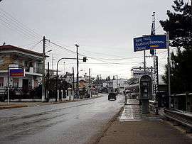
Ovrya (Greek: Οβρυά) is a town in Achaea, Greece. It is a suburb of Patras, located 6 km south of Patras city centre. It was the seat of the former municipality of Messatida. The Greek National Roads 9 (Patras - Pyrgos) and 33 (Patras - Tripoli) pass through the town. Ovrya is in the transition zone from the densely populated coastal area to the hills in the southeast, including Omplos. Agriculture (olive groves, pastures) is still the dominant land use in the areas south and east of Ovrya. Neighboring communities are Demenika to the northeast, Mintilogli to the west, Krini to the east, and Kallithea to the south.
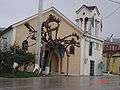
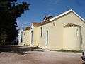
Gallery
References
- ↑ "Απογραφή Πληθυσμού - Κατοικιών 2011. ΜΟΝΙΜΟΣ Πληθυσμός" (in Greek). Hellenic Statistical Authority.
External links
| Wikimedia Commons has media related to Ovrya. |
This article is issued from
Wikipedia.
The text is licensed under Creative Commons - Attribution - Sharealike.
Additional terms may apply for the media files.