Academy, St. Louis
| Academy | |
|---|---|
| Neighborhood of St. Louis | |
.jpg) Houses on Cabanne Avenue in Academy, January 2012 | |
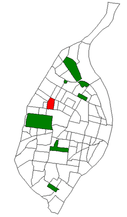 Location of Academy within St. Louis | |
| Country | United States |
| State | Missouri |
| City | St. Louis |
| Wards | 18, 26 |
| Area | |
| • Total | 0.44 sq mi (1.1 km2) |
| Population (2010)[1] | |
| • Total | 2,816 |
| • Density | 6,400/sq mi (2,500/km2) |
| ZIP code(s) | Parts of 63108, 63113 |
| Area code(s) | 314 |
| Website | stlouis-mo.gov |
Academy/Sherman Park is a neighborhood in North St. Louis, just outside Central West End. The official boundaries of the area are Dr. Martin Luther King Drive on the north, Delmar Boulevard on the south, North Kingshighway Boulevard on the east, and Union Boulevard on the west.[2]
As of the census of 2010, there were 2,816 people residing in the neighborhood, which contained 1,401 housing units. The racial makeup of the neighborhood was 1.92% White, 95.88% Black, 0.21% Native American, less than 0.01% Asian, 0% Pacific Islander, 0.18% from other races, and 1.74% from two or more races. Hispanic or Latino of any race were 1.28% of the population.[1]
As of 2015[3], there were 3,006 people residing in the neighborhood, which contained 1,409 housing units. The racial makeup of the neighborhood was 21.92% White, 67.88% Black, 3.01% Asian, 1.42% from other races, and 0.32% from two or more races. Hispanic or Latino of any race were 5.46% of the population.
Sally Benson grew up in the Academy neighborhood. She described her childhood in her novels that inspired the film Meet Me in St. Louis. The Benson house at 5135 Kensington Avenue[4][5] no longer exists. After being sold, it fell into disrepair, eventually became uninhabitable, and was demolished in 1994.[6]
Tennessee Williams attended Soldan High School in the neighborhood and used it as a setting for his play The Glass Menagerie.[7]
| Historical population | ||
|---|---|---|
| Year | Pop. | ±% |
| 2000 | 3,797 | — |
| 2010 | 2,816 | −25.8% |
References
- 1 2 Census Summary By Neighborhoods
- ↑ Neighborhood Data Profile for Academy. Accessed 12 April 2008. Archived July 5, 2007, at the Wayback Machine.
- ↑ "Academy, St. Louis MO Demographics 2015". Academy, St. Louis MO Demographics 2015.
- ↑ https://maps.google.com/maps?f=q&hl=en&geocode=&q=5135+Kensington+Ave.,+St.+Louis,+MO&sll=37.0625,-95.677068&sspn=42.85226,79.101563&ie=UTF8&ll=38.65452,-90.267963&spn=0.001294,0.002414&t=h&z=18&om=0
- ↑ http://hookedonhouses.net/2009/12/13/meet-me-in-st-louis-the-victorian-on-kensington-ave/
- ↑ http://abcnews.go.com/Nightline/story?id=1602258&page=1
- ↑ "Free Research Paper on Glass Menagerie Means 181 - 210". Cyberessays.com. Retrieved 2011-03-15.
External links
- Academy neighborhood website
Coordinates: 38°39′30″N 90°16′02″W / 38.6584°N 90.2673°W