Aboyne
Aboyne
| |
|---|---|
 The Green in Aboyne | |
 Aboyne Aboyne shown within Aberdeenshire | |
| Population |
2,202 [4] (2001 census) |
| OS grid reference | NO527986 |
| Council area | |
| Lieutenancy area | |
| Country | Scotland |
| Sovereign state | United Kingdom |
| Post town | ABOYNE |
| Postcode district | AB34 |
| Dialling code | 013398 |
| Police | Scottish |
| Fire | Scottish |
| Ambulance | Scottish |
| EU Parliament | Scotland |
| UK Parliament | |
| Scottish Parliament | |
Aboyne (Scots: Abyne, Scottish Gaelic: Abèidh) is a village on the edge of the Highlands in Aberdeenshire, Scotland, on the River Dee, approximately 26 miles (42 km) west of Aberdeen. It has a swimming pool at Aboyne Academy, all-weather tennis courts, a bowling green and is home to the oldest 18 hole Golf course on Royal Deeside. Aboyne Castle and the Loch of Aboyne are nearby.
Aboyne has many businesses, including a supermarket (Co-op),[6] two banks, several hairdressers, a butcher, a newsagent, an Indian restaurant and a post office. Originally, there was a railway station in the village, but it was closed on 18 June 1966. The station now contains some shops and the tunnel running under the village is now home to a firearms club. The market-day in Aboyne was known as Fèill Mhìcheil (Scottish Gaelic for "Michael's Fair").
History
The locale was inhabited since very early times with the west wing of Aboyne Castle dated to 1671 AD.[7] The siting of the castle itself is related to the limited number of the crossings of the Mounth of the Grampian Mountains to the south.[8] In 1715 Aboyne was the scene of a tinchal, or great hunt, organised by John Erskine, sixth Earl of Mar, on 3 September, as a cover for the gathering of Jacobite nobles and lairds to discuss a planned Jacobite rising. The uprising began three days later in Braemar.[9]
Climate
Aboyne has a Temperate climate similar to all of the United Kingdom. Due to its high inland position in Scotland, Aboyne can record some very low temperatures and some high snowfall. Conversely, temperatures can reach exceptional values for the latitude, particularly during the winter months due to the foehn effect; it holds the January and March record for the highest temperatures in Scotland, 18.3°C on 26th January 2003 and 23.6°C on 27th March 2012. The former is also the UK's highest January temperature on record, which it shares with Inchmarlo, Kincardineshire and Aber, Gwynedd.[10]
| Climate data for Aboyne (140m asl, averages 1981-2010) | |||||||||||||
|---|---|---|---|---|---|---|---|---|---|---|---|---|---|
| Month | Jan | Feb | Mar | Apr | May | Jun | Jul | Aug | Sep | Oct | Nov | Dec | Year |
| Record high °C (°F) | 18.3 (64.9) |
15.4 (59.7) |
23.6 (74.5) |
25.0 (77) |
28.4 (83.1) |
30.3 (86.5) |
31.6 (88.9) |
29.7 (85.5) |
28.5 (83.3) |
21.4 (70.5) |
19.0 (66.2) |
17.2 (63) |
31.6 (88.9) |
| Average high °C (°F) | 6.0 (42.8) |
6.5 (43.7) |
9.0 (48.2) |
11.5 (52.7) |
14.6 (58.3) |
17.1 (62.8) |
19.4 (66.9) |
18.7 (65.7) |
16.2 (61.2) |
12.2 (54) |
8.6 (47.5) |
5.9 (42.6) |
12.2 (54) |
| Average low °C (°F) | −1.0 (30.2) |
−0.9 (30.4) |
0.6 (33.1) |
2.0 (35.6) |
4.2 (39.6) |
7.5 (45.5) |
9.4 (48.9) |
8.9 (48) |
6.9 (44.4) |
4.0 (39.2) |
1.3 (34.3) |
−1.1 (30) |
3.5 (38.3) |
| Record low °C (°F) | −23.2 (−9.8) |
−21.4 (−6.5) |
−16.7 (1.9) |
−10.5 (13.1) |
−6.3 (20.7) |
−3.4 (25.9) |
−1.3 (29.7) |
−2.5 (27.5) |
−4.3 (24.3) |
−9.1 (15.6) |
−18.3 (−0.9) |
−22.2 (−8) |
−23.2 (−9.8) |
| Average rainfall mm (inches) | 66.2 (2.606) |
48.5 (1.909) |
53.6 (2.11) |
56.0 (2.205) |
59.1 (2.327) |
55.6 (2.189) |
67.9 (2.673) |
60.8 (2.394) |
68.0 (2.677) |
92.7 (3.65) |
84.8 (3.339) |
66.9 (2.634) |
780.0 (30.709) |
| Average rainy days (≥ 1 mm) | 12.8 | 10.7 | 11.0 | 10.0 | 11.5 | 10.2 | 10.7 | 10.7 | 9.2 | 12.9 | 12.6 | 11.6 | 133.7 |
| Source: Met Office [11] | |||||||||||||
Tourism and culture
.jpg)
In summer, when tourists visit, the number of people and vehicles increases dramatically. The Highland Games on the Village Green features in August. Aboyne is unusual in having The Green on which events are held, as the village was modelled by one of the first Marquesses of Huntly (inhabitants of Aboyne Castle) on a traditional English village with a green at the centre. The green includes facilities for rugby and football and a play park.
The British Royal Family are residents in nearby Balmoral Castle during the Summer.
Outdoor pursuits include golf, walking, cycling, and gliding from the airfield just outside the village. Aboyne has become popular with gliding enthusiasts from Britain and Europe due to its suitable air currents (due to the surrounding terrain). The airfield has two parallel tarmac runways running east-west, a webcam[12] and small weather-monitoring centre[13] on its premises.
The close-by pass of Ballater is a rock-climbing area. The village of Dinnet is a few miles west and is the first being located inside the Cairngorms National Park. Walkers and cyclists can ascend Mount Keen by cycling as far as they can from Glen Tanar forest before walking to the summit.
There are two schools, Aboyne Academy and a primary school. The academy has around 650 pupils, about a third from Aboyne itself, with the remaining two thirds from surrounding villages. The school has access to a full-size swimming pool and gym run by the adjacent Deeside Community Centre.
References
- ↑ "Ainmean-Àite na h-Alba (AÀA) – Gaelic Place-names of Scotland". www.gaelicplacenames.org. Retrieved 14 April 2018.
- ↑ The Online Scots Dictionary.
- ↑ "Scotslanguage.com - Names in Scots - Places in Scotland". scotslanguage.com. Retrieved 14 April 2018.
- ↑ "Comparative Population Profile: Aboyne Locality". Scotland's Census Results Online. 2001-04-29. Archived from the original on 2011-05-19. Retrieved 2008-08-31.
- ↑ "Archived copy". Archived from the original on 2008-09-30. Retrieved 2008-09-02.
- ↑ Aboyne location map Archived September 28, 2007, at the Wayback Machine.
- ↑ John Mackintosh, History of the Valley of the Dee, from the Earliest Times to the Present Day
- ↑ C. Michael Hogan, Elsick Mounth, Megalithic Portal, ed A. Burnham, 2007
- ↑ J.Baynes, The Jacobite Rising of 1715 (1970), pp. 35-36
- ↑ Office, Met. "UK climate". www.metoffice.gov.uk. Retrieved 14 April 2018.
- ↑ "Aboyne climate information". Met Office. Retrieved 26 October 2015.
- ↑ Aboyne Airfield Webcam Archived July 21, 2006, at the Wayback Machine.
- ↑ Aboyne meteorological data Archived September 24, 2006, at the Wayback Machine.
External links
| Wikimedia Commons has media related to Aboyne. |
- Aboyne Academy Website
- Aboyne Rugby Football Club
- Aboyne-Dinnet Church
- Deeside Gliding Club
- grid reference NO525985
- The Aboyne and Deeside festival
Settlements and places of interest in Marr, Aberdeenshire | ||
|---|---|---|
| Primary settlements | 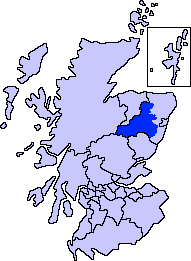 | |
| Other settlements | ||
| Places of interest |
| |
Areas and primary settlements in Aberdeenshire (see also: Aberdeen City) | ||
|---|---|---|
| in Banff and Buchan |  | |
| in Buchan | ||
| in Formartine | ||
| in Garioch | ||
| in Kincardine and Mearns | ||
| in Marr | ||
| Authority control |
|---|