Abbotsbury, New South Wales
| Abbotsbury Sydney, New South Wales | |||||||||||||||
|---|---|---|---|---|---|---|---|---|---|---|---|---|---|---|---|
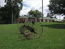 Calmsley Hill Farm, Abbotsbury | |||||||||||||||
| Population | 4,253 (2016 census)[1] | ||||||||||||||
| • Density | 3,270/km2 (8,500/sq mi) | ||||||||||||||
| Postcode(s) | 2176 | ||||||||||||||
| Area | 1.3 km2 (0.5 sq mi) | ||||||||||||||
| Location | 39 km (24 mi) west of Sydney CBD | ||||||||||||||
| LGA(s) | City of Fairfield | ||||||||||||||
| State electorate(s) | Mulgoa | ||||||||||||||
| Federal Division(s) | Fowler, McMahon | ||||||||||||||
| |||||||||||||||
Abbotsbury is a suburb of Sydney, New South Wales, Australia 39 kilometres west of the Sydney central business district in the local government area of the City of Fairfield. Abbotsbury is part of the Greater Western Sydney region.
Most of the suburb's estates were built in the late 1980s and early 1990s, although a few acres of undeveloped land in the north-west area was subdivided and developed in the early 2010s. The western border of the suburb is delineated by a line of pine trees, which gives privacy to the homes backing onto the farmlands.
History
Abbotsbury was named from Major Edward Abbott, a Canadian born soldier who arrived in New South Wales in 1790. Abbott was granted land in what is now Abbotsbury in 1806 although sold it to William Browne in 1810. The estate remained intact until the late 19th century when it was subdivided into small farms and it remained a rural area until the late 20th century when residential subdivision began. The name for the suburb was approved in 1991.[2][3][4]
Demographics
According to the 2016 census, there were 4,253 residents in Abbotsbury. 62.7% of residents were born in Australia. The most common countries of birth were Iraq 7.0%, Italy 3.5%, Vietnam 2.7%, Philippines 1.5% and Croatia 1.4%.
The most common ancestries were Italian 18.4%, Australian 12.3%, English 9.3%, Assyrian 6.4% and Croatian 4.4%.
51.9% of people only spoke English at home. Other languages spoken at home included Assyrian Neo-Aramaic 7.0%, Italian 6.5%, Arabic 4.5%, Vietnamese 3.5% and Spanish 3.3%.
The most common responses for religion were Catholic 56.0%, No Religion 7.0%, Eastern Orthodox 6.7%, Anglican 4.7% and Assyrian Church of the East 4.3%. Overall, Christianity was the largest religious group reported overall (84.4%).[1]
Landmarks
Abbotsbury is best known for Calmsley Hill Farm, which is located on the western side of the suburb.[5]
In the north-west of the suburb lies the Western Sydney Parklands, which sits on a hilly ridge. On these large hills there are a few recreational spots, such as Moonrise Lookout and Sugarloaf Ridge. They are both adjacent to each other and would feature a panoramic view of all of Sydney, where the city skyline may be seen from there. Families enjoy to picnic and walk in these area, and even come here to view the new years fireworks from Sydney Harbour.
Commercial area
The suburb also has a small shopping complex, including a grocery store, a vet, a hairdressers, a cafe and a gourmet pizzeria. Abbotsbury's telephone and internet runs off the Edensor Park Exchange. iiNet's and TPG's ADSL2+ service as well as general ADSL and Cable are available in the area.
Abbotsbury is also one of the safest suburbs in Western Sydney, due to the fact that the only entrance is on the east. The North and West of Abbotsbury leads to a national park and there are no roads here.
Transport
Abbotsbury is serviced by the region three bus operator Transit Systems. The 808 and 806 buses come through here. The most common form of transport used by residents is private vehicle.
Sport and recreation
The Western Sydney cycling path passes through Abbotsbury. Stretching far along Western Sydney, the cycling path passes through the Calmsley Hill Farm (previously known as Fairfield City Farm), which is located at the Western Sydney Regional Park. Calmsley Hill Farm was used during the 2000 Sydney Olympics for the mountain biking events.[6] The biking tracks remain.[7]
The suburb also has a sporting field named Stockdale Reserve. Adjacent to this park, there are several ponds, home to many species of birds, mainly ducks.
Housing
In 2015, the median sale price of houses in the area was $1,198,750. Abbotsbury contains some large properties on the outskirts, some blocks reaching sizes over half of an acre, which is rare to find in the suburbs of Sydney. Withers Place, located in the north of Abbotsbury, is the most expensive and affluent with a medium price of $1,700,000.[8]
References
- 1 2 Australian Bureau of Statistics (27 June 2017). "Abbotsbury (State Suburb)". 2016 Census QuickStats. Retrieved 28 June 2017.

- ↑ "Abbotsbury". Fairfield City Council. Archived from the original on 17 August 2008. Retrieved 2008-06-12.
- ↑ "Abbott, Edward (1766 - 1832)". Australian Dictionary of Biography Online. Retrieved 2008-06-12.
- ↑ "Abbotsbury". Geographical Names Register (GNR) of NSW. Geographical Names Board of New South Wales. Retrieved 2008-06-12.
- ↑ "Fairfield City Farm". Fairfield City Council. Archived from the original on 2 August 2008. Retrieved 2008-06-12.
- ↑ 2000 Summer Olympics official report. Archived 9 November 2000 at the Wayback Machine. Volume 1. p. 374.
- ↑ "Fairfield City Farm: History". Fairfield City Council. Archived from the original on 6 May 2008. Retrieved 2008-06-12.
- ↑ "Abbotsbury suburb profile". Fairfax. Retrieved 2008-06-12.
Coordinates: 33°52′30″S 150°51′43″E / 33.875°S 150.862°E
_pictogram.svg.png)