A580 road
| |
|---|---|
| Route information | |
| Length | 29.5 mi (47.5 km) |
| History | Construction began 29 April 1929 and finished in 1934 |
| Major junctions | |
| West end | Walton, Liverpool |
|
[[Image:Motorway Left.svg|[ |x30px|link=]] [[Image:Motorway Left.svg|[ |x30px|link=]] [[Image:Motorway Left.svg|[ |x30px|link=]] [[Image:Motorway Left.svg|[ |x30px|link=]] | |
| East end | Irlams o' th' Height, Salford (A6) |
| Location | |
| Primary destinations | St Helens, Merseyside |
| Road network | |

The A580 (officially the Liverpool–East Lancashire Road or colloquially the East Lancs) is the United Kingdom's first purpose-built intercity highway.[1] The road, which remains a primary A road, was officially opened by King George V on 18 July 1934. It links Walton in Liverpool to Salford about 3 miles west of Manchester city centre. The road is known colloquially as the "East Lancs Road" or simply "the Lancs".[1]
Purpose
The road was built to provide better access between the Port of Liverpool and the industrial areas of East Lancashire around Manchester.[1] The new high-quality trunk road would supersede the indirect and heavily built-up A57 through Prescot, Warrington and Eccles. Journey times for road haulage would be reduced to under an hour.
This road was built with a Dutch-style cycle path running its entire length. Many roads at this time were built with cycle paths but most have been lost due to road widening schemes.
History
First phase (completed)
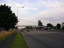
The first part, which was completed within three years, was from Walton, Liverpool, to the junction with the A6 at Irlams o' th' Height in Salford. The 29.5-mile (47.5 km) road was constructed in an almost straight alignment with few curves.
To be a high-speed trunk route, its 1930s planners designed some parts to be three roads in one. The central section was exclusively for through traffic while adjacent side roads – either side of the main carriageway – provided local access.[1] Although the sections within Liverpool were dual carriageway from the beginning, a few short stretches through Salford continue to use the original three-lane layout. The rest of the road was converted to dual with a central reservation in the 1950s and 1960s. Many of the original 1930s bridges remain; they were built from steel in preparation for any future expansion as they would be easier to replace than ones constructed from moulded concrete.
The road remains the UK's largest pre-motorway project. In 2004 the Highways Agency detrunked the road, passing control and maintenance over to the local authorities along its route.
Second phase (uncompleted)
With the completion of the first phase, the next stage was to extend the road beyond Salford and into East Lancashire proper. However this was never undertaken. Its failure was largely due to the road's location. Despite linking North West England's largest cities, the East Lancs remained isolated from the rest of the UK's national road network. Both ends of the highway began in high-density urban areas that were not close to any comparable infrastructure that could assist rapid transit connections.
By 1942, proposals were put forward to extend the A580 across the Pennines to Hull on the east coast of Britain.[2] Although this plan never came to fruition, its purpose became the foundation for the construction of the M62 motorway in 1960.
References
- 1 2 3 4 "Early Highways Liverpool-East Lancashire Road A580". Historic Highways. Lancashire County Council. Archived from the original on 29 December 2007. Retrieved 2008-01-19.
- ↑ "Preston Bypass". www.cbrd.co.uk. Retrieved 9 September 2013.
External links
A roads in Zone 5 of the Great Britain road numbering scheme | ||
|---|---|---|