A528 road
| |
|---|---|
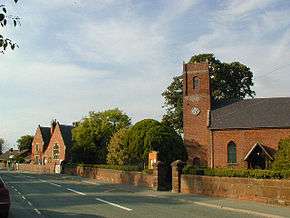 The A528 at Cockshutt | |
| Route information | |
| Length | 28 mi (45 km) |
| Major junctions | |
| North end | Marchwiel, Wrexham |
|
| |
| South end | Shrewsbury, Shropshire |
| Location | |
| Primary destinations |
Overton, Ellesmere |
| Road network | |

The A528 is a route on the UK highway network that runs from Marchwiel, near Wrexham, in North Wales (53°01′21″N 2°57′35″W / 53.0225°N 2.9597°W), to Shrewsbury, Shropshire, in England (52°42′46″N 2°45′04″W / 52.7128°N 2.7512°W). On the way it passes through Ellesmere and Coton Hill. The road follows an old route that was Turnpiked in the 18th century.[1]
Route
The road starts 2.5 miles (4 km) south east of Wrexham at Marchwiel by a junction on the A525 road.[2] It heads due south through Cock Bank and Overton Bridge before combining with the A539 road and going eastwards through the village of Overton-on-Dee.
It then heads south east through to Ellesmere, where it shares a small section of road with the A495, before heading south through Crosemere, Harmer Hill, Albrighton and intersecting with the A5124 at Harlescott north east of Shrewsbury.
The final short section into Shrewsbury goes over the Shrewsbury-Chester railway line and intersects with the A5191 in Shrewsbury town centre. A small stub going northwards only (due to the one-way system in Shrewsbury) starts off the A458 road.[3]
Safety
The A528 is one of Wales' most riskiest and dangerous routes. It is third behind the A44 and the A5 for the number of road casualties per year.[4]
References
- ↑ Williams, Paul (November 1998). "A watching brief on the A5124 Battlefield Link Road, Shrewsbury" (PDF). archaeologydataservice.ac.uk. ADS. p. 4. Retrieved 6 February 2017.
- ↑ "256" (Map). Wrexham & Llangollen. 1:25,000. Explorer. Ordnance Survey. 2015. ISBN 9780319244524.
- ↑ Collins Britain Big Road Atlas 2009 (Map). 1:200,000. Collins Bartholomew. 2008. p. 88. ISBN 978-0-00-727240-2.
- ↑ Owen, Cathy (15 September 2015). "The most dangerous roads in Wales revealed". walesonline. Retrieved 6 February 2017.
A roads in Zone 5 of the Great Britain road numbering scheme | ||
|---|---|---|
Coordinates: 52°53′09″N 2°51′40″W / 52.8859°N 2.8611°W