A4161 road
| |
|---|---|
 Newport Road and the Southern Way | |
| Major junctions | |
| East end |
A4232 (Southern Way) 51°30′01″N 3°08′25″W / 51.5002°N 3.1402°W |
|
| |
| West end |
A48 (Ely Bridge) 51°29′06″N 3°13′43″W / 51.4851°N 3.2286°W |
| Location | |
| Primary destinations | Cardiff |
| Road network | |

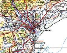
The A4161 is a main road in Cardiff, Wales, United Kingdom. The main purpose of the road is to link the city centre with the M4 motorway in the west at junction 33, and in the east with the A48(M) motorway at St Mellons.
The 1923 route of the A48 was the main east-west link in south Wales. The A48 in Cardiff was re-numbered to the A4161 on 19 November 1971 when the Eastern Avenue dual carriageway became the A48.[1] By 2 November 1975, Queen Street was partly pedestrianised and 2 subways were opened under North Road and Boulevard de Nantes[1] to allow the A4161 then to move from Queen Street to Dumfries Place, Stuttgart Strasse, Boulevard De Nantes. The A48 section between Rumney and St Mellons later became the B4487 and Southern Way (A4232) was built in 1978.[2]
Historic route of the old A48 in Cardiff
From east to west:
- Newport Road
- Queen Street
- Duke Street
- Castle Street
- Cowbridge Road East
Current route of the A4161
From east to west it runs through the following roads in Cardiff:
- From Southern Way west along Newport Road
- Dumfries Place
- Stuttgarter Strasse
- Boulevard De Nantes
The road then follows the A470 from North Road (alongside Cardiff Castle through to Duke Street, before becoming the A4161 again from:
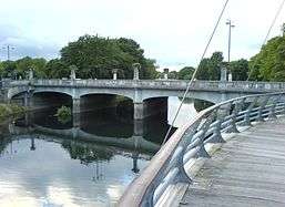
- Castle Street, and over Cardiff Bridge
- Cowbridge Road East
- Wellington Street
- Atlas Road
- Lansdowne Road
- Cowbridge Road East again, ending at Ely Bridge (roundabout on the A48)
Single or dual carriageway
| Junction | ||
| From | To | Type of road |
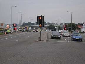
| Southern Way | Albany Road | 3 lane (both ways) dual carriageway |
| Albany Road | Broadway | 2 lane single carriageway |
| Broadway | North Road | 2 lane (both ways) dual carriageway |
| North Road and Duke Street (A470) | ||
| High Street | Cathedral Road | 2 lane (both ways) dual carriageway |
| Cathedral Road | Ely Bridge | 2 lane single carriageway |
Notes
- Cardiff & Newport A-Z Street Atlas 2007 Edition
References
- 1 2 "Cardiff Timeline". Cardiff Council. Archived from the original on 29 September 2007. Retrieved 2007-10-03.
- ↑ South Wales Echo, "Opening up southern Cardiff – Value of PDR", Wednesday 22 May, 1985, Page 15
| Motorways and A roads |  | |
|---|---|---|
| Pedestrian precincts and commercial streets | ||
| Bus | ||
| Cycling | ||
| Railway lines and operators | ||
| Major railway stations | ||
| Other city railway stations | ||
| Air | ||
| Water | ||