94th meridian west

94°
94th meridian west

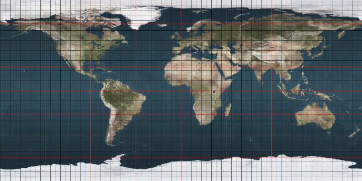
The meridian 94° west of Greenwich is a line of longitude that extends from the North Pole across the Arctic Ocean, North America, the Gulf of Mexico, Central America, the Pacific Ocean, the Southern Ocean, and Antarctica to the South Pole.

The 94th meridian west forms a great circle with the 86th meridian east.

In the United States, the meridian runs just east of, and approximately parallel to, part of the border of Texas with Arkansas and Louisiana.

From Pole to Pole

Starting at the North Pole and heading south to the South Pole, the 94th meridian west passes through:

Co-ordinates Country, territory or sea Notes
90°0′N 94°0′W / 90.000°N 94.000°W / 90.000; -94.000 (Arctic Ocean) Arctic Ocean
81°21′N 94°0′W / 81.350°N 94.000°W / 81.350; -94.000 (Canada)  Canada NunavutAxel Heiberg Island
78°53′N 94°0′W / 78.883°N 94.000°W / 78.883; -94.000 (Norwegian Bay) Norwegian Bay
77°44′N 94°0′W / 77.733°N 94.000°W / 77.733; -94.000 (Canada)  Canada NunavutCornwall Island
77°27′N 94°0′W / 77.450°N 94.000°W / 77.450; -94.000 (Belcher Channel) Belcher Channel
76°55′N 94°0′W / 76.917°N 94.000°W / 76.917; -94.000 (Canada)  Canada NunavutDevon Island
76°15′N 94°0′W / 76.250°N 94.000°W / 76.250; -94.000 (Wellington Channel) Wellington Channel
75°28′N 94°0′W / 75.467°N 94.000°W / 75.467; -94.000 (Canada)  Canada NunavutCornwallis Island
74°39′N 94°0′W / 74.650°N 94.000°W / 74.650; -94.000 (Parry Channel) Parry Channel Barrow Strait
74°8′N 94°0′W / 74.133°N 94.000°W / 74.133; -94.000 (Canada)  Canada NunavutSomerset Island
72°10′N 94°0′W / 72.167°N 94.000°W / 72.167; -94.000 (Gulf of Boothia) Gulf of Boothia Brentford Bay
71°48′N 94°0′W / 71.800°N 94.000°W / 71.800; -94.000 (Canada)  Canada Nunavut — mainland
68°48′N 94°0′W / 68.800°N 94.000°W / 68.800; -94.000 (Rasmussen Basin) Rasmussen Basin
68°27′N 94°0′W / 68.450°N 94.000°W / 68.450; -94.000 (Canada)  Canada Nunavut — mainland
61°5′N 94°0′W / 61.083°N 94.000°W / 61.083; -94.000 (Hudson Bay) Hudson Bay
58°46′N 94°0′W / 58.767°N 94.000°W / 58.767; -94.000 (Canada)  Canada Manitoba
Ontario — from 53°32′N 94°0′W / 53.533°N 94.000°W / 53.533; -94.000 (Ontario)
48°39′N 94°0′W / 48.650°N 94.000°W / 48.650; -94.000 (United States)  United States Minnesota
Iowa — from 43°30′N 94°0′W / 43.500°N 94.000°W / 43.500; -94.000 (Iowa)
Missouri — from 40°34′N 94°0′W / 40.567°N 94.000°W / 40.567; -94.000 (Missouri)
Arkansas — from 36°30′N 94°0′W / 36.500°N 94.000°W / 36.500; -94.000 (Arkansas)
Louisiana — from 33°1′N 94°0′W / 33.017°N 94.000°W / 33.017; -94.000 (Louisiana)
Texas — from 31°58′N 94°0′W / 31.967°N 94.000°W / 31.967; -94.000 (Texas)
29°40′N 94°0′W / 29.667°N 94.000°W / 29.667; -94.000 (Gulf of Mexico) Gulf of Mexico
18°15′N 94°0′W / 18.250°N 94.000°W / 18.250; -94.000 (Mexico)  Mexico Tabasco
Veracruz — from 17°50′N 94°0′W / 17.833°N 94.000°W / 17.833; -94.000 (Veracruz)
Oaxaca — from 17°9′N 94°0′W / 17.150°N 94.000°W / 17.150; -94.000 (Oaxaca)
Chiapas — from 16°48′N 94°0′W / 16.800°N 94.000°W / 16.800; -94.000 (Chiapas)
16°0′N 94°0′W / 16.000°N 94.000°W / 16.000; -94.000 (Pacific Ocean) Pacific Ocean
60°0′S 94°0′W / 60.000°S 94.000°W / -60.000; -94.000 (Southern Ocean) Southern Ocean
72°31′S 94°0′W / 72.517°S 94.000°W / -72.517; -94.000 (Antarctica) Antarctica Unclaimed territory

See also

This article is issued from Wikipedia. The text is licensed under Creative Commons - Attribution - Sharealike. Additional terms may apply for the media files.