22nd Street (San Francisco)
Coordinates: 37°45′17″N 122°25′40″W / 37.754782°N 122.427703°W
22nd Street is an east-west street passing through the Noe Valley, Mission, and Potrero Hill districts of San Francisco, California. The street is discontinuous and exists in several sections: the main western section between Hoffman Avenue and the Bayshore Freeway, a segment from Vermont Street to Wisconsin Street, a short alley off of Missouri Street, and an eastern section from Texas Street to Pier 70. Below the elevated Interstate 280 and at-grade eastern section lies 22nd Street station, Caltrain's only station beneath ground level.
Steepness
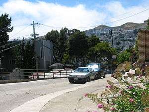
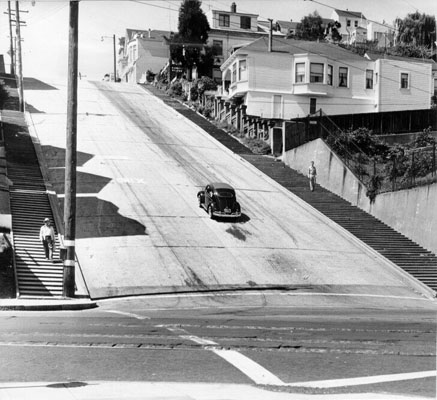
It is one of the steepest streets in the city. In the 250-foot block from Vicksburg to Church Streets in the Noe Valley neighborhood, the city map shows a 79-foot descent along the south side of the street (78-1/2 feet along the north side) for an average grade of just over 31%, about the same as the steepest block of Filbert Street in San Francisco.[1] (Both streets are one-way down; bottom of the 22nd St hill at 37°45′18″N 122°25′40″W / 37.7549°N 122.4279°W A 1956 view seems to show a two-way street.)
See also
- 22nd Street (Caltrain station)
- Baldwin Street, Dunedin — the world's steepest residential street.
References
- ↑ John Snyder (1999). San Francisco Secrets: Fanscinating Facts about the City by the Bay. Chronicle Books. ISBN 0-8118-2222-2.
| Numbered streets |  | |
|---|---|---|
| North–south streets |
| |
| East–west streets | ||
| Diagonal streets | ||
| Alleyways | ||
| Routes | ||