1992 Pacific typhoon season
| 1992 Pacific typhoon season | |
|---|---|
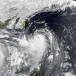
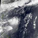
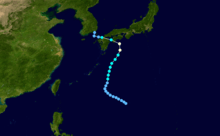
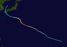
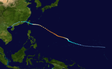
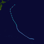
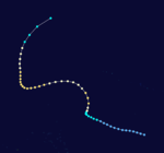
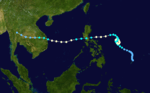
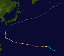
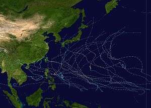 Season summary map | |
| Seasonal boundaries | |
| First system formed | January 4, 1992 |
| Last system dissipated | November 29, 1992 |
| Strongest storm | |
| Name | Gay |
| • Maximum winds |
205 km/h (125 mph) (10-minute sustained) |
| • Lowest pressure | 900 hPa (mbar) |
| Seasonal statistics | |
| Total depressions | 40 |
| Total storms | 31 |
| Typhoons | 16 |
| Super typhoons | 5 (unofficial) |
| Total fatalities | 399 |
| Total damage | $2.64 billion (1992 USD) |
| Related articles | |
The 1992 Pacific typhoon season had no official bounds; it ran year-round in 1992. Despite this, most tropical cyclones tend to form in the northwestern Pacific Ocean between May and November.[1] These dates conventionally delimit the period of each year when most tropical cyclones form in the northwestern Pacific Ocean.
The scope of this article is limited to the Pacific Ocean, north of the equator and west of the International Date Line. Storms that formed north of the equator and east of the Date Line in 1992 are part of the 1992 Pacific hurricane season. In the West Pacific basin, tropical depressions have the "W" suffix added to their number. Storms reaching tropical storm intensity of 34 kn (63 km/h) sustained winds were assigned a name by the Joint Typhoon Warning Center (JTWC). Storms with sustained winds exceeding 64 knots (119 km/h) are called typhoons, while intense typhoons with sustained winds exceeding 130 knots (240 km/h) are designated super typhoons by the JTWC (see tropical cyclone scales).
Furthermore, tropical depressions that enter or form in the Philippine Area of Responsibility are assigned an internal name by the Philippine Atmospheric, Geophysical and Astronomical Services Administration (PAGASA). This can often result in the same storm having two names.
Season summary
Systems
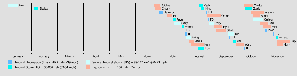
There were a total of 40 tropical cyclones in the Western Pacific in 1992. 39 of these formed within the basin, and 1 storm, Tropical Storm Ekeka, formed in the Central Pacific basin, crossing the Date Line to enter the Western Pacific. Out of the 39, 32 became named tropical storms, 21 reached typhoon intensity, and 5 reached super typhoon strength. Storms are listed in numerical ascending order by their JTWC tropical depression numbers except for Ekeka, and not in alphabetical order of names. Thus, Tropical Storm Zack (22W) is listed before Super Typhoon Yvette (23W).
Severe Tropical Storm Axel
| Severe tropical storm (JMA) | |
| Category 1 typhoon (SSHWS) | |
  | |
| Duration | January 4 – January 15 |
|---|---|
| Peak intensity | 100 km/h (65 mph) (10-min) 980 hPa (mbar) |
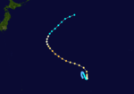
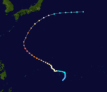
Axel formed as a tropical storm on January 4. It then curved and reached tropical storm strength. Axel continued to intensify, and it reached its peak as a severe tropical storm. Then, Axel weakened to a tropical storm. Axel continued to weak further until it was a tropical depression. It curve northeast until it was dissipated on January 15.
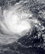
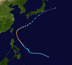
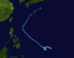
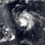
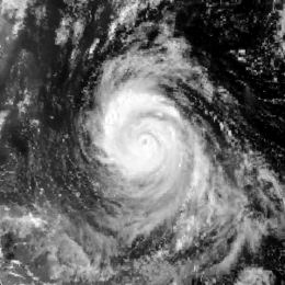
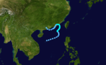
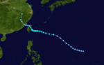
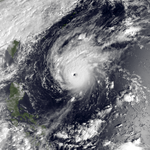
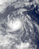
Tropical Storm Ekeka
| Tropical storm (JMA) | |
| Tropical storm (SSHWS) | |
.JPG) 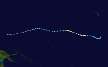 | |
| Duration | February 3 (Entered basin) – February 8 |
|---|---|
| Peak intensity | 85 km/h (50 mph) (10-min) 990 hPa (mbar) |
On February 3, Hurricane Ekeka entered the basin as a moderately strong tropical storm. Ekeka began to weak to a low-end tropical storm, then to a tropical depression on February 4. On February 8, JMA noticed that Ekeka dissipated, but the JTWC continued to track the system until February 9.
Typhoon Bobbie (Asiang)
| Typhoon (JMA) | |
| Category 4 typhoon (SSHWS) | |
  | |
| Duration | June 23 – June 30 |
|---|---|
| Peak intensity | 165 km/h (105 mph) (10-min) 940 hPa (mbar) |
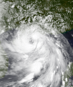
Bobbie formed as a tropical storm on June 22 east of Philippines. Then it curved northwest and intensified into a tropical storm. A few days later, it intensified into a category 1 hurricane. Later, it was upgraded into a category 2 typhoon, then it was greatly intensified on a category 4 typhoon. Then it reached its peak intensity with 165 km/h (105 mph) on 10-minute sustained. Subsequently, it weakened into a category 3 typhoon. Later, it was already a category 2 typhoon. Bobbie weakened further, as it was in a category 1 typhoon then a tropical storm. Bobbie landed in southeast Japan as a tropical storm. Then it was already dissipated on June 30.
Throughout Japan, damage reached 371.8 million yen ($2.9 million).
Typhoon Chuck (Biring)
| Typhoon (JMA) | |
| Category 1 typhoon (SSHWS) | |
  | |
| Duration | June 24 – July 1 |
|---|---|
| Peak intensity | 130 km/h (80 mph) (10-min) 965 hPa (mbar) |
When 90 mph (140 km/h) Typhoon Chuck hit southern Hainan Island and northern Vietnam on June 28 and 29, it brought heavy flooding.
At least seven people were killed by Typhoon Chuck and nine others were reported missing. Damage in China amounted to $36.4 million.
Tropical Depression Deanna
| Tropical depression (JMA) | |
| Tropical storm (SSHWS) | |
  | |
| Duration | June 29 – July 3 |
|---|---|
| Peak intensity | 75 km/h (45 mph) (1-min) 1002 hPa (mbar) |
Deanna re-curved out to sea.
Typhoon Eli (Konsing)
| Typhoon (JMA) | |
| Category 1 typhoon (SSHWS) | |
  | |
| Duration | July 8 – July 14 |
|---|---|
| Peak intensity | 130 km/h (80 mph) (10-min) 965 hPa (mbar) |
One person was killed and eight others were reported missing when the storm moved through the Philippines. Extensive damage took place in China with losses amounting to $235 million.
Tropical Storm Faye (Ditang)
| Tropical storm (JMA) | |
| Tropical storm (SSHWS) | |
  | |
| Duration | July 15 – July 18 |
|---|---|
| Peak intensity | 65 km/h (40 mph) (10-min) 1000 hPa (mbar) |
Two people were killed in Hong Kong.
Severe Tropical Storm Gary (Edeng)
| Severe tropical storm (JMA) | |
| Category 1 typhoon (SSHWS) | |
  | |
| Duration | July 17 – July 24 |
|---|---|
| Peak intensity | 100 km/h (65 mph) (10-min) 980 hPa (mbar) |
At least 48 people were killed by Gary. Extensive damage took place in China with losses reaching $940 million.
Tropical Storm Helen
| Tropical storm (JMA) | |
| Tropical storm (SSHWS) | |
  | |
| Duration | July 26 – July 28 |
|---|---|
| Peak intensity | 75 km/h (45 mph) (10-min) 996 hPa (mbar) |
Helen moved north away from land.
Severe Tropical Storm Irving
| Severe tropical storm (JMA) | |
| Category 1 typhoon (SSHWS) | |
  | |
| Duration | July 31 – August 5 |
|---|---|
| Peak intensity | 100 km/h (65 mph) (10-min) 980 hPa (mbar) |
Three people were killed and damage reached 64 million yen ($835,000).
Typhoon Janis (Gloring)
| Typhoon (JMA) | |
| Category 4 typhoon (SSHWS) | |
  | |
| Duration | August 3 – August 9 |
|---|---|
| Peak intensity | 175 km/h (110 mph) (10-min) 935 hPa (mbar) |
In Japan, Typhoon Janis killed two people and injured 41 others. Total losses from the storm reached 5.8 billion yen ($45.6 million).
Typhoon Kent
| Typhoon (JMA) | |
| Category 4 super typhoon (SSHWS) | |
  | |
| Duration | August 6 – August 19 |
|---|---|
| Peak intensity | 175 km/h (110 mph) (10-min) 930 hPa (mbar) |
Kent formed on August 5 in the Federated States of Micronesia. Then, it tracked northwest and was intensified into a tropical storm. Then, it was upgraded into a category 1 typhoon. A few days later, the JTWC upgraded Kent into a category 2 typhoon. Then, Kent intensified into a category 3 then to a category 4 typhoon. Kent reached its peak intensity as a super typhoon. Afterwards, Kent moved very slowly. Then, the JTWC downgraded Kent into a category 4 typhoon then to a category 3 typhoon. Kent still moved slowly. Afterwards, the JTWC downgraded Kent into a category 2 typhoon. However, it still moved slowly until it was downgraded into a category 1 typhoon. Afterwards, the JTWC downgraded Kent into a tropical storm. Kent moved northeastwards then affected Japan. After it affected Japan, it weakened into a tropical depression then dissipated on the Sea of Japan.
When Kent was traveling towards Japan, its large waves swept five people on the sea. Overall, Kent caused five deaths.
Tropical Storm Lois (Huaning)
| Tropical storm (JMA) | |
| Tropical storm (SSHWS) | |
  | |
| Duration | August 14 – August 21 |
|---|---|
| Peak intensity | 65 km/h (40 mph) (10-min) 996 hPa (mbar) |
Lois moved northeast away from Japan.
Tropical Storm Mark
| Tropical storm (JMA) | |
| Tropical storm (SSHWS) | |
 | |
| Duration | August 15 – August 19 |
|---|---|
| Peak intensity | 85 km/h (50 mph) (10-min) 990 hPa (mbar) |
One person was killed and another reported missing. Losses reached $10.4 million.
Tropical Storm Nina
| Tropical storm (JMA) | |
| Tropical storm (SSHWS) | |
 | |
| Duration | August 17 – August 21 |
|---|---|
| Peak intensity | 65 km/h (40 mph) (10-min) 996 hPa (mbar) |
Nina curved away from land.
Typhoon Omar (Lusing)
| Typhoon (JMA) | |
| Category 4 super typhoon (SSHWS) | |
  | |
| Duration | August 24 – September 9 |
|---|---|
| Peak intensity | 185 km/h (115 mph) (10-min) 920 hPa (mbar) |
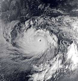
Typhoon Omar originated into a tropical disturbance on August 20. On those days, the basin saw the dissipation of 2 tropical cyclones and another two more cyclones that begin their extratropical transition. The system intensified,prompting JMA and JTWC to name the Tropical depression 15W. 15W tracked westward, and it intensified to become Tropical storm Omar. Omar begin to track westward, causing the outflow of Tropical Storm Polly to shear the system and slowing intensification. Then JTWC noticed that the wind shear can weaken Omar. The two storms furthered apart, allowing a ridge to develop between them. This caused Omar to drift slowly on the north, and because of the decreasing wind shear, Omar resumed strengthening. The storm later resumed its west-northwest track. On August 27, JTWC designed the storm as a typhoon, developing an eye. On August 28, Omar rapidly intensified and it made landfall on Guam with maximum sustained winds with 195 km/h (120 mph). On August 29, the storm reached its peak intensity with 10 min. sustained winds of 185 km/h (115 mph) and the lowest pressure of 920 mbar. This intensity remained for 24 hours before it weakened. However, JTWC estimated 1 min. winds at 240 km/h (150 mph). Two days later, Omar entered the PAR and PAGASA assigned the local name Lusing. On September 3, Omar weakened into a tropical storm by JMA, but JTWC maintained the storm at the typhoon strength. The storm still tracked westward, then made landfall on east coast of Taiwan. Then it made its final landfall near Fujian in Eastern China in September 5. Then it degenerated to a tropical depression before turning west-southwest. Then it moved on southern China as a weak system, dissipating on September 9 on northern Vietnam.
Typhoon Omar was a destructive storm to Guam, causing over a foot of rain there, amounting to $702 million in damage (2008 USD) and a death. In Taiwan, the storm caused 2 deaths and heavy rainfall, which warranted the name's retirement.
Severe Tropical Storm Polly (Isang)
| Severe tropical storm (JMA) | |
| Tropical storm (SSHWS) | |
 | |
| Duration | August 27 – September 1 |
|---|---|
| Peak intensity | 100 km/h (65 mph) (10-min) 975 hPa (mbar) |
Developing to Omar's west, Polly began its life on August 23 and reached tropical storm strength on the 26th. As a developing monsoon depression, it had a large outflow. Polly retained that throughout its lifetime, inhibiting intensification past 60 mph (97 km/h) winds. On the 30th, the storm hit southeastern Taiwan, and on the 31st it hit China.
Torrential rains produced by Tropical Storm Polly triggered devastating floods that killed 202 people and injured hundreds more. More than 5 million people were left homeless across Fujian and Zhejiang Provinces in China. Total losses from the storm were roughly $450 million.
Typhoon Ryan
| Typhoon (JMA) | |
| Category 4 typhoon (SSHWS) | |
  | |
| Duration | September 1 – September 11 |
|---|---|
| Peak intensity | 155 km/h (100 mph) (10-min) 945 hPa (mbar) |
Ryan was a potent typhoon that passed east of Japan.
Typhoon Sibyl
| Typhoon (JMA) | |
| Category 3 typhoon (SSHWS) | |
 | |
| Duration | September 4 – September 15 |
|---|---|
| Peak intensity | 155 km/h (100 mph) (10-min) 940 hPa (mbar) |
Sibyl did not affect land.
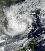
Severe Tropical Storm Ted (Maring)
| Severe tropical storm (JMA) | |
| Category 1 typhoon (SSHWS) | |
 | |
| Duration | September 18 – September 24 |
|---|---|
| Peak intensity | 95 km/h (60 mph) (10-min) 985 hPa (mbar) |
Tropical Storm Ted, having developed on September 14, stalled off northern Luzon on the 20th. It turned northward, and hit southern Taiwan on the 22nd as a minimal typhoon. Ted weakened to a tropical storm over the island, and hit eastern China on the 23rd. It turned to the northeast, hit South Korea, and became extratropical on the 24th.
At least 61 people were killed by Typhoon Ted and 51 others were reported missing. Losses from the storm reached $360 million in China.
Tropical Storm Val
| Tropical storm (JMA) | |
| Tropical storm (SSHWS) | |
 | |
| Duration | September 24 – September 27 |
|---|---|
| Peak intensity | 85 km/h (50 mph) (10-min) 990 hPa (mbar) |
Dingus
Typhoon Ward
| Typhoon (JMA) | |
| Category 2 typhoon (SSHWS) | |
  | |
| Duration | September 27 (Entered basin) – October 6 |
|---|---|
| Peak intensity | 155 km/h (100 mph) (10-min) 945 hPa (mbar) |
On September 23, a tropical depression developed just east of the International Dateline; however, it was warned upon by the Joint Typhoon Warning Center rather than the Central Pacific Hurricane Center as it was expected to become a significant tropical cyclone outside of the CPHC's area of responsibility. Just prior to crossing into the Western Pacific basin, it reached tropical storm intensity, at which time it was given the name Ward from the list of Pacific typhoon names. Winds at this time were estimated at 40 mph (65 km/h);[2] the Japan Meteorological Agency reported the system to have also attained a pressure of 1002 mbar (hPa; 29.59 inHg).[3] Over the following days, Ward gradually intensified, peaking as a Category 2 storm with winds of 110 mph (175 km/h). The storm eventually weakened as it moved through higher latitudes, becoming extratropical on October 7 over open waters.[2]
Typhoon Yvette (Ningning)
| Typhoon (JMA) | |
| Category 5 super typhoon (SSHWS) | |
  | |
| Duration | October 7 – October 17 |
|---|---|
| Peak intensity | 185 km/h (115 mph) (10-min) 915 hPa (mbar) |
Yvette was a recurving super typhoon.
Tropical Storm Zack
| Tropical storm (JMA) | |
| Tropical storm (SSHWS) | |
 | |
| Duration | October 8 – October 16 |
|---|---|
| Peak intensity | 75 km/h (45 mph) (10-min) 992 hPa (mbar) |
Zack stayed away from land.
Typhoon Angela (Osang)
| Typhoon (JMA) | |
| Category 2 typhoon (SSHWS) | |
  | |
| Duration | October 15 – October 30 |
|---|---|
| Peak intensity | 120 km/h (75 mph) (10-min) 970 hPa (mbar) |
At least 49 people were killed by Typhoon Angela, mostly in Vietnam, while 14 others were reported missing.
Typhoon Brian
| Typhoon (JMA) | |
| Category 2 typhoon (SSHWS) | |
  | |
| Duration | October 17 – October 25 |
|---|---|
| Peak intensity | 150 km/h (90 mph) (10-min) 950 hPa (mbar) |
Brian caused small damage in Guam.
No deaths were reported.
Severe Tropical Storm Colleen (Paring)
| Severe tropical storm (JMA) | |
| Category 1 typhoon (SSHWS) | |
  | |
| Duration | October 17 – October 29 |
|---|---|
| Peak intensity | 100 km/h (65 mph) (10-min) 980 hPa (mbar) |
Colleen intensified over the South China Sea before making landfall in Vietnam.
Typhoon Dan
| Typhoon (JMA) | |
| Category 3 typhoon (SSHWS) | |
  | |
| Duration | October 25 (Entered basin) – November 3 |
|---|---|
| Peak intensity | 165 km/h (105 mph) (10-min) 935 hPa (mbar) |
Dan came nowhere near land.
Typhoon Elsie (Reming)
| Typhoon (JMA) | |
| Category 5 super typhoon (SSHWS) | |
  | |
| Duration | October 29 – November 7 |
|---|---|
| Peak intensity | 185 km/h (115 mph) (10-min) 915 hPa (mbar) |
Elsie recurved away from land.
Tropical Depression 29W
| Tropical depression (JMA) | |
| Tropical depression (SSHWS) | |
 | |
| Duration | October 31 – November 3 |
|---|---|
| Peak intensity | 45 km/h (30 mph) (1-min) 1004 hPa (mbar) |
On October 30, a tropical disturbance began to form west of the International Date Line. The JTWC then issued a Tropical Cyclone Formation Alert late the next day as the system moved westward and started warnings on Tropical Depression 29W on November 1. However, intensification was severely inhibited by outflow from nearby Typhoon Dan, and the depression failed to develop. It passed within 30 nmi (55 km) of Wake Island, causing a minor pressure dip and gusts to 32 kn (60 km/h). No damage was reported, due to the relative weakness of 29W as compared to Dan, which ravaged the island 3 days earlier. The depression dissipated on November 2 over open ocean.[4]
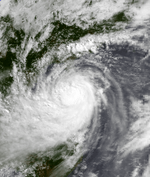
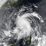
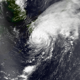
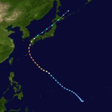
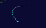
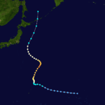
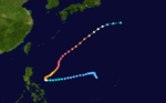
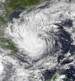
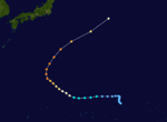
Tropical Storm Forrest
| Tropical storm (JMA) | |
| Tropical storm (SSHWS) | |
.JPG) 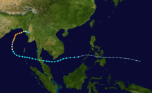 | |
| Duration | November 13 – November 15 (Exited basin) |
|---|---|
| Peak intensity | 85 km/h (50 mph) (10-min) 996 hPa (mbar) |
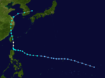
On November 8 a tropical depression formed from the monsoon trough east of the Philippines. It crossed the islands, and strengthened to a tropical storm in the South China Sea on the 12th. Forrest continued westward until hitting and crossing the Malay Peninsula on the 15th. It reached a peak of 145 mph (233 km/h) winds in the Bay of Bengal before hitting Myanmar on the 21st.
At least two people were killed by Tropical Storm Forrest and 31 others were reported missing after a ship capsized.
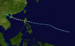
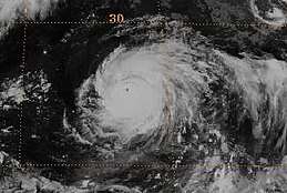
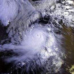
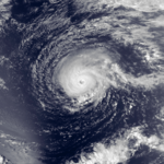
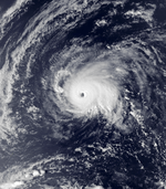
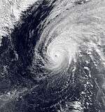
Typhoon Gay (Seniang)
| Typhoon (JMA) | |
| Category 5 super typhoon (SSHWS) | |
  | |
| Duration | November 14 – November 29 |
|---|---|
| Peak intensity | 205 km/h (125 mph) (10-min) 900 hPa (mbar) |
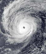
Typhoon Gay was the strongest and longest-lasting storm of the season, forming on November 13 near the International Date Line. As it moved to the west, Gay steadily intensified and moved through the Marshall Islands as an intensifying typhoon. After passing through the country, it intensified its peak intensity over open waters. The JTWC estimated peak winds of 295 km/h (185 mph) and a minimum barometric pressure of 872 mb (25.8 inHg). However, the Japan Meteorological Agency (JMA), which is the official warning center in the western Pacific, estimated winds of 205 km/h (125 mph), with a pressure of 900 mbar (27 inHg). Typhoon Gay weakened rapidly after peaking due to interaction with another typhoon, and it struck Guam with winds of 160 km/h (100 mph) on November 23. The typhoon briefly re-intensified, although it weakened as it turned toward Japan and became extratropical on November 29.[5][6]
The typhoon first affected the Marshall Islands, where 5,000 people were left homeless and heavy crop damage was reported. The nation's capital of Majuro lost power during the storm and experienced power and water outages. No Marshall Islands citizens were killed,[5] although the typhoon killed a sailor who was traveling around the world.[7] When Gay struck Guam, it became the sixth typhoon of the year to affect the island. Most of the weaker structures were destroyed during Typhoon Omar earlier in the year. Due to its substantial weakening, Gay had a disrupted inner-core that dropped minimal rainfall, which caused extensive defoliation of plants due to salt water scorching. Further north, the typhoon destroyed a house on Saipan from high waves.[5]
Typhoon Hunt
| Typhoon (JMA) | |
| Category 4 typhoon (SSHWS) | |
  | |
| Duration | November 15 – November 22 |
|---|---|
| Peak intensity | 165 km/h (105 mph) (10-min) 940 hPa (mbar) |
The last storm of the year formed on November 13 and became extratropical on November 22.
Storm names
During the season 31 named tropical cyclones developed in the Western Pacific and were named by the Joint Typhoon Warning Center, when it was determined that they had become tropical storms. These names were contributed to a revised list which started on mid-1989.
| Axel | Bobbie | Chuck | Deanna | Eli | Faye | Gary | Helen | Irving | Janis | Kent | Lois | Mark | Nina | Omar | Polly |
| Ryan | Sibyl | Ted | Val | Ward | Yvette | Zack | Angela | Brian | Colleen | Dan | Elsie | Forrest | Gay | Hunt |
Philippines
| Asiang | Biring | Konsing | Ditang | Edeng |
| Gloring | Huaning | Isang | Lusing | Maring |
| Ningning | Osang | Paring | Reming | Seniang |
| Toyang (unused) | Ulpiang (unused) | Welpring (unused) | Yerling (unused) | |
| Auxiliary list | ||||
|---|---|---|---|---|
| Aring (unused) | ||||
| Basiang (unused) | Kayang (unused) | Dorang (unused) | Enang (unused) | Grasing (unused) |
The Philippine Atmospheric, Geophysical and Astronomical Services Administration uses its own naming scheme for tropical cyclones in their area of responsibility. PAGASA assigns names to tropical depressions that form within their area of responsibility and any tropical cyclone that might move into their area of responsibility. Should the list of names for a given year prove to be insufficient, names are taken from an auxiliary list, the first 6 of which are published each year before the season starts. Names not retired from this list will be used again in the 1996 season. This is the same list used for the 1988 season. PAGASA uses its own naming scheme that starts in the Filipino alphabet, with names of Filipino female names ending with "ng" (A, B, K, D, etc.). Names that were not assigned/going to use are marked in gray.
Retirement
Due to extensive damage caused by Typhoon Omar in Guam, the name was later retired and was replaced by Oscar and was first used in the 1995 season.
Season effects
This table summarizes all the systems that developed within or moved into the North Pacific Ocean, to the west of the International Date Line during 1992. The tables also provide an overview of a systems intensity, duration, land areas affected and any deaths or damages associated with the system.
| Name | Dates active | Peak classification | Sustained wind speeds |
Pressure | Areas affected | Damage (USD) |
Deaths | Refs |
|---|---|---|---|---|---|---|---|---|
| Axel | January 4 – 15 | Severe tropical storm | 100 km/h (65 mph) | 980 hPa (28.94 inHg) | Marshall Islands, Caroline Islands, Mariana Islands | None | None | |
| Ekeka | February 3 – 8 | Tropical storm | 85 km/h (50 mph) | 990 hPa (29.23 inHg) | Marshall Islands | None | None | |
| Bobbie (Asiang) | June 23 – 30 | Typhoon | 165 km/h (105 mph) | 940 hPa (27.76 inHg) | Philippines, Japan | $2.9 million | Unknown | |
| Chuck (Biring) | June 24 – July 1 | Typhoon | 130 km/h (80 mph) | 965 hPa (28.50 inHg) | Philippines, South China, Vietnam | $36.4 million | 7 | |
| Deanna | June 28 – July 3 | Tropical depression | 75 km/h (45 mph) | 1002 hPa (29.59 inHg) | Caroline Islands | None | None | |
| Eli (Konsing) | July 8 – 14 | Typhoon | 130 km/h (80 mph) | 965 hPa (28.50 inHg) | Caroline Islands, Philippines, South China, Vietnam | $235 million | 1 | |
| Faye (Ditang) | July 15 – 18 | Tropical storm | 65 km/h (40 mph) | 1000 hPa (29.53 inHg) | Philippines, South China | None | 2 | |
| Gary (Edeng) | July 17 – 24 | Severe tropical storm | 100 km/h (65 mph) | 980 hPa (28.94 inHg) | Marshall Islands, Caroline Islands, Mariana Islands | $940 million | 48 | |
| Helen | July 26 – 28 | Tropical storm | 75 km/h (45 mph) | 996 hPa (29.41 inHg) | None | None | None | |
| TD | July 29 | Tropical depression | Not specified | 1010 hPa (29.83 inHg) | None | None | None | |
| TD | July 30 – 31 | Tropical depression | Not specified | 1012 hPa (29.89 inHg) | None | None | None | |
| Irving | July 31 – August 5 | Severe tropical storm | 100 km/h (65 mph) | 980 hPa (28.94 inHg) | Japan, South Korea | $835 thousand | 3 | |
| Janis (Gloring) | August 3 – 9 | Typhoon | 175 km/h (110 mph) | 935 hPa (27.61 inHg) | Caroline Islands, Mariana Islands, Japan | $45.6 million | 2 | |
| Kent | August 6 – 19 | Typhoon | 175 km/h (110 mph) | 930 hPa (27.46 inHg) | Marhsall Islands, Japan | Unknown | 5 | |
| Lois (Huaning) | August 14 – 21 | Tropical storm | 65 km/h (40 mph) | 996 hPa (29.41 inHg) | None | None | None | |
| Mark | August 15 – 19 | Tropical storm | 85 km/h (50 mph) | 990 hPa (29.23 inHg) | China, Taiwan | $10.4 million | 1 | |
| Nina | August 17 – 21 | Tropical storm | 65 km/h (40 mph) | 996 hPa (29.41 inHg) | None | None | None | |
| TD | August 23 – 24 | Tropical depression | Not specified | 1008 hPa (29.77 inHg) | Japan | None | None | |
| Omar (Lusing) | August 24 – September 9 | Typhoon | 185 km/h (115 mph) | 920 hPa (27.17 inHg) | Marshall Islands, Caroline Islands, Mariana Islands, Philippines, Taiwan, China, Ryukyu Islands | $561 million | 15 | |
| TD | August 25 – 26 | Tropical depression | Not specified | 1000 hPa (29.53 inHg) | None | None | None | |
| Polly (Ising) | August 27 – September 1 | Severe tropical storm | 100 km/h (65 mph) | 975 hPa (28.79 inHg) | Taiwan, Ryukyu Islands, China | $450 million | 202 | |
| Ryan | September 1 – 11 | Typhoon | 155 km/h (100 mph) | 945 hPa (27.91 inHg) | Mariana Islands | None | None | |
| Sibyl | September 4 – 15 | Typhoon | 155 km/h (100 mph) | 940 hPa (27.76 inHg) | None | None | None | |
| Ted (Maring) | September 18 – 24 | Severe tropical storm | 95 km/h (60 mph) | 985 hPa (29.09 inHg) | Philippines, Taiwan, East China, Korean Peninsula | $360 million | 61 | |
| TD | September 19 – 20 | Tropical depression | Not specified | 1004 hPa (29.65 inHg) | South China, Vietnam | None | None | |
| Val | September 24 – 27 | Tropical storm | 85 km/h (50 mph) | 990 hPa (29.23 inHg) | None | None | None | |
| Ward | September 27 – October 6 | Typhoon | 155 km/h (100 mph) | 945 hPa (27.91 inHg) | None | None | None | |
| TD | October 7 | Tropical depression | Not specified | 1008 hPa (29.77 inHg) | Vietnam | None | None | |
| Yvette (Ningning) | October 7 – 17 | Typhoon | 185 km/h (115 mph) | 915 hPa (27.02 inHg) | Philippines | None | None | |
| Zack | October 8 – 16 | Tropical storm | 75 km/h (45 mph) | 992 hPa (29.29 inHg) | Marshall Islands | None | None | |
| Angela (Osang) | October 15 – 30 | Typhoon | 120 km/h (75 mph) | 970 hPa (28.94 inHg) | Philippines, Vietnam, Cambodia, Thailand, Malaysia | Unknown | 49 | |
| Brian | October 17 – 25 | Typhoon | 150 km/h (90 mph) | 950 hPa (28.05 inHg) | Caroline Islands, Mariana Islands | None | None | |
| Colleen (Paring) | October 17 – 29 | Severe tropical storm | 100 km/h (85 mph) | 985 hPa (29.09 inHg) | Philippines, Vietnam, Cambodia, Laos, Thailand, Myanmar | Unknown | Unknown | |
| Dan | October 25 – November 3 | Typhoon | 165 km/h (105 mph) | 935 hPa (27.61 inHg) | Marshall Islands | None | None | |
| Elsie (Reming) | October 29 – November 7 | Typhoon | 150 km/h (90 mph) | 950 hPa (28.05 inHg) | Caroline Islands, Mariana Islands | None | None | |
| 29W | October 31 – November 2 | Tropical depression | 45 km/h (30 mph) | 1004 hPa (29.65 inHg) | None | None | None | |
| TD | November 10 – 11 | Tropical depression | Not specified | 1008 hPa (29.77 inHg) | Philippines | None | None | |
| Forrest | November 13 – 15 | Tropical storm | 75 km/h (45 mph) | 992 hPa (29.29 inHg) | Vietnam, Thailand, Myanmar | None | 2 | |
| Gay (Seniang) | November 14 – 29 | Typhoon | 205 km/h (125 mph) | 900 hPa (26.58 inHg) | Marshall Islands, Caroline Islands, Mariana Islands | None | 1 | |
| Hunt | November 15 – 21 | Typhoon | 165 km/h (105 mph) | 940 hPa (27.76 inHg) | Mariana Islands | None | None | |
| Season aggregates | ||||||||
| 40 systems | January 4 – November 29 | 205 km/h (125 mph) | 900 hPa (26.58 inHg) | >$2.64 billion | 399 | |||
See also
- 1992 Pacific hurricane season
- 1992 Atlantic hurricane season
- 1992 North Indian cyclone season
- List of wettest tropical cyclones
- South-West Indian Ocean cyclone season: 1991–92, 1992–93
- Australian region cyclone season: 1991–92, 1992–93
- South Pacific cyclone season: 1991–92, 1992–93
References
- ↑ Gary Padgett (2003-08-17). "May 2003 Global Tropical Cyclone Summary". Archived from the original on 25 September 2006. Retrieved 2006-08-26.
- 1 2 Joint Typhoon Warning Center (1993). "Typhoon Ward (21W) Preliminary Report" (PDF). Naval Meteorology and Oceanography Command. Retrieved July 21, 2010.
- ↑ "Japan Meteorological Agency Best Tracks for 1991–1995". Japan Meteorological Agency. 1996. Archived from the original (TXT) on May 21, 2008. Retrieved July 21, 2010.
- ↑ Elizabeth B. Borelli (1993). "Tropical Depression 29W" (PDF). 1992 Annual Tropical Cyclone Report. Joint Typhoon Warning Center. Retrieved 1 January 2010.
- 1 2 3 "1992 Annual Tropical Cyclone Report" (PDF). Joint Typhoon Warning Center. Retrieved 2011-11-28.
- ↑ Japan Meteorological Agency (1992-12-25). "RSMC Best Track Data - 1990-1999" (TXT). Retrieved 2011-11-28.
- ↑ Sherryl Connelly (1999-06-03). "A Lady In Distress ... And The Lover Who Threw Her Cautions To The Wind". New York Daily News. Retrieved 2011-12-05.
External links
- Satellite movie of the 1992 Pacific typhoon season
- Japan Meteorological Agency
- Joint Typhoon Warning Center.
- China Meteorological Agency
- National Weather Service Guam
- Hong Kong Observatory
- Macau Meteorological Geophysical Services
- Korea Meteorological Agency
- Philippine Atmospheric, Geophysical and Astronomical Services Administration
- Taiwan Central Weather Bureau
Tropical cyclones of the 1992 Pacific typhoon season | ||
|---|---|---|
| ||
| ||