Öræfajökull
| Öræfajökull | |
|---|---|
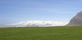 View of Öræfajökull, showing its broad shape. | |
| Highest point | |
| Elevation | 2,109.6 metres (6,921 ft) at Hvannadalshnúkur [1] |
| Prominence | 2,109.6 metres (6,921 ft) at Hvannadalshnúkur |
| Coordinates | 64°00′N 16°39′W / 64.000°N 16.650°W |
| Geography | |
| Location | Iceland |
| Parent range | Mid-Atlantic Ridge |
| Geology | |
| Age of rock | Pleistocene |
| Mountain type | Stratovolcano |
| Last eruption | 1727 to 1728 |
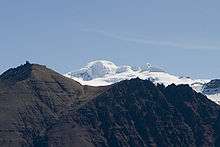
Öræfajökull, (Icelandic pronunciation: [ˈœːraivaˌjœːkʏtl̥]) is an ice-covered volcano in south-east Iceland. The largest active volcano and the highest peak in Iceland at 2,110 metres (6,920 ft), it lies within the Vatnajökull National Park and is covered by the glacier.
Description
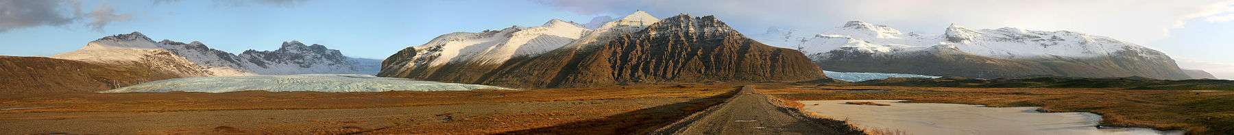
Öræfajökull is located at the southern extremity of the Vatnajökull glacier and overlooking the Ring Road between Höfn and Vík. It is the largest active volcano in the country, and on the summit crater's north-western rim is Hvannadalshnúkur, the highest peak in Iceland at 2,110 metres (6,920 ft). Geographically, Öræfajökull is considered part of Vatnajökull, and the area covered by glacier is within the boundary of Vatnajökull National Park.
Activity
Öræfajökull has erupted twice in historical times, in 1362 and 1728.
1362 eruption
In 1362, the volcano erupted explosively, with huge amounts of tephra being ejected. The district of Litla-Hérað was destroyed by floods and tephra fall. Sailors reported pumice “in such masses that ships could hardly make their way through it”. Thick volcanic deposits obliterated farmland and ash travelled as far as western Europe. More than 40 years passed before people again settled the area, which became known as Öræfi. The name literally means an area without harbour, but it took on a meaning of wasteland in Icelandic.[2]
1728 eruption
An eruption in August 1727-28 was smaller than 1362, though floods are known to have caused three fatalities when the meltwater swept their farm away.[2]
2017 activity
Increased earthquake activity in the form of small tremors ranging from a depth of 1.5–10 km beneath the summit crater, began in August 2017 according to the Icelandic Meteorological Office.
The Aviation Colour Code of the United States was raised to yellow on 17 November 2017, after the appearance of an ice-cauldron inside the main crater and increased geothermal activity under the glacier.[3]
2018 activity
Increased earthquake activity in April.
See also
References
External links
- Öræfajökull in the Catalogue of Icelandic Volcanoes
- Volcano Images of Europe
- Photos of Öræfajökull www.Icelandportfolio.com
- http://www.volcano.si.edu/world/volcano.cfm?vnum=1704-01=