Stockton (Wiltshire)
Stockton is een dorp (village) en civil parish in de unitary authority Wiltshire, in het Engelse graafschap Wiltshire. De civil parish telt 204 inwoners.
| Bronnen, noten en/of referenties
|
Aldbourne · Alderbury · All Cannings · Allington · Alton · Alvediston · Amesbury · Ansty · Ashton Keynes · Atworth · Avebury · Barford St. Martin · Baydon · Beechingstoke · Berwick Bassett · Berwick St. James · Berwick St. John · Berwick St. Leonard · Biddestone · Bishops Cannings · Bishopstone (Swindon) · Bishopstone (Wiltshire) · Bishopstrow · Blunsdon St Andrew · Bower Chalke · Box · Boyton · Bradford on Avon · Bratton · Braydon · Bremhill · Brinkworth · Britford · Brixton Deverill · Broad Chalke · Broad Hinton · Broad Town · Brokenborough · Bromham · Broughton Gifford · Bulford · Bulkington · Burbage · Burcombe Without · Buttermere · Calne Without · Calne · Castle Combe · Castle Eaton · Chapmanslade · Charlton · Charlton · Cherhill · Cheverell Magna · Cheverell Parva · Chicklade · Chilmark · Chilton Foliat · Chippenham Without · Chippenham · Chirton · Chiseldon · Chitterne · Cholderton · Christian Malford · Chute Forest · Chute · Clarendon Park · Clyffe Pypard · Codford · Colerne · Collingbourne Ducis · Collingbourne Kingston · Compton Bassett · Compton Chamberlayne · Coombe Bissett · Corsham · Corsley · Coulston · Covingham · Cricklade · Crudwell · Dauntsey · Devizes · Dilton Marsh · Dinton · Donhead St. Andrew · Donhead St. Mary · Downton · Durnford · Durrington · East Kennett · East Knoyle · Easterton · Easton Grey · Easton · Ebbesborne Wake · Edington · Enford · Erlestoke · Etchilhampton · Everleigh · Figheldean · Firsdown · Fittleton · Fonthill Bishop · Fonthill Gifford · Fovant · Froxfield · Fyfield · Grafton · Great Bedwyn · Great Hinton · Great Somerford · Great Wishford · Grimstead · Grittleton · Ham · Hankerton · Hannington · Haydon Wick · Heddington · Heytesbury · Heywood · Highworth · Hilmarton · Hilperton · Hindon · Holt · Horningsham · Huish · Hullavington · Idmiston · Inglesham · Keevil · Kilmington · Kingston Deverill · Kington Langley · Kington St. Michael · Knook · Lacock · Landford · Lands common to the parishes of Broughton Gifford and Melksham Without · Langley Burrell Without · Latton · Laverstock · Lea and Cleverton · Leigh · Liddington · Limpley Stoke · Little Bedwyn · Little Somerford · Longbridge Deverill · Luckington · Ludgershall · Lydiard Millicent · Lydiard Tregoze · Lyneham and Bradenstoke · Maiden Bradley with Yarnfield · Malmesbury · Manningford · Marden · Market Lavington · Marlborough · Marston Maisey · Marston · Melksham Without · Melksham · Mere · Mildenhall · Milston · Milton Lilbourne · Minety · Monkton Farleigh · Netheravon · Netherhampton · Nettleton · Newton Tony · North Bradley · North Newnton · North Wraxall · Norton Bavant · Norton · Oaksey · Odstock · Ogbourne St. Andrew · Ogbourne St. George · Orcheston · Patney · Pewsey · Pitton and Farley · Potterne · Poulshot · Preshute · Purton · Quidhampton · Ramsbury · Redlynch · Roundway · Rowde · Rushall · Savernake · Seagry · Sedgehill and Semley · Seend · Semington · Shalbourne · Sherrington · Sherston · Shrewton · Sopworth · South Marston · South Newton · South Wraxall · Southwick · St. Paul Malmesbury Without · Stanton Fitzwarren · Stanton Saint Bernard · Stanton St. Quintin · Stapleford · Staverton · Steeple Ashton · Steeple Langford · Stert · Stockton · Stourton with Gasper · Stratford Toney · Stratton St Margaret · Sutton Benger · Sutton Mandeville · Sutton Veny · Swallowcliffe · Teffont · Tidcombe and Fosbury · Tidworth · Tilshead · Tisbury · Tockenham · Tollard Royal · Trowbridge · Upavon · Upton Lovell · Upton Scudamore · Urchfont · Wanborough · Warminster · West Ashton · West Dean · West Knoyle · West Lavington · West Overton · West Tisbury · Westbury · Westwood · Whiteparish · Wilcot · Wilsford cum Lake · Wilsford · Wilton · Wingfield · Winsley · Winterbourne Bassett · Winterbourne Monkton · Winterbourne Stoke · Winterbourne · Winterslow · Woodborough · Woodford · Wootton Bassett · Wootton Rivers · Worton · Wroughton · Wylye · Yatton Keynell · Zeals
Geplaatst op: 06-09-2009 |
Dit artikel is een beginnetje over landen & volken. U wordt uitgenodigd om op bewerken te klikken om uw kennis aan dit artikel toe te voegen. |
| Civil parish in Engeland | |||
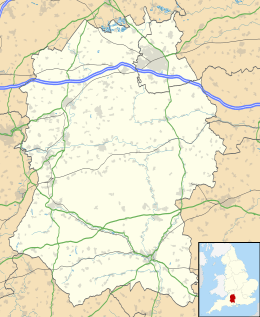 | |||
| Situering | |||
| Regio | South West England | ||
| Graafschap | Wiltshire | ||
| District | Wiltshire | ||
| Coördinaten | 51° 9' NB, 2° 2' WL | ||
| Algemeen | |||
| Oppervlakte | 13,3155 km² | ||
| Inwoners (2011) | 204 (15 inw./km²) | ||
| Overig | |||
| ONS-code | E04011828 | ||
| Foto's | |||
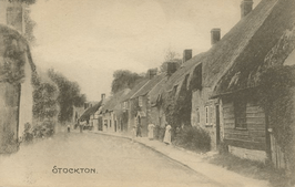 | |||
| Stockton, c. 1910 | |||
| |||