Santo Tomas (Batangas)
Santo Tomas is een gemeente in de Filipijnse provincie Batangas op het eiland Luzon. Bij de laatste census in 2010 telde de gemeente bijna 125 duizend inwoners.[2]
Gemeente in de Filipijnen | |||
 | |||
Situering | |||
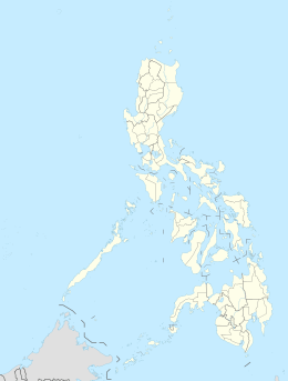
| Eiland | Luzon | ||
| Provincie | Batangas | ||
| Regio | CALABARZON (regio IV-A) | ||
| Coördinaten | 14° 5′ NB, 121° 11′ OL | ||
Statistische informatie | |||
| Oppervlakte | 95,4[1] km² | ||
| Inwoners (2010) | 124.740 (1.307,4 inw./km²) | ||
Bestuurlijke informatie | |||
| Barangays | 30 | ||
| Tijdzone | UTC+8 | ||
| Detailkaart | |||
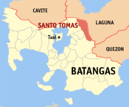 | |||
| Positie van Santo Tomas binnen Batangas | |||
| |||
Geografie
Bestuurlijke indeling
Santo Tomas is onderverdeeld in de volgende 30 barangays[3]:
|
|
Demografie
| Aantal inwoners van Santo Tomas | |||
|---|---|---|---|
| Census | Inwoners | %/jr | |
| 1995 | 65.759 | — | |
| 2000 | 80.393 | 4,40% | |
| 2007 | 113.105 | 4,82% | |
| 2010 | 124.740 | 3,62% | |
Santo Tomas had bij de census van 2010 een inwoneraantal van 124.740 mensen. Dit waren 11.635 mensen (10,3%) meer dan bij de vorige census van 2007. Ten opzichte van de census van 2000 was het aantal inwoners gegroeid met 44.347 mensen (55,2%). De gemiddelde jaarlijkse groei in die periode kwam daarmee uit op 4,49%, hetgeen hoger was dan het landelijk jaarlijks gemiddelde over deze periode (1,90%).[2] De bevolkingsdichtheid van Santo Tomas was ten tijde van de laatste census, met 124.740 inwoners op 95,41 km², 1307,4 mensen per km².
Geboren in Santo Tomas
- Miguel Malvar (27 september 1865), generaal in de Filipijnse Revolutie (overleden 1911).
Bronnen, noten en/of referenties
|
| Steden en gemeenten van de provincie Batangas | |
|---|---|
|
Agoncillo · Alitagtag · Balayan · Balete · Batangas City · Bauan · Calaca · Calatagan · Cuenca · Ibaan · Laurel · Lemery · Lian · Lipa · Lobo · Mabini · Malvar · Mataasnakahoy · Nasugbu · Padre Garcia · Rosario · San Jose · San Juan · San Luis · San Nicolas · San Pascual · Santa Teresita · Santo Tomas · Taal · Talisay · Tanauan · Taysan · Tingloy · Tuy | |