Sandown
Sandown is een stad (town) en civil parish in de unitary authority Wight, in het Engelse graafschap Wight. De civil parish telt 7185 inwoners.
| Civil parish in Engeland | |||
 | |||
| Situering | |||
| Regio | South East England | ||
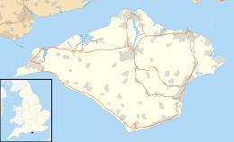
| Graafschap | Wight | ||
| District | Wight | ||
| Coördinaten | 50° 39' NB, 1° 9' WL | ||
| Algemeen | |||
| Oppervlakte | 4,2445 km² | ||
| Inwoners (2011) | 7185 (1693 inw./km²) | ||
| Overig | |||
| Postcode(s) | PO36 | ||
| Netnummer(s) | 01983 | ||
| Grid code | SZ600843 | ||
| Post town | SANDOWN | ||
| ONS-code | E04001311 | ||
| Foto's | |||
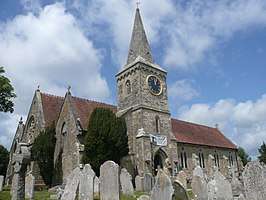 | |||
| Christ Church, Sandown | |||
| |||
Geboren
- Charles Ralph Boxer (1904-2000), historicus
| Bronnen, noten en/of referenties
|
| Civil parishes op Wight (eiland en graafschap) |
|---|
|
Arreton · Bembridge · Brading · Brighstone · Calbourne · Chale · Cowes · East Cowes · Fishbourne · Freshwater · Gatcombe · Godshill · Gurnard · Havenstreet and Ashey · Lake · Nettlestone and Seaview · Newchurch · Newport · Niton and Whitwell · Northwood · Rookley · Ryde · Sandown · Shalfleet · Shanklin · Shorwell · St Helens · Totland · Ventnor · Whippingham · Wootton Bridge · Wroxall · Yarmouth |
Geplaatst op: 09-07-2007 |
Dit artikel is een beginnetje over landen & volken. U wordt uitgenodigd om op bewerken te klikken om uw kennis aan dit artikel toe te voegen. |
This article is issued from
Wikipedia.
The text is licensed under Creative
Commons - Attribution - Sharealike.
Additional terms may apply for the media files.