Pakur (district)
Pakur is een district van de Indiase staat Jharkhand. Het district telt 701.616[1] inwoners (2001) en heeft een oppervlakte van 1805 km².
Bronnen, noten en/of referenties
|
| Districten in de deelstaat Jharkhand | |
|---|---|
|
Bokaro · Chatra · Deoghar · Dhanbad · Dumka · Garhwa · Giridih · Godda · Gumla · Hazaribagh · Jamtara · Khunti · Koderma · Latehar · Lohardaga · Pakur · Palamu · Pashchimi Singhbhum · Purbi Singhbhum · Ramgarh · Ranchi · Sahebganj · Saraikela Kharsawan · Simdega | |
Geplaatst op: 30-05-2009 |
Dit artikel is een beginnetje over landen & volken. U wordt uitgenodigd om op bewerken te klikken om uw kennis aan dit artikel toe te voegen. |
| District van India | |||
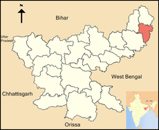 Ligging in Jharkhand | |||
| Situering | |||
| Staat | Jharkhand | ||
| Coördinaten | 24°37'48"NB, 87°51'0"OL | ||
| Algemeen | |||
| Oppervlakte | 1805 km² | ||
| Inwoners (2001) | 701.616 (389 inw./km²) | ||
| Hoofdstad | Pakur | ||
| |||
This article is issued from
Wikipedia.
The text is licensed under Creative
Commons - Attribution - Sharealike.
Additional terms may apply for the media files.