Midlothian (Schotland)
Midlothian (Schots-Gaelisch: Meadhan Lodainn) is een raadsgebied (council area) en lieutenancy area in het zuidoosten van Schotland met een oppervlakte van 354 km². De hoofdplaats is Dalkeith en het raadsgebied heeft 79.610 inwoners (2004).
| Raadsgebied van Schotland | |||
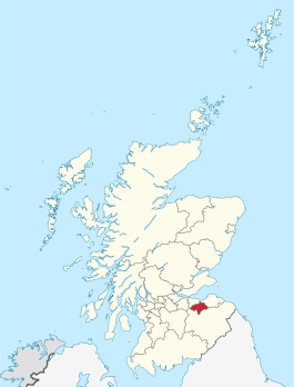 Ligging van Midlothian in Schotland | |||
| Coördinaten | 55°53'39"NB, 3°4'7"WL | ||
| Algemeen | |||
| Oppervlakte | 353,6818[1] km² | ||
| Hoofdplaats | Dalkeith | ||
| - rang | 21e | ||
| Inwoners (2004) | ( inw./km²) | ||
| Politiek | |||
| Bestuur | |||
| MP's | David Hamilton | ||
| MSP's | Rhona Brankin | ||
| Overig | |||
| ONS code | S12000019 | ||
| ISO 3166 | GB-MLN | ||
| Website | midlothian.gov.uk | ||
| |||
De naam Midlothian was ook tussen 1921 en 1975 de naam van een graafschap, dat echter een grotere omvang had dan het gelijknamige raadsgebied, omdat het ook de Schotse hoofdstad Edinburgh omvatte, die direct ten noordwesten van het huidige raadsgebied ligt. Voor 1921 had dit historische graafschap de naam County of Edinburgh of Edinburghshire.
Plaatsen
- Auchendinny
- Bilston
- Bonnyrigg
- Borthwick
- Carrington
- Dalkeith
- Danderhall
- Easthouses
- Fala
- Fushiebridge
- Gorebridge
- Gowkshill
- Hillend
- Howgate
- Lasswade
- Leadburn
- Loanhead
- Mayfield
- Millerhill
- Milton Bridge
- Newbattle
- Newtongrange
- Nine Mile Burn
- North Middleton
- Pathhead
- Penicuik
- Rosewell
- Roslin, Rosslynkapel
- Shawfair
- Silverburn
- Temple
Bezienswaardigheden
- Borthwick Castle
- Castlelaw Fort
- Crichton Castle
- Dalhousie Castle
- Dalkeith Palace
- Flotterstone
- Hawthornden Castle
- Hillend Snowsports Centre
- Mavisbank House
- Newbattle Abbey
- Pentland Hills
- Roslin Castle
- Roslin Glen Country Park
- Rosslyn Chapel
- Tyne-Esk Walk
- Vogrie Country Park
- Wallace's Cave
Zie ook
| Bronnen, noten en/of referenties |
| Bestuurlijke indeling van het Verenigd Koninkrijk: council areas in Schotland | |
|---|---|
|
Aberdeen · Aberdeenshire · Angus · Argyll and Bute · City of Edinburgh · Clackmannanshire · Dumfries and Galloway · Dundee City · East Ayrshire · East Dunbartonshire · East Lothian · East Renfrewshire · Falkirk · Fife · Glasgow City · Highland · Inverclyde · Midlothian · Moray · Na h-Eileanan Siar (Buiten-Hebriden) · North Ayrshire · North Lanarkshire · Orkney Islands · Perth and Kinross · Renfrewshire · Scottish Borders · Shetland Islands · South Ayrshire · South Lanarkshire · Stirling · West Dunbartonshire · West Lothian Zie ook: lieutenancy areas, de vroegere regio's en graafschappen | |