East Ayrshire
East Ayrshirex (Schots-Gaelisch: Siorrachd Inbhir Àir an Ear) is een raadsgebied (council area) in het zuidwesten van Schotland met een oppervlakte van 1262 km². De hoofdplaats is Kilmarnock en het raadsgebied heeft 119.720 inwoners (2004).
| Raadsgebied van Schotland | |||
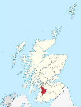 Ligging van East Ayrshire in Schotland | |||
| Coördinaten | 55°30'NB, 4°15'WL | ||
| Algemeen | |||
| Oppervlakte | 1262,1276[1] km² | ||
| Hoofdplaats | Kilmarnock | ||
| - rang | 14e | ||
| Inwoners (2004) | ( inw./km²) | ||
| Politiek | |||
| Bestuur | |||
| MP's | Des Browne, Sandra Osborne | ||
| MSP's | Willie Coffey, Cathy Jamieson | ||
| Overig | |||
| ONS code | S12000008 | ||
| ISO 3166 | GB-EAY | ||
| Website | east-ayrshire.gov.uk | ||
| |||
Het raadsgebied behoort tot de lieutenancy area Ayrshire and Arran en het historische graafschap Ayrshire.
Plaatsen
- Cumnock
- Galston
- Kilmarnock
- Stewarton
| Bronnen, noten en/of referenties |
| Bestuurlijke indeling van het Verenigd Koninkrijk: council areas in Schotland | |
|---|---|
|
Aberdeen · Aberdeenshire · Angus · Argyll and Bute · City of Edinburgh · Clackmannanshire · Dumfries and Galloway · Dundee City · East Ayrshire · East Dunbartonshire · East Lothian · East Renfrewshire · Falkirk · Fife · Glasgow City · Highland · Inverclyde · Midlothian · Moray · Na h-Eileanan Siar (Buiten-Hebriden) · North Ayrshire · North Lanarkshire · Orkney Islands · Perth and Kinross · Renfrewshire · Scottish Borders · Shetland Islands · South Ayrshire · South Lanarkshire · Stirling · West Dunbartonshire · West Lothian Zie ook: lieutenancy areas, de vroegere regio's en graafschappen | |
| Zie de categorie East Ayrshire van Wikimedia Commons voor mediabestanden over dit onderwerp. |