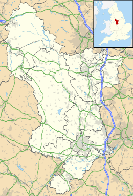
Matlock (Engeland)
Matlock, ook Matlock Town, is de hoofdstad van het Engelse graafschap Derbyshire. Matlock telt 9543 inwoners.
| Zie de categorie Matlock, Derbyshire van Wikimedia Commons voor mediabestanden over dit onderwerp. |
Unitary authority: Derby
Districten: Amber Valley · Bolsover · Chesterfield · Derbyshire Dales · Erewash · High Peak · North East Derbyshire · South Derbyshire
Lijst van plaatsen in het graafschap Derbyshire
Civil parishes in het ceremoniële graafschap Derbyshire:
Abney and Abney Grange
· Aldercar and Langley Mill
· Alderwasley
· Aldwark
· Alfreton
· Alkmonton
· Ash
· Ashbourne
· Ashford in the Water
· Ashleyhay
· Ashover
· Aston-on-Trent
· Aston
· Atlow
· Ault Hucknall
· Bakewell
· Ballidon
· Bamford
· Barlborough
· Barlow
· Barrow upon Trent
· Barton Blount
· Baslow and Bubnell
· Bearwardcote
· Beeley
· Belper
· Biggin by Hulland
· Birchover
· Blackwell
· Blackwell in the Peak
· Bonsall
· Boylestone
· Brackenfield
· Bradbourne
· Bradley
· Bradwell
· Brailsford
· Brampton
· Brassington
· Breadsall
· Breaston
· Bretby
· Brimington
· Brough and Shatton
· Brushfield
· Burnaston
· Calke
· Callow
· Calow
· Calver
· Carsington
· Castle Gresley
· Castleton
· Catton
· Cauldwell
· Chapel-en-le-Frith
· Charlesworth
· Chatsworth
· Chelmorton
· Chinley, Buxworth and Brownside
· Chisworth
· Church Broughton
· Clay Cross
· Clifton and Compton
· Clowne
· Codnor
· Coton in the Elms
· Crich
· Cromford
· Cubley
· Curbar
· Dalbury Lees
· Dale Abbey
· Darley Dale
· Denby
· Derwent
· Dethick, Lea and Holloway
· Doveridge
· Drakelow
· Draycott and Church Wilne
· Dronfield
· Duffield
· Eaton and Alsop
· Eckington
· Edale
· Edensor
· Edlaston and Wyaston
· Egginton
· Elmton with Creswell
· Elton
· Elvaston
· Etwall
· Eyam
· Fenny Bentley
· Findern
· Flagg
· Foolow
· Foremark
· Foston and Scropton
· Froggatt
· Glapwell
· Grassmoor, Hasland and Winswick
· Gratton
· Great Hucklow
· Great Longstone
· Green Fairfield
· Grindleford
· Grindlow
· Harthill
· Hartington Middle Quarter
· Hartington Nether Quarter
· Hartington Town Quarter
· Hartington Upper Quarter
· Hartshorne
· Hassop
· Hathersage
· Hatton
· Hayfield
· Hazelwood
· Hazlebadge
· Heanor and Loscoe
· Heath and Holmewood
· Highlow
· Hilton
· Hognaston
· Holbrook
· Hollington
· Holmesfield
· Holymoorside and Walton
· Hoon
· Hope
· Hope Woodlands
· Hopton
· Hopwell
· Horsley
· Horsley Woodhouse
· Hulland
· Hulland Ward
· Hungry Bentley
· Ible
· Idridgehay and Alton
· Ingleby
· Ironville
· Ivonbrook Grange
· Kedleston
· Kilburn
· Killamarsh
· King Sterndale
· Kirk Ireton
· Kirk Langley
· Kniveton
· Lea Hall
· Linton
· Little Eaton
· Little Hucklow
· Little Longstone
· Litton
· Longford
· Lullington
· Mackworth
· Mapleton
· Mapperley
· Marston Montgomery
· Marston on Dove
· Matlock Bath
· Matlock Town
· Melbourne
· Mercaston
· Middleton
· Middleton and Smerrill
· Monyash
· Morley
· Morton
· Nether Haddon
· Netherseal
· New Mills
· Newton Grange
· Newton Solney
· Norbury and Roston
· North Wingfield
· Northwood and Tinkersley
· Ockbrook and Borrowash
· Offcote and Underwood
· Offerton
· Old Bolsover
· Osleston and Thurvaston
· Osmaston
· Outseats
· Over Haddon
· Overseal
· Parwich
· Peak Forest
· Pentrich
· Pilsley
· Pilsley
· Pinxton
· Pleasley
· Quarndon
· Radbourne
· Ravensdale Park
· Repton
· Ripley
· Risley
· Rodsley
· Rosliston
· Rowland
· Rowsley
· Sandiacre
· Sawley
· Scarcliffe
· Shardlow and Great Wilne
· Sheldon
· Shipley
· Shirebrook
· Shirland and Higham
· Shirley
· Shottle and Postern
· Smalley
· Smisby
· Snelston
· Somercotes
· Somersal Herbert
· South Darley
· South Normanton
· South Wingfield
· Stanley and Stanley Common
· Stanton
· Stanton by Bridge
· Stanton By Dale
· Staveley
· Stenson Fields
· Stoney Middleton
· Stretton
· Sudbury
· Sutton-cum-Duckmanton
· Sutton on the Hill
· Swanwick
· Swarkestone
· Taddington
· Tansley
· Temple Normanton
· Thornhill
· Thorpe
· Tibshelf
· Ticknall
· Tideswell
· Tintwistle
· Tissington
· Trusley
· Tupton
· Turnditch
· Twyford and Stenson
· Unstone
· Walton-upon-Trent
· Wardlow
· Wessington
· West Hallam
· Weston-on-Trent
· Weston Underwood
· Whaley Bridge
· Wheston
· Whitwell
· Willington
· Windley
· Wingerworth
· Winster
· Wirksworth
· Woodville
· Wormhill
· Yeaveley
· Yeldersley
· Youlgreave
Geplaatst op: 26-12-2008 |
Dit artikel is een beginnetje over landen & volken. U wordt uitgenodigd om op bewerken te klikken om uw kennis aan dit artikel toe te voegen. |
| Civil parish in Engeland | |||
 | |||
| Situering | |||
| Regio | East Midlands | ||
| Graafschap | Derbyshire | ||
| District | Derbyshire Dales | ||
| Coördinaten | 53° 8' NB, 1° 33' WL | ||
| Algemeen | |||
| Oppervlakte | 14,1450 km² | ||
| Inwoners (2011) | 9543 (675 inw./km²) | ||
| Overig | |||
| Postcode(s) | DE4 | ||
| Netnummer(s) | 01629 | ||
| Grid code | SK298601 | ||
| Post town | MATLOCK | ||
| ONS-code | E04002786 | ||
| Foto's | |||
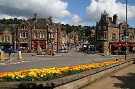 | |||
| Bank Road | |||
| |||