Karabağlar
Karabağlar is een Turks district in de provincie İzmir en telt 480.790 inwoners (2017). Het district heeft een oppervlakte van 495 km².
District in Turkije | |||
 | |||
| Situering | |||
| Regio | Ege Bölgesi | ||
| Provincie | İzmir | ||
| Coördinaten | 38°22'14"NB, 27°6'14"OL | ||
| Algemeen | |||
| Oppervlakte | 495 km² | ||
| Inwoners (2017) | 480.790[1] (971 inw./km²) | ||
| Hoogte | 510 m | ||
| Burgemeester | Muhittin Selvitopu (CHP)[2] | ||
| Overig | |||
| Postcode | 35110 - 35360 | ||
| Netnummer | (+90) 232 | ||
| Kenteken | 35 | ||
| Tijdzone | TRT (UTC+3) | ||
| Website | http://www.karabaglar.bel.tr/ http://www.karabaglar.gov.tr/ | ||
| |||
De bevolkingsontwikkeling van het district is weergegeven in onderstaande tabel.[1]
| Jaar | Inwonersaantal |
|---|---|
| 2008 | 443.159 |
| 2009 | 449.707 |
| 2010 | 458.890 |
| 2011 | 463.279 |
| 2012 | 466.023 |
| 2013 | 471.676 |
| 2014 | 473.741 |
| 2015 | 477.238 |
| 2016 | 480.253 |
| 2017 | 480.790 |
| Bronnen, noten en/of referenties |
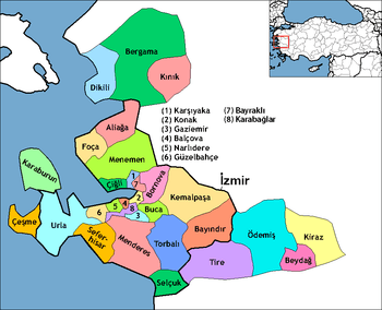
| Districten van de provincie İzmir |
|---|
|
Aliağa · Balçova · Bayraklı · Bayındır · Bergama · Beydağ · Bornova · Buca · Çeşme · Çiğli · Dikili · Foça · Gaziemir · Güzelbahçe · Karabağlar · Karaburun · Karşıyaka · Kemalpaşa · Kınık · Kiraz · Konak · Menderes · Menemen · Narlıdere · Ödemiş · Seferihisar · Selçuk · Tire · Torbalı · Urla |
This article is issued from
Wikipedia.
The text is licensed under Creative
Commons - Attribution - Sharealike.
Additional terms may apply for the media files.