Ilhéu Caroço
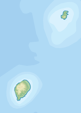
Ilhéu Caroço (ook Dutchman’s Cap genoemd) is een eilandje in de Golf van Guinee. Het ligt net ten zuidoosten van Principe en maakt deel uit van de republiek Sao Tomé en Principe.
| Eiland van Sao Tomé en Principe | |||
 | |||
Locatie | |||
| Land | Sao Tomé en Principe | ||
| Locatie | Golf van Guinee, ten zuidoosten van Principe | ||
| Coördinaten | 1° 31′ NB, 7° 26′ OL | ||
Algemeen | |||
| Oppervlakte | 0,4 km² | ||
| Lengte | 840 meter | ||
| Breedte | 550 meter | ||
| |||
Het eiland is slechts 0,4 km² groot en kent geen permanente bewoning. Administratief valt het eiland onder de provincie Principe en het district Pagué.
| Deelgebieden (hoofdsteden) van Sao Tomé en Principe | ||
|---|---|---|
|
Provincies: Sao Tomé (Sao Tomé) · Principe (Santo António) Districten: Água Grande (Sao Tomé) · Cantagalo (Santana) · Caué (São João dos Angolares) · Lembá (Neves) · Lobata (Guadalupe) · Mé-Zóchi (Trindade) · Pagué (Santo António) Eilanden: Ilhéu Bom Bom · Ilhéu das Cabras · Ilhéu Caroço · Principe · Ilhéu das Rolas · Ilhéu de Santana · Sao Tomé · Tinhosa Grande · Tinhosa Pequena | ||
This article is issued from
Wikipedia.
The text is licensed under Creative
Commons - Attribution - Sharealike.
Additional terms may apply for the media files.