Helpringham
Helpringham is een civil parish in het bestuurlijke gebied North Kesteven, in het Engelse graafschap Lincolnshire.
 Helpringham
Geplaatst op: 4-8-2010 |
Dit artikel is een beginnetje over landen & volken. U wordt uitgenodigd om op bewerken te klikken om uw kennis aan dit artikel toe te voegen. |
| Civil parish in Engeland | |||
 | |||
| Situering | |||
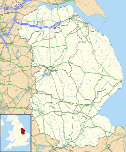
| Regio | East Midlands | ||
| Graafschap | Lincolnshire | ||
| District | North Kesteven | ||
| Coördinaten | 52° 57' NB, 0° 18' WL | ||
| Algemeen | |||
| Oppervlakte | 1,9691 km² | ||
| Inwoners (2011) | 828 (420 inw./km²) | ||
| Overig | |||
| Postcode(s) | NG34 0 | ||
| Netnummer(s) | 01529 | ||
| Grid code | TF139410 | ||
| Post town | SLEAFORD | ||
| ONS-code | E04005808 | ||
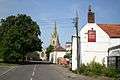
| Foto's | |||
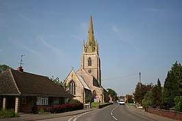 | |||
| High Street | |||
| |||
This article is issued from
Wikipedia.
The text is licensed under Creative
Commons - Attribution - Sharealike.
Additional terms may apply for the media files.