Adams County (Washington)
Adams County is een van de 39 county's in de Amerikaanse staat Washington.
| County in de Verenigde Staten | |||
 | |||
| Situering | |||
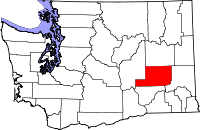
| Staat | Washington | ||
| Tijdzone | Pacific Standard Time (UTC−8) | ||
| Coördinaten | 46°59'24"NB, 118°33'36"WL | ||
| Algemeen | |||
| Oppervlakte | 4.998 km² | ||
| - land | 4.986 km² | ||
| - water | 12 km² | ||
| Inwoners (2000) | 16.428 (3 inw./km²) | ||
| Overig | |||
| Zetel | Ritzville | ||
| FIPS-code | 53001 | ||
| Foto's | |||
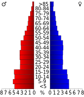 Bevolkingspiramide Adams County | |||
| Statistieken volkstelling Adams County | |||
| |||
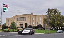
Adams County Courthouse, Ritzville
De county heeft een landoppervlakte van 4986 km² en telt 16.428 inwoners (volkstelling 2000). De hoofdplaats is Ritzville.
Bevolkingsontwikkeling
| Historische inwonertallen | |||
|---|---|---|---|
| Jaar | Inwoners | % ± | |
| 1900 | 4.840 | ||
| 1910 | 10.920 | 125,6% | |
| 1920 | 9.623 | −11,9% | |
| 1930 | 7.719 | −19,8% | |
| 1940 | 6.209 | −19,6% | |
| 1950 | 6.584 | 6,0% | |
| 1960 | 9.929 | 50,8% | |
| 1970 | 12.014 | 21,0% | |
| 1980 | 13.267 | 10,4% | |
| 1990 | 13.603 | 2,5% | |
| 2000 | 16.428 | 20,8% | |
| Bron: (en) Historical Decennial Census Population | |||
Plaatsen in Adams County
| County's in Washington |
|---|
|
Adams · Asotin · Benton · Chelan · Clallam · Clark · Columbia · Cowlitz · Douglas · Ferry · Franklin · Garfield · Grant · Grays Harbor · Island · Jefferson · King · Kitsap · Kittitas · Klickitat · Lewis · Lincoln · Mason · Okanogan · Pacific · Pend Oreille · Pierce · San Juan · Skagit · Skamania · Snohomish · Spokane · Stevens · Thurston · Wahkiakum · Whatcom · Whitman · Yakima |
| Zie de categorie Adams County, Washington van Wikimedia Commons voor mediabestanden over dit onderwerp. |
This article is issued from
Wikipedia.
The text is licensed under Creative
Commons - Attribution - Sharealike.
Additional terms may apply for the media files.