Tokushima (city)
Tokushima (徳島市, Tokushima-shi, Japanese: [tokɯꜜɕima]) is the capital city of Tokushima Prefecture on Shikoku island in Japan.
Tokushima 徳島市 | |
|---|---|
City | |
| Tokushima City | |
Flag Emblem | |
Location of Tokushima in Tokushima Prefecture | |
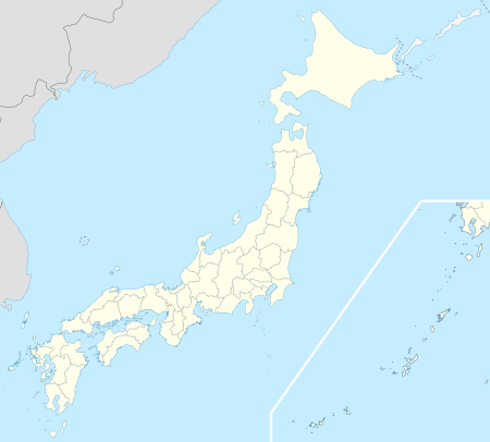 Tokushima Location in Japan | |
| Coordinates: 34°4′N 134°33′E | |
| Country | Japan |
| Region | Shikoku |
| Prefecture | Tokushima Prefecture |
| Government | |
| • Mayor | Akiyoshi Endo (since April 2016) |
| Area | |
| • Total | 191.39 km2 (73.90 sq mi) |
| Population (June 1, 2019) | |
| • Total | 255,439 |
| • Density | 1,300/km2 (3,500/sq mi) |
| Symbols | |
| • Tree | Elaeocarpus |
| • Flower | Cherry blossom |
| Time zone | UTC+9 (JST) |
| City hall address | 2-5 Saiwai, Tokushima-shi, Tokushima-ken 770-8571 |
| Website | www |
| Tokushima | |||||
|---|---|---|---|---|---|
| Japanese name | |||||
| Kanji | 徳島市 | ||||
| Hiragana | とくしまし | ||||
| Katakana | トクシマシ | ||||
| |||||
As of June 1, 2019, the city had an estimated population of 255,439 and a population density of 1,335 persons per km². Its total area is 191.39 km². The city is situated in the north-eastern part of Tokushima Prefecture at the mouth of the Yoshino River. In terms of layout and organization, Tokushima displays the typical characteristics of a Japanese castle town. Tokushima was developed under the Hachisuka clan. Its prosperity was built on a strong indigo dye industry.
The modern city of Tokushima was founded on October 1, 1889. At the time, it was the 10th largest city in Japan. The city is served by Tokushima Airport (recently renamed to Awa Odori Airport), in nearby Matsushige.
History
World War II air raid
Tokushima was selected as a target by the United States' XXI Bomber Command during World War II because of the city's role as an agricultural center for the region. On July 3, 1945 at 5:45 PM (JST) 137 aircraft took off to bomb Tokushima. 1,050 tons of incendiary bombs were dropped on Tokushima, destroying 74% of the built up areas of the city.[1]
Culture
Every August, during the Obon Festival, Tokushima holds a cultural dance festival, the Awa Odori. Awa Odori literally translates as "Awa Dance" (Awa being Tokushima Prefecture's ancient name). During the festival, residents ranging from young children to professional dance troupes perform a distinctive style of Japanese traditional dance in regional costumes, accompanied by strings, drums, and singing (usually by the dancers themselves).
Climate
Tokushima has a humid subtropical climate (Köppen climate classification Cfa) with hot summers and cool winters. Precipitation is high, but there is a pronounced difference between the wetter summers and drier winters.
| Climate data for Tokushima, Tokushima | |||||||||||||
|---|---|---|---|---|---|---|---|---|---|---|---|---|---|
| Month | Jan | Feb | Mar | Apr | May | Jun | Jul | Aug | Sep | Oct | Nov | Dec | Year |
| Average high °C (°F) | 9.3 (48.7) |
9.7 (49.5) |
13.0 (55.4) |
18.7 (65.7) |
23.0 (73.4) |
25.8 (78.4) |
29.7 (85.5) |
31.1 (88.0) |
27.4 (81.3) |
22.2 (72.0) |
17.0 (62.6) |
12.0 (53.6) |
19.9 (67.8) |
| Daily mean °C (°F) | 5.4 (41.7) |
5.7 (42.3) |
8.7 (47.7) |
14.3 (57.7) |
18.6 (65.5) |
22.1 (71.8) |
26.1 (79.0) |
27.2 (81.0) |
23.7 (74.7) |
18.1 (64.6) |
12.9 (55.2) |
7.9 (46.2) |
15.9 (60.6) |
| Average low °C (°F) | 1.9 (35.4) |
2.1 (35.8) |
4.6 (40.3) |
10.0 (50.0) |
14.5 (58.1) |
18.9 (66.0) |
23.2 (73.8) |
24.0 (75.2) |
20.6 (69.1) |
14.6 (58.3) |
9.1 (48.4) |
4.1 (39.4) |
12.3 (54.2) |
| Average precipitation mm (inches) | 46.2 (1.82) |
56.3 (2.22) |
83.1 (3.27) |
130.9 (5.15) |
136.6 (5.38) |
229.6 (9.04) |
168.6 (6.64) |
178.4 (7.02) |
307.8 (12.12) |
141.7 (5.58) |
96.9 (3.81) |
37.9 (1.49) |
1,614 (63.54) |
| Average snowfall cm (inches) | 3 (1.2) |
3 (1.2) |
0 (0) |
0 (0) |
0 (0) |
0 (0) |
0 (0) |
0 (0) |
0 (0) |
0 (0) |
0 (0) |
0 (0) |
6 (2.4) |
| Average relative humidity (%) | 62 | 62 | 63 | 67 | 70 | 76 | 79 | 76 | 74 | 69 | 67 | 63 | 69 |
| Mean monthly sunshine hours | 156.3 | 143.0 | 169.2 | 173.3 | 191.6 | 147.8 | 190.2 | 213.3 | 150.9 | 158.2 | 145.9 | 154.1 | 1,993.8 |
| Source: NOAA (1961-1990)[2] | |||||||||||||
Education
- University of Tokushima
- Tokushima Bunri University
- Shikoku University
Geography
Mountains
| Name | Height | Notes |
|---|---|---|
| Bizan (眉山) |
277 m | |
| Shiroyama (城山) |
62 m | |
| Nakatsu Mineyama (中津峰山) |
773 m | The highest mountain in the Tokushima City district. |
| Nishi Ryuo-san (西竜王山) |
495 m | |
| Higashi Ryuo-san (東龍王山) |
408m | |
| Kinobeyama (気延山) |
212 m | |
| Bentenzan (弁天山) |
6.1 m | Claimed to be the smallest natural mountain in Japan. |
Rivers
- Akui River
- Imagire River
- Shinmachi River
- Suketō River
- Yoshino River
Gallery
 Tokushima Station Bus Terminal
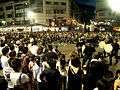 Awa Dancing Festival, wellknown Bon Festival
 statue of Hachisuka Iemasa
References
External links
| Wikimedia Commons has media related to Tokushima, Tokushima. |
- Tokushima City official website (in Japanese)
- Tokushima City official website (in English)


Tokushima (capital) | |
| Cities |
|
| Districts |
|
List of mergers in Tokushima Prefecture | |
| 2,000,000 and more | |
|---|---|
| 1,000,000–1,999,999 | |
| 500,000–999,999 | |
| 200,000–499,999 |
|
| Authority control |
|
|---|