Luton
Luton (/ˈluːtən/ (![]()
Luton | |
|---|---|
Town, borough and unitary authority | |
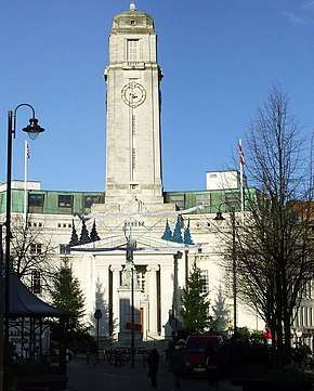  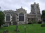 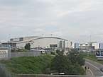 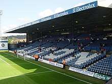 Top to bottom, left to right: Luton Town Hall, Luton Hoo, St Mary's Church, Luton Airport and Luton Town's stadium Kenilworth Road | |
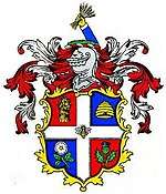 Coat of arms | |
| Motto(s): | |
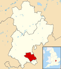 Luton shown within Bedfordshire | |
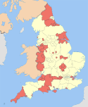
 Luton Location within England | |
| Coordinates: 51°53′N 0°25′W | |
| Sovereign state | United Kingdom |
| Constituent country | England |
| Region | East of England |
| Ceremonial county | Bedfordshire |
| Settlement | c. 6th century |
| Borough | 1876 |
| Unitary authority | 1997 |
| Government | |
| • Type | Unitary authority |
| • Body | Luton Borough Council |
| • Executive | Labour |
| • Mayor | Cllr Tahir Malik |
| • MPs | Sarah Owen (Labour) Rachel Hopkins (Labour) |
| Area | |
| • Total | 16.74 sq mi (43.35 km2) |
| Area rank | 275th |
| Population | |
| • Total | 214,109 |
| • Rank | 82nd |
| • Density | 12,790/sq mi (4,939/km2) |
| Demonym(s) | Lutonian |
| Ethnicity | |
| • White | 54.6% |
| • Asian | 29.9% |
| • Black | 9.8% |
| • Mixed race | 4.2% |
| • Other | 1.5% |
| Time zone | UTC+0 (GMT) |
| • Summer (DST) | UTC+1 (BST) |
| Postcode Area | LU |
| Dialling code | 01582 |
| ISO 3166 code | GB-LUT |
| International airport | London Luton Airport (LTN) |
| Railway stations | Luton (B) Luton Airport Parkway (D) Leagrave (D) |
| OS grid reference | TL0896521763 |
| GSS code | E06000032 |
| ONS code | 00KA |
| NUTS 3 | UKH21 |
| FIPS 10-4 | UKI1 |
| Website | www |
Luton was for many years famous for hatmaking, and also had a large Vauxhall Motors factory. Car production at the plant began in 1905 and continued until the plant's closure in 2002.[13] Production of commercial vehicles continues, and the head office of Vauxhall Motors is still in the town.[14] London Luton Airport opened in 1938, and is now one of Britain's major airports,[15] with three railway stations also in the town. The University of Bedfordshire was created from a merger with the University of Luton,[16] and two of its campuses are in Luton.[17]
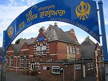
Luton Town Football Club, nicknamed "the Hatters" due to the town's connection to hatmaking, has had several spells in the top flight of the English league as well as a Football League Cup triumph in 1988. They play at Kenilworth Road, their home since 1905, and planning permission for a new larger stadium was approved in 2019.[18] Luton International Carnival, the largest one-day carnival in Europe, is held on the day before the last Monday in May,[19][n 1] and the Saint Patrick's festival is held on the weekend nearest to Saint Patrick's Day[20] as there is a large Irish community in Luton. The town also has a large Pakistani community, which along with the Irish were attracted to employment at the Vauxhall car plant.[21][22] Luton Hoo is an English country house, estate and Grade I listed building designed by Scottish architect Robert Adam.
Toponymy
Luton's earliest recorded name is Lygea-Byrig, where Lygea means 'a river in an open field' and Byrid means 'a town'.[23] The name shown as gradually converting to Luton over the centuries with Lvton being the used in the charter of Charles I.[23]
History
Luton is believed to have been founded by the Anglo-Saxons sometime in the 6th century.[24]
The Domesday Book records Luton as Loitone and also as Lintone.[9] Agriculture dominated the local economy at that time, and the town's population was around 700 to 800.[25]
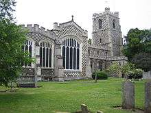
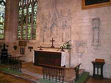
In 1121 Robert, 1st Earl of Gloucester started work on St Mary's Church in the centre of the town. The work was completed by 1137.[26] A motte-and-bailey castle which gives its name to the modern Castle Street was built in 1139 but demolished by 1154.[27]
The hat making industry began in the 17th century and became synonymous with the town.[28][29]
The town grew: in 1801 the population was 3,095,[30] but by 1850 it was over 10,000 and by 1901 it was almost 39,000.
Newspaper printing arrived in the town in 1854. The first public cemetery was opened in the same year and Luton was made a borough in 1876.[31]
Luton's hat trade reached its peak in the 1930s,[32] but severely declined after the Second World War and was replaced by other industries.
In 1907, Vauxhall Motors opened the largest car plant in the United Kingdom in Luton, during the Second World War, it built Churchill tanks[33] as part of the war effort. Despite heavy camouflage, the factory made Luton a target for the Luftwaffe and the town suffered a number of air raids. 107 died[34] and there was extensive damage to the town (over 1,500 homes were damaged or destroyed).
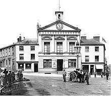
The original town hall was destroyed in 1919 during Peace Day celebrations at the end of the First World War. Dr. John G. Dony, author of The Flora of Bedfordshire[35] told his history students (he taught at Luton Grammar, predecessor of Luton Sixth Form College), during the 1950s, that he had broken the last intact window of the old town hall during the 1919 riots. Local people, including many ex-servicemen, were unhappy with unemployment and had been refused the use of a local park to hold celebratory events. They stormed the town hall, setting it alight (see Luton Town Hall). A replacement building was completed in 1936.
Luton Borough Corporation had provided the borough with electricity since the early twentieth century from Luton power station, located adjacent to the railway. Upon nationalisation of the electricity industry in 1948 ownership passed to the British Electricity Authority and later to the Central Electricity Generating Board. Electricity connections to the national grid rendered the 23 megawatt (MW) coal and latterly oil-fired power station redundant. The station had a single chimney and two reinforced concrete cooling towers.[36] The power station closed in 1968; in its final year of operation it delivered 3,192 MWh of electricity to the borough.[37]
Luton Airport opened in 1938, owned and operated by the council. It's now one of the largest employers in the area.
The pre-war years, were something of an economic boom for Luton, as new industries grew and prospered. New private and council housing was built in the 1920s and 1930s, with Luton starting to incorporate nearby villages Leagrave, Limbury and Stopsley between 1928 and 1933.[38]
Post-war, a number of substantial estates of council housing were built, notably at Farley Hill, Stopsley, Limbury, Marsh Farm and Leagrave (Hockwell Ring). The Marsh Farm area of the town was developed in the mid to late 1960s as a large council housing estate, mostly to house the overspill population from London. However, the estate gained a reputation for high levels of crime, poverty and unemployment, which culminated in a riot on the estate in July 1992 and another more serious riot three years later.[39]
The closure of the Vauxhall manufacturing plant in 2002 had negative effects for Luton, leading to increased unemployment and deprivation.[40] It has also led to increasing racial tensions.[41][42]
Governance


The town is situated within the historic county of Bedfordshire, but since 1997 Luton has been an administratively independent unitary authority. The town remains part of Bedfordshire for ceremonial purposes.
Luton is represented in Parliament by Sarah Owen who holds Luton North and Rachel Hopkins who holds Luton South.
There are 48 councillors on Luton Borough Council, representing 19 wards. The Council is controlled by the Labour group, who have 36 Local Councillors compared to the Liberal Democrats with eight seats and the Conservative Party with four.[44]
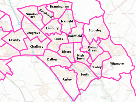
Wards
The electoral wards in Luton are:
|
  |
|
In 1876 the town council was granted its own coat of arms.[2] The wheatsheaf was used on the crest to represent agriculture and the supply of straw used in the local hatmaking industry (the straw plaiting industry was brought to Luton by a group of Scots under the protection of Sir John Napier of Luton Hoo). The bee is traditionally the emblem of industry and the hive represents the straw plaiting industry for which Luton was famous. The rose is from the arms of the Napier family, whereas the thistle is a symbol for Scotland. An alternative suggestion is that the rose was a national emblem, and the thistle represents the Marquess of Bute, who formerly owned the Manor of Luton Hoo.[45][46]
Geography
Luton is located in a break in the eastern part of the Chiltern Hills. The Chilterns are a mixture of chalk from the Cretaceous period[47] (about 66 – 145 million years ago) and deposits laid at the southernmost points of the ice sheet during the last ice age (the Warden Hill area can be seen from much of the town).
Bedfordshire had a reputation for brick making but the industry is now significantly reduced. The brickworks[48] at Stopsley took advantage of the clay deposits in the east of the town.
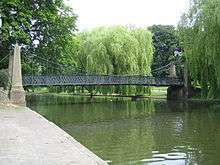
The source of the River Lea, part of the Thames Valley drainage basin, is in the Leagrave area of the town. The Great Bramingham Wood surrounds this area. It is classified as ancient woodland; records mention the wood at least 400 years ago.
There are few routes through the hilly area for some miles, this has led to several major roads (including the M1 and the A6) and a major rail-link being constructed through the town.
Climate
Luton has a temperate marine climate, like much of the British Isles, with generally light precipitation throughout the year. The weather is very changeable from day to day and the warming influence of the Gulf Stream makes the region mild for its latitude. The average total annual rainfall is 698 mm (27.5 in) with rain falling on 117 days of the year.
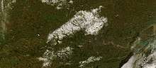
The local climate around Luton is differentiated somewhat from much of South East England due to its position in the Chiltern Hills, meaning it tends to be 1–2 degrees Celsius cooler than the surrounding towns – often flights at Luton airport, lying 160 m (525 ft) above sea level, will be suspended when marginal snow events occur, while airports at lower elevations, such as Heathrow, at 25 m (82 ft) above sea level, continue to function. An example of this is shown in the photograph to the right, the snowline being about 100 m (328 ft) above sea level. Absolute temperature extremes recorded at Rothamsted Research Station, 5 miles (8 km) south south east of Luton town centre and at a similar elevation range from −17.0 °C (1.4 °F)[49] in December 1981 and −16.7 °C (1.9 °F) in January 1963[50] to 36.6 °C (97.9 °F) in July 2019[51] and 33.8 °C (92.8 °F) in August 1990[52] and July 2006.[53] Records for Rothamsted date back to 1901.
| Climate data for Rothamsted, elevation: 128 m (420 ft), 1981–2010 normals, extremes 1914–present | |||||||||||||
|---|---|---|---|---|---|---|---|---|---|---|---|---|---|
| Month | Jan | Feb | Mar | Apr | May | Jun | Jul | Aug | Sep | Oct | Nov | Dec | Year |
| Record high °C (°F) | 14.2 (57.6) |
18.2 (64.8) |
22.2 (72.0) |
26.8 (80.2) |
27.7 (81.9) |
33.0 (91.4) |
36.6 (97.9) |
35.6 (96.1) |
31.0 (87.8) |
26.8 (80.2) |
17.3 (63.1) |
15.3 (59.5) |
36.6 (97.9) |
| Average high °C (°F) | 6.7 (44.1) |
7.0 (44.6) |
9.9 (49.8) |
12.7 (54.9) |
16.1 (61.0) |
19.2 (66.6) |
21.8 (71.2) |
21.6 (70.9) |
18.3 (64.9) |
14.1 (57.4) |
9.7 (49.5) |
6.9 (44.4) |
13.7 (56.7) |
| Daily mean °C (°F) | 4.0 (39.2) |
4.0 (39.2) |
6.3 (43.3) |
8.4 (47.1) |
11.5 (52.7) |
14.5 (58.1) |
16.9 (62.4) |
16.7 (62.1) |
14.1 (57.4) |
10.6 (51.1) |
6.8 (44.2) |
4.3 (39.7) |
9.8 (49.6) |
| Average low °C (°F) | 1.2 (34.2) |
1.0 (33.8) |
2.7 (36.9) |
4.0 (39.2) |
6.9 (44.4) |
9.8 (49.6) |
11.9 (53.4) |
11.8 (53.2) |
9.9 (49.8) |
7.1 (44.8) |
3.8 (38.8) |
1.6 (34.9) |
6.0 (42.8) |
| Record low °C (°F) | −16.7 (1.9) |
−13.6 (7.5) |
−12.2 (10.0) |
−6.2 (20.8) |
−2.8 (27.0) |
0.0 (32.0) |
2.8 (37.0) |
3.1 (37.6) |
−0.6 (30.9) |
−4.7 (23.5) |
−7.5 (18.5) |
−17.0 (1.4) |
−17.0 (1.4) |
| Average precipitation mm (inches) | 67.0 (2.64) |
47.7 (1.88) |
49.1 (1.93) |
54.1 (2.13) |
52.0 (2.05) |
52.7 (2.07) |
48.8 (1.92) |
62.5 (2.46) |
57.2 (2.25) |
81.1 (3.19) |
75.0 (2.95) |
65.1 (2.56) |
712.3 (28.04) |
| Average precipitation days (≥ 1.0 mm) | 12.1 | 9.4 | 10.2 | 10.2 | 8.8 | 8.6 | 8.0 | 8.8 | 8.9 | 11.0 | 11.6 | 11.0 | 118.5 |
| Mean monthly sunshine hours | 60.6 | 77.3 | 111.7 | 159.0 | 193.9 | 199.1 | 207.1 | 199.1 | 143.7 | 133.2 | 69.1 | 50.6 | 1,585.3 |
| Source #1: Met Office[54] | |||||||||||||
| Source #2: KNMI[55] | |||||||||||||
Demography
The United Kingdom Census 2011 showed that the borough had a population of 203,201,[56] a 10.2% increase from the previous census in 2001, when Luton was the 27th[57] largest settlement in the United Kingdom. In 2011, 46,756 were aged under 16, 145,208 were 16 to 74, and 11,237 were 75 or over.[58] The latest population figure for the borough is 214,109 (mid-2018 est.).[5]
Local inhabitants are known as Lutonians.
Ethnicity
| Luton: Ethnicity: 2011 Census[59] | |||||||||||||
| Ethnic group | Population | % | |||||||||||
|---|---|---|---|---|---|---|---|---|---|---|---|---|---|
| White | 111,079 | 54.7 | |||||||||||
| Mixed | 8,281 | 4.1 | |||||||||||
| Asian or Asian British | 60,952 | 30.0 | |||||||||||
| Black or Black British | 19,909 | 9.8 | |||||||||||
| Other Ethnic Group | 2,980 | 1.5 | |||||||||||
| Total | 203,201 | 100 | |||||||||||
Luton has seen several waves of immigration. In the early part of the 20th century, there was internal migration of Irish and Scottish people to the town. These were followed by Afro-Caribbean and Asian immigrants. More recently immigrants from European Union countries have made Luton their home. As a result of this Luton has a diverse ethnic mix, with a significant population of Asian descent, mainly Pakistani 29,353 (14.4%) and Bangladeshi 13,606 (6.7%).[59] The latter two also make up most of the Muslim religious population in Luton, which is the third highest for a town or city in England by proportion.[60]
Since the 2011 census, Luton has had a white British population less than 50%, one of three towns in the United Kingdom along with Leicester and Slough. Luton has a majority white population when non-British white people are included, such as the Irish and Eastern Europeans.[59] 81% of the population of Luton define themselves as British.[61]

Economy
Luton's economy has traditionally been focused on several different areas of industry, including car manufacturing, engineering and millinery. However, today, Luton is moving towards a service based economy mainly in the retail and the airport sectors, although there is still a focus on light industry in the town.
Notable firms with headquarters in Luton include:
- EasyJet – head office (originally EasyLand, later moved into Hangar 89)[62] and main base at London Luton Airport
- Impellam Group – headquarters at Capability Green[63]
- TUI UK (Thomson Holidays and Thomson Airways) – travel (Wigmore House)[64][65]
- Vauxhall Motors – headquarters (Griffin House)[66]
Notable firms with offices in Luton include:
- Anritsu – electronics[67]
- AstraZeneca – pharmaceuticals[68]
- Selex ES – aerospace[69]
- Ernst & Young – accountants[70]
- Whitbread – hospitality[71]
- Stonegate Pub Company – hospitality[72]
Luton's post-war and more recent industrial decline has been compared to that of similar towns in northern England.[73]
Employment
Of the town's working population (classified 16–74 years of age by the Office for National Statistics), 63% are employed. This figure includes students, the self-employed and those who are in part-time employment. 11% are retired, 8% look after the family or take care of the home and 5% are unemployed.[74]
Transport
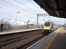
Luton is situated less than 30 miles (50 km) north of the centre of London, giving it good links with the City and other parts of the country via rail and major roads such as the M1 and A6. Luton has three railway stations: Luton,[75] Leagrave,[76] and Luton Airport Parkway[77] that are served by East Midlands Railway and Thameslink services. Luton is also home to London Luton Airport, one of the major feeder airports for London and the southeast. A network of bus services run by Arriva Shires & Essex, Grant Palmer,[78] and Centrebus serves the urban area of Luton and Dunstable, and in 2013 a bus rapid transit route opened,[79] the Luton to Dunstable Busway, connecting the town with the airport, Dunstable and Houghton Regis.
Luton is also served by a large taxi network. As a unitary authority, Luton Borough Council is responsible for the local highways and public transport in the borough and licensing of taxis.[80]
Education
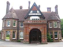
Luton is one of the main locations of the University of Bedfordshire. A large campus of the university is in Luton town centre, with a smaller campus based on the edge of town in Putteridge Bury, an old Victorian manor house. The other main campus of the university is located in Bedford.
The town is home to Luton Sixth Form College and Barnfield College. Both have been awarded Learning & Skills Beacon Status by the Department for Children, Schools and Families.[81][82]
Luton's schools and colleges had also been earmarked for major investment in the government scheme Building Schools for the Future programme, which intends to renew and refit buildings in institutes across the country. Luton is in the third wave of this long-term programme with work intending to start in 2009.[83] Some schools were rebuilt before the programme was scrapped by the coalition government.
There are 98 educational institutes in Luton – seven nurseries, 56 primary schools (9 voluntary-aided, 2 special requirements), 13 secondary schools (1 voluntary-aided, 1 special requirements), four further educational institutes and four other educational institutes.[84]
Culture
Architecture
The town contains 92 listed buildings.[85]
Leisure and entertainment
Luton International Carnival
Luton International Carnival is the largest one-day carnival in Europe. It usually takes place on the late May Bank Holiday. Crowds can reach 150,000[86] on each occasion.
The procession starts at Wardown Park and makes its way down New Bedford Road, around the town centre via St George's Square, back down New Bedford Road and finishes back at Wardown Park. There are music stages and stalls around the town centre and at Wardown Park.
Luton is home to the UK Centre for Carnival Arts (UKCCA), the country's first purpose-built facility of its kind.[87]
Luton St Patrick's Festival
The festival celebrating the patron saint of Ireland St Patrick and organised by Luton Irish Forum,[20] is held on the weekend nearest to 17 March.[88] In its 15th year in 2014,[89] the festival includes a parade, market stalls and music stands as well as Irish themed events.[90]
Luton Mela
The first Luton Mela took place in August 2000 and has developed into one of the most significant and well attended south Asian cultural events in the eastern region.
City of Culture bid and pilot year
Luton Council's strategic vision for the Arts, and Cultural and Creative industries includes the plan to bid for City of Culture Status. This plan includes a pilot year with the theme of Peace Riots starting in Spring 2019.[91] Events will be published on the Luton.Events website.
Theatre and performing arts
Luton is home to the Library Theatre, a 238-seat theatre located on the 3rd floor of the town's Central Library. The theatre's programme consists of local amateur dramatic societies, pantomime, children's theatre (on Saturday mornings) and one night shows of touring theatre companies.[92]
Luton is also home to the Hat Factory, originally as its name suggests, this arts centre was in fact a real hat factory. The Hat Factory is a combined arts venue in the centre of Luton. It opened in 2003 and since then has been the area’s main provider of contemporary theatre, dance and music. The venue provides live music, club nights, theatre, dance, films, children's activities, workshops, classes and gallery exhibitions.
Media
Radio
- BBC Three Counties Radio, the local BBC station, broadcasts from its office in Dunstable to Bedfordshire, Hertfordshire and Buckinghamshire.[93]
- Heart 97.6 a formally independent local station, broadcast from Milton Keynes.
- Diverse FM[94] began broadcasts in April 2007 having been awarded a community radio licence from Ofcom.
- Radio LaB (formerly Luton FM), the university's radio station, began broadcasting full-time in 2010 having been awarded a community radio licence from Ofcom.
- In addition, Radio Ramadhan used to broadcast during the month of Ramadan until Inspire FM, a full-time community radio station, broadcasting on 105.1 FM, became available in 2010.
Television
- Television Luton falls at the cross over point between the two regions of Carlton/LWT (ITV London) and Anglia Television (ITV Anglia) which transmits from Norwich. Coverage for most Luton Town FC games and highlights is usually shown on BBC London news and on BBC 1 London's Football League show
Local attractions
- Dunstable Downs
- Leagrave Park
- Leighton Buzzard Light Railway
- The Hat Factory
- Luton Hoo
- Someries Castle
- Stockwood Discovery Centre
- Stockwood Park
- Wardown Park
- Wardown Park Museum
- Waulud's Bank
- Whipsnade Tree Cathedral
- Whipsnade Zoo
- Woburn Safari Park
- Woodside Farm and Wildfowl Park
- Wrest Park
Recreation
Parks and open spaces
| Wikimedia Commons has media related to Parks and open spaces in Luton. |
Luton has a variety of parks ranging from district parks, neighbourhood parks, local open space and leisure gardens.
Brantwood Park
In the 1880s, the land now known as Brantwood Park was an open field on the south side of Dallow. The site was purchased by the Town Council in 1894 for use as a recreation ground and there is reference to it as ‘West Ward Recreation Ground' in a 1911 year book. It is reported as being one of the first two recreation grounds in Luton; the other being East Ward Recreation Ground, now known as Manor Road Park.[95]
Kidney Wood
Kidney Wood is ancient semi-natural woodland on the southern edge of Luton that has been identified as a County Wildlife Site. The wood was purchased by Luton Borough Council as an area of public open space. The council seeks to maintain and enhance the nature conservation interest of Kidney Wood, including its habitats while allowing public access for informal recreation including play. Kidney Wood includes a way marked nature trail and play dells.
Memorial Park
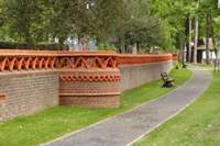
Sir Julius Wernher purchased the Luton Hoo Estate and the Manor of Luton from Madame de Falbe around 1903. He carried out substantial renovation works to the Manor and grounds. On his death in 1912 the estate passed to Lady Ludlow. Lady Ludlow presented the Park to the people of Luton on 12 June 1920, in memory of her son Alex Piggott Werner, who was killed in action during the First World War. The site is officially named Luton Hoo Memorial Park. Council records state that the area was purchased under the Statutory Powers of the Public Health Acts.
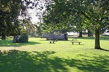
Stockwood Park
_-_geograph.org.uk_-_1548315.jpg)
Stockwood Park is a large municipal park near Junction 10 of the M1. Located in the park is Stockwood Discovery Centre, a free museum that houses Luton local social history, archaeology and geology. The collection of rural crafts and trades held at Stockwood Discovery Centre was amassed by Thomas Wyatt Bagshawe, who was a notable local historian and a leading authority on folk life. The park is an athletics track, an 18-hole golf course, several rugby pitches and areas of open space. The park was originally the estate and grounds to Stockwood house, which was demolished in 1964. The museum includes the Mossman Collection of horse-drawn vehicles, which is the largest and most significant vehicle collection of its kind in the country, including originals from the 18th, 19th and 20th centuries.
Wardown Park
Wardown Park is situated on the River Lea in Luton. The park has sporting facilities, is home to the Wardown Park Museum and contains formal gardens. The park is located between Old Bedford Road and the A6, New Bedford Road and is within walking distance of the town centre.[96] The park houses Wardown House Museum and Gallery, previously known as Luton Museum and Art Gallery, in a large Victorian mansion. The museum collection focuses on the traditional crafts and industry of Luton and Bedfordshire, notably lace making and hatmaking. There are samples of local lace from as early as the 17th century.
Shopping
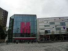
The main shopping area in Luton is centred on the Mall Luton. Built in the 1960s/1970s and opened as an Arndale Centre,[97] construction of the shopping centre led to the demolition of a number of the older buildings in the town centre including the Plait Halls (a Victorian covered market building with an iron and glass roof). Shops and businesses in the remaining streets, particularly in the roads around Cheapside and in High Town, have been in decline ever since. George Street, on the south side of the Arndale, was pedestrianised in the 1990s.
The shopping centre had some construction and re-design work done to it over the 2011/12 period and now has a new square used for leisure events, as well as numerous new food restaurants such as Toby's Carvery and Costa Coffee.
Contained within the main shopping centre is the market, which contains butchers, fishmongers, fruit and veg, hairdressers, tattoo parlours, ice cream, flower stall, T-shirt printing and the markets original sewing shop for clothes alterations and repairs as well as eating places.[98]
Another major shopping area is Bury Park where there are shops catering to Luton's ethnic minorities.
Sport
Luton has a wide range of sports clubs. It's the home town of Luton Town Football Club who currently play in the English football Championship[99] and whose history includes several spells in the top flight of the English league as well as a League Cup triumph in 1988. They play at Kenilworth Road, their home since 1905, with a new larger capacity stadium known as Power Court under construction.[18] Their nickname, 'The Hatters', dates back to when Luton had a substantial millinery industry, and their logo is based on the town's coat of arms.
Bedfordshire County Cricket Club is based at Wardown Park and is one of the county clubs which make up the Minor Counties in the English domestic cricket structure, representing the historic county of Bedfordshire. Luton Rugby Club are a local rugby union club based on Newlands Road, by the M1 motorway just outside Stockwood Park, who play in London 1 North. Speedway racing was once staged at Luton Stadium from 1934 to 1937.[100]
Twin towns
Luton participates in international town twinning; its partners[101][102] are:
| Country | Place | State/Region | Date | ||
|---|---|---|---|---|---|
| Germany | Bergisch Gladbach | North Rhine-Westphalia | 1956 | ||
| France | Bourgoin-Jallieu[102] | Auvergne-Rhône-Alpes | 1956 | ||
| Sweden | Eskilstuna | Södermanland | 1949 | ||
| Germany | Berlin-Spandau | Berlin | 1959 | ||
| Germany | Wolfsburg | Lower Saxony | 1950 | ||
Notable people
People who were born in Luton or are associated with the town.
By birth
|
|
|
By association
- Ian Anderson, leader of British rock band Jethro Tull[105]
- Rodney Bewes, actor
- Mo Chaudry, entrepreneur
- Diana Dors, actress[106]
- Ian Dury, singer[107]
- John Hegley, poet
- Hilda Hewlett, UK's first female pilot
- Sir Alec Jeffreys, geneticist
- Sarfraz Manzoor, author and columnist, The Guardian
- Eric Morecambe, entertainer
- Elizabeth Price, artist
- Colin Salmon, actor
See also
- List of places in Luton
- List of schools in Luton
- List of towns in England
- List of unitary authorities of England
- List of urban areas in the United Kingdom
- History of Luton
- Demography of Luton
- Economy of Luton
- Politics in Luton
- Transport in Luton
Notes
- Like most long-held UK events on this date, before 1972 it was held during the Christian moving feast and discretionary holiday of Whitsuntide (Pentecost) exactly seven weeks after Easter, in this case usually on the Monday
References
- Relief of Luton's coat of arms and motto on the gate of Wardown Park
- "Luton - Coat of arms (crest) of Luton".
- Luton: Straw Hat Boom Town (pdf). Luton Cultural Services Trust. 2011. p. 9.
The aspiration contained in its motto: Scientiae et labori detur (May it be given to skill and industry)
- Leadership=Mayor & Cabinet
- "Population Estimates for UK, England and Wales, Scotland and Northern Ireland, Mid-2018". Office for National Statistics. 28 June 2019. Retrieved 4 July 2019.
- Office for National Statistics
- "Luton". Collins Dictionary. n.d. Retrieved 23 September 2014.
- "Table PHP01 2011 Census: Usual residents ... wards in England and Wales;". 2011 Census: population and household estimates for Wards and Output Areas in England and Wales. Office for National Statistics. 23 November 2012. Retrieved 19 January 2013.. Dunstable wards 36,253. Houghton Regis wards 17,283.
- "Domesday book record". Retrieved 16 June 2008.
- "Saint Marys Luton Church Architecture". bedsarchives.bedford.gov.uk. 5 August 2016. Retrieved 8 April 2019.
- "Wardown House and Museum - About". Luton Culture.
- "Stockwood Discovery Centre - About". Luton Culture.
- "End of an era for Vauxhall". bbc.co.uk.
- "Contact Vauxhall".
- "CAA Airport Data 2018" (PDF). caa.co.uk. UK Civil Aviation Authority.
- "Our Heritage". beds.ac.uk.
- "Our Campuses". beds.ac.uk.
- "Power Court: Luton Town football stadium gains planning permission". bbc.co.uk.
- "Luton – the town: Cultural diversity". Our location. University of Bedfordshire. Archived from the original on 23 October 2013. Retrieved 30 December 2011.
- "Are you interested in your culture & heritage?". lutonirishforum.org. Luton Irish Forum.
- Robin Richardson; Angela Wood. "The Achievement of British Pakistani Learners" (PDF). Trentham Books. pp. 2, 1–17.
- https://www.irishtimes.com/life-and-style/abroad/working-abroad/lending-a-helping-hand-to-the-20-000-luton-irish-1.2995449
- "Early history of Luton". Retrieved 16 June 2008.
- "A History of Luton".
- "History of St Mary's Church". Archived from the original on 28 June 2008. Retrieved 16 June 2008.
- "Luton Castle only lasted 15 years". Archived from the original on 1 January 2011. Retrieved 16 June 2008.
- "A history hat making in Luton". Plaiting and Straw Hat Making. Luton Libraries. Archived from the original on 27 May 2013. Retrieved 18 June 2008.
- "The Hat Industry of Luton and its Buildings". English Heritage.
Long before it became associated with motor cars, Luton was well established as an international centre of hat making. More specifically, Luton was the main centre of ladies’ hat production in the UK for over 200 years ... This success was founded on the earlier regional industry of straw plaiting, an occupation that was well established by the late 17th century
- "Population figures for 1801, 1901 and 1901". Retrieved 16 June 2008.
- "Luton was made a borough". Retrieved 16 June 2008.
- "The Hat Industry of Luton and its Buildings". The Hat Industry of Luton and its Buildings. Historic England. 2013. Archived from the original on 24 January 2018. Retrieved 23 January 2018.
- "Churchill Tanks at Vauxhall". Bbc.co.uk. Retrieved 17 March 2013.
- "Deaths during WWII". Localhistories.org. Retrieved 17 March 2013.
- https://www.biodiversitylibrary.org/part/170088#/summary
- "Luton town centre with the old cooling towers". Twitter. 12 May 2016. Retrieved 3 February 2020.
- CEGB Statistical Yearbook 1968, CEGB, London
- "A History of Luton". Localhistories.org. Retrieved 17 March 2013.
- https://www.politico.eu/article/immigrants-who-voted-for-brexit-luton-migration/
- https://www.theguardian.com/uk/2005/mar/06/religion.faithschools
- https://www.telegraph.co.uk/news/uknews/terrorism-in-the-uk/8197799/Sweden-suicide-bombings-Luton-synonymous-with-Islamic-extremism-and-racial-tension.html
- "A fresh and modern brand for Luton".
- Archived 9 May 2011 at the Wayback Machine
- "Luton Town Coat of Arms". Retrieved 30 January 2011.
- "Arms of Luton (England)". Archived from the original on 25 September 2008. Retrieved 18 June 2008.
- Map of soil distribution in Beds Archived 29 January 2007 at the Wayback Machine
- ISBN 1-871199-94-8
- "Anomaly details for station Rothamsted, UK and index TXx: Maximum value of daily maximum temperature". Royal Netherlands Meteorological Institute.
- "Anomaly details for station Rothamsted, UK and index TXx: Maximum value of daily maximum temperature". Royal Netherlands Meteorological Institute.
- "Hot Spell - Aug 1990 Statistics" (PDF). Royal Netherlands Meteorological Institute.
- "Anomaly details for station Rothamsted, UK and index TXx: Maximum value of daily maximum temperature". Royal Netherlands Meteorological Institute.
- "Met Office: July 2006 – record temperatures and sunshine". Met Office.
- "Rothamsted 1981–2010 averages". Met Office. Retrieved 7 March 2019.
- "Indices Data - Rothamsted Station 1844". KNMI. Retrieved 7 March 2019.
- "2011 Census: Population and household estimates fact file, unrounded estimates, local authorities in England and Wales – unrounded figures for the data published 16 July 2012". Office for National Statistics. 24 September 2012. Retrieved 19 January 2013.
- KS01 Usual resident population: Census 2001, Key Statistics for urban areas Archived 6 March 2006 at the Wayback Machine
- "Table PP04 2011 Census: Usual resident population by single year of age, unrounded estimates, local authorities in England and Wales;". 2011 Census: population and household estimates for England and Wales – unrounded figures for the data published 16 July 2012. Office for National Statistics. 24 September 2012. Retrieved 19 January 2013.
- "Local Authority by Ethnic Group". Office for National Statistics. Retrieved 20 February 2013.
- https://www.ipsos.com/sites/default/files/ct/publication/documents/2018-03/a-review-of-survey-research-on-muslims-in-great-britain-ipsos-mori_0.pdf
- Philipson, Alice (10 January 2013). "White Britons a minority in Leicester, Luton and Slough". Telegraph. Archived from the original on 13 January 2013. Retrieved 17 March 2013.
- "New headquarters for easyJet at London Luton Airport Archived 18 January 2010 at the Wayback Machine." Easyjet. Retrieved on 27 September 2009.
- "Impellam Group - Company Contacts". Investors.impellam.com. Retrieved 24 September 2017.
- "Contact Us." TUI UK & Ireland. Retrieved on 4 January 2011. "Wigmore House Wigmore Lane Luton Bedfordshire LU2 9TN"
- "Luton." Thomson UK. Retrieved on 27 September 2009.
- "Corporate contact information Archived 30 September 2009 at the Wayback Machine." Vauxhall Motors. Retrieved on 2 September 2009.
- "Contact US (Test and Measurement)- Anritsu Europe". Anritsu.com. Retrieved 24 September 2017.
- "Working with UK Healthcare Professionals". Astrazeneca.co.uk. Retrieved 24 September 2017.
- "Archived copy". Archived from the original on 17 April 2015. Retrieved 3 April 2015.CS1 maint: archived copy as title (link)
- "Ernst and Young Locations". Ey.com. Retrieved 17 March 2013.
- "Contact Us". Whitbread.co.uk. Archived from the original on 29 November 2017. Retrieved 24 September 2017.
- "Contact Us". stonegatepubs.com. Retrieved 30 October 2019.
- https://www.luton.gov.uk/Council_government_and_democracy/Lists/LutonDocuments/PDF/Community%20cohesion/Building%20Cohesion%20in%20Luton.pdf
- "Employment statistics". National Office of Statistics. Retrieved 16 June 2008.
- "National Rail Enquiries - Station facilities for Luton". www.nationalrail.co.uk. Retrieved 10 April 2019.
- "National Rail Enquiries - Station facilities for Leagrave". www.nationalrail.co.uk. Retrieved 10 April 2019.
- "National Rail Enquiries - Station facilities for Luton Airport Parkway". www.nationalrail.co.uk. Retrieved 10 April 2019.
- "Grant Palmer". www.grantpalmer.com. Retrieved 10 April 2019.
- "Delayed busway opening announced". 23 August 2013. Retrieved 10 April 2019.
- Customer services, Town Hall (21 March 2012). "Taxi and private hire licences". www.luton.gov.uk. Retrieved 10 April 2019.
- "Barnfield Newsletter". Communiqueonline.com. Archived from the original on 2 May 2013. Retrieved 17 March 2013.
- "Luton Sixth Form College". Archived from the original on 9 April 2008. Retrieved 16 June 2008.
- "L2G Building for the Future Programme details". Retrieved 19 June 2008.
- "LEA School List". Luton Borough Council. Archived from the original on 16 May 2008. Retrieved 16 June 2008.
- "Building on the statutory list" (PDF).
- "Luton Carnival Coverage on the BBC". Retrieved 16 June 2008.
- "Archived copy". Archived from the original on 11 February 2014. Retrieved 5 February 2014.CS1 maint: archived copy as title (link)
- "Beds Herts and Bucks – Why Don't You – Luton's turning green!". BBC. Retrieved 17 March 2013.
- "Luton Irish Forum – St patrick's festival" (PDF). Archived from the original (PDF) on 9 March 2012. Retrieved 17 March 2013.
- "St Patrick's Day party is coming to Luton". Luton Today. Retrieved 17 March 2013.
- "8 Strategic vision for the arts cultural and creative industries" (PDF).
- "Shout Luton Theatre Guide". Archived from the original on 24 June 2008. Retrieved 16 June 2008.
- "BBC Three Counties Radio". Retrieved 21 January 2018.
- "Diverse FM". Retrieved 16 June 2008.
- "Brantwood Park - Luton Borough Council".
- "Luton Council website". Archived from the original on 9 February 2007. Retrieved 16 June 2008.
- "As We Were - Luton 1926-1976". East Anglian Film Archive.
- "Shop & Eat | Luton Indoor Market". Retrieved 20 March 2019.
- "Luton Town Football Club Official Website".
- "Defunct Speedway Tracks - Luton".
- "Town Twinning - Luton Council". Luton Borough Council.
- "British towns twinned with French towns". Archant Community Media Ltd. Retrieved 11 July 2013.
- "Lewis Baker". Chelsea Football Club. Retrieved 14 June 2019.
-
- "UK far-right figure Tommy Robinson jailed for contempt". Business Insider. 29 May 2018. Archived from the original on 15 June 2018. Retrieved 15 June 2018.
- "Morrissey defends Tommy Robinson and new far-right party". The Week. 7 June 2018. Archived from the original on 15 June 2018. Retrieved 15 June 2018.
- Hamilton, Fiona (30 May 2018). "Far-right provocateur Tommy Robinson jailed over court rant". The Times. Archived from the original on 15 June 2018. Retrieved 15 June 2018.
- Morrin, Siobhan (29 May 2018). "Why Tommy Robinson Was Jailed, and Why U.S. Rightwingers Care". Time. Archived from the original on 15 June 2018. Retrieved 15 June 2018.
- Palmer, Ewan (29 May 2018). "Why Was Tommy Robinson Arrested? Far-Right Activist Jailed For 13 Months For 'Prejudicing Rape Trial'". Newsweek. Archived from the original on 15 June 2018. Retrieved 15 June 2018.
- Wiser, Carl, "Ian Anderson of Jethro Tull" (interview), Songfacts, n.d. Anderson talked in the interview of having, in late 1967, a day job cleaning Luton's Ritz Cinema. Retrieved 6 March 2013.
- "The English Rose Public House Luton". Bedford Borough Council.
During the 1950s a regular visitor was actress Diana Dors, whose first husband Dennis Hamilton was the son of landlord Stanley Gittins. She is said to have served behind the bar in the pub on a number of occasions.
- "Ian Dury - A brief biography".
Ian found part-time work as an Art teacher at Luton College of Further Technology
.jpg)
Bibliography
- Dyer, James; Stygall, Frank; Dony, John (1964). The Story of Luton. Luton: White Crescent Press.CS1 maint: ref=harv (link)
External links
| Look up luton in Wiktionary, the free dictionary. |
| Wikisource has the text of the 1921 Collier's Encyclopedia article Luton. |
| Wikimedia Commons has media related to: |
| Wikivoyage has a travel guide for Luton. |
- Luton in the Domesday Book
- Luton at the Encyclopædia Britannica
- Luton Borough Council
- Luton Borough Council's channel on YouTube
- Bedfordshire Police
- Bedfordshire Fire and Rescue
- Luton and Dunstable - major local hospital
- Luton Today - local news
- Luton Culture - charity which manages museums and various events
- Luton Town F.C. - local football team
Places adjacent to Luton | ||||||||||
|---|---|---|---|---|---|---|---|---|---|---|
| ||||||||||
| ||||||
| Places |
| |||||
| Amenities |
| |||||
| Culture & Sport |
| |||||
| Education |
| |||||
| Politics |
| |||||
| Transport |
| |||||
| Media |
| |||||
| ||||||
| Unitary authorities |
|
|---|---|
| Major settlements | |
| Topics |
|
| Districts |
|  |
|---|---|---|
| Councils |
| |
| Local elections |
| |
Districts of the East of England | ||
|---|---|---|
| Bedfordshire |
|  |
| Cambridgeshire |
| |
| Essex |
| |
| Hertfordshire |
| |
| Norfolk |
| |
| Suffolk |
| |
London commuter belt | ||
|---|---|---|
| Home counties | 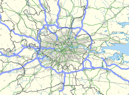 | |
| Urban areas |
| |
| Cities and towns (100k+) | ||
| Towns (25k–99k) |
| |
| Towns (10k–25k) |
| |
| Authority control |
|---|