Hammersmith & City line
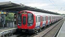
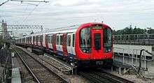
The Hammersmith & City line is a London Underground line that runs between Hammersmith in west London and Barking in east London. Coloured pink on the Tube map, it serves 29 stations over 15.8 miles (25.5 km). Between Farringdon and Aldgate East it skirts the City of London, the capital's financial heart, hence the line's name. Its tunnels are just below the surface and are a similar size to those on British main lines. Most of the track and all stations are shared with either the District, Circle or Metropolitan lines, the other parts of London Underground's sub-surface railway, and over 114 million passenger journeys are made each year on the Hammersmith & City and Circle lines.
| Hammersmith & City line | |||||||||||||||||||||
|---|---|---|---|---|---|---|---|---|---|---|---|---|---|---|---|---|---|---|---|---|---|
 | |||||||||||||||||||||
 A Hammersmith & City line train at West Ham, bound for Hammersmith | |||||||||||||||||||||
| Overview | |||||||||||||||||||||
| Type | Rapid transit | ||||||||||||||||||||
| System | London Underground | ||||||||||||||||||||
| Stations | 29 | ||||||||||||||||||||
| Ridership | 114.6 million (2011/12)[lower-alpha 1][1] passenger journeys | ||||||||||||||||||||
| Colour on map | Pink | ||||||||||||||||||||
| Website | tfl.gov.uk | ||||||||||||||||||||
| Operation | |||||||||||||||||||||
| Opened | Infrastructure opened in stages between 1863 and 1902, shown as a separate line on the tube map from 1990. | ||||||||||||||||||||
| Character | Sub-surface | ||||||||||||||||||||
| Depot(s) | Hammersmith[2] | ||||||||||||||||||||
| Rolling stock | S7 Stock (7 carriages per trainset) | ||||||||||||||||||||
| Technical | |||||||||||||||||||||
| Line length | 25.5 km (15.8 mi)[3] | ||||||||||||||||||||
| Track gauge | 1,435 mm (4 ft 8 1⁄2 in) standard gauge | ||||||||||||||||||||
| |||||||||||||||||||||
In 1863, the Metropolitan Railway began the world's first underground railway service between Paddington and Farringdon with wooden carriages and steam locomotives. The following year, a railway west from Paddington to Hammersmith was opened and this soon became operated and owned jointly by the Metropolitan and Great Western Railway companies. The line was then extended to the east, in stages, reaching the East London Railway in 1884. The line was electrified in 1906, and, in 1936, after the Metropolitan Railway had been absorbed by the London Passenger Transport Board, some Hammersmith & City line trains were extended over the former District Railway line to Barking. The Hammersmith & City route was shown on the Tube map as part of the Metropolitan line until 1990, when it was redesignated as a separate line.
The track and signalling systems have been upgraded, and the old six-car C69/C77 Stock trains were replaced by new S7 Stock trains from 2012 to 2014 in a programme to increase capacity by 65 per cent by 2019.
The line runs parallel to the Great Western Main Line between Paddington and Westbourne Park, and parallel to the London, Tilbury and Southend Railway between West Ham and Barking.
History
Metropolitan Railway
Hammersmith & City Line | |||||||||||||||||||||||||||||||||||||||||||||||||||||||||||||||||||||||||||||||||||||||||||||||||||||||||||||||||||||||||||||||||||||||||||||||||||||||||||||||||||||||||||||||||||||||||||||||||||||||||||||||||||||||||||||||||||||||||||||||||||||||||||||||||||||||||||||||||||||||||||||||||||||||||||||||||||||||||||||||||||||||||||||||||||||||||||||||||||||||||||||||||||||||||||||||||||||||||||||||||||||
|---|---|---|---|---|---|---|---|---|---|---|---|---|---|---|---|---|---|---|---|---|---|---|---|---|---|---|---|---|---|---|---|---|---|---|---|---|---|---|---|---|---|---|---|---|---|---|---|---|---|---|---|---|---|---|---|---|---|---|---|---|---|---|---|---|---|---|---|---|---|---|---|---|---|---|---|---|---|---|---|---|---|---|---|---|---|---|---|---|---|---|---|---|---|---|---|---|---|---|---|---|---|---|---|---|---|---|---|---|---|---|---|---|---|---|---|---|---|---|---|---|---|---|---|---|---|---|---|---|---|---|---|---|---|---|---|---|---|---|---|---|---|---|---|---|---|---|---|---|---|---|---|---|---|---|---|---|---|---|---|---|---|---|---|---|---|---|---|---|---|---|---|---|---|---|---|---|---|---|---|---|---|---|---|---|---|---|---|---|---|---|---|---|---|---|---|---|---|---|---|---|---|---|---|---|---|---|---|---|---|---|---|---|---|---|---|---|---|---|---|---|---|---|---|---|---|---|---|---|---|---|---|---|---|---|---|---|---|---|---|---|---|---|---|---|---|---|---|---|---|---|---|---|---|---|---|---|---|---|---|---|---|---|---|---|---|---|---|---|---|---|---|---|---|---|---|---|---|---|---|---|---|---|---|---|---|---|---|---|---|---|---|---|---|---|---|---|---|---|---|---|---|---|---|---|---|---|---|---|---|---|---|---|---|---|---|---|---|---|---|---|---|---|---|---|---|---|---|---|---|---|---|---|---|---|---|---|---|---|---|---|---|---|---|---|---|---|---|---|---|---|---|---|---|---|---|---|---|---|---|---|---|---|---|---|---|---|---|---|---|---|---|---|---|---|---|---|---|---|---|---|---|---|---|---|---|---|---|---|---|---|---|---|---|---|---|---|---|---|---|---|---|---|---|---|---|
| |||||||||||||||||||||||||||||||||||||||||||||||||||||||||||||||||||||||||||||||||||||||||||||||||||||||||||||||||||||||||||||||||||||||||||||||||||||||||||||||||||||||||||||||||||||||||||||||||||||||||||||||||||||||||||||||||||||||||||||||||||||||||||||||||||||||||||||||||||||||||||||||||||||||||||||||||||||||||||||||||||||||||||||||||||||||||||||||||||||||||||||||||||||||||||||||||||||||||||||||||||||
The first line built by the Metropolitan Railway (Met) was from Paddington to near Smithfield, near London's financial heart in the City; with gas-lit wooden carriages hauled by steam locomotives. Opened on 10 January 1863, it was the world's first underground railway. The line was built mostly under the New Road using the "cut-and-cover" method between Paddington and King's Cross and then in tunnel and cuttings beside Farringdon Road.[4][5] Supported by the Met and the Great Western Railway (GWR), the Hammersmith & City Railway (H&CR) was built from the GWR's main line a mile west of Paddington station to the developing suburbs of Shepherd's Bush and Hammersmith.[6][7] Built on viaduct largely across open fields,[8] the line opened on 13 June 1864 with a GWR service from Farringdon[9] to Hammersmith,[10] services to Addison Road (now Kensington (Olympia)) on the West London Railway via a link at Latimer Road starting a few weeks later.[9] From 1865 the Met ran trains to Hammersmith and the GWR trains to Addison Road.[lower-alpha 2] In 1867 the line became jointly owned by the two companies. In 1871 two additional tracks parallel to the GWR between Westbourne Park and Paddington were brought into use for the H&CR, and in 1878 the flat crossing at Westbourne Park was replaced by a dive-under.[8] A year earlier some services had been extended via London & South Western Railway's Hammersmith (Grove Road) railway station and their line to Richmond.[12][10]
The railway was extended east of Farringdon and a terminus opened at Aldgate on 18 November 1876.[13] The Met wished to access the South Eastern Railway via the East London Railway (ELR) and jointly with the District Railway built lines from their Mansion House station to the Met's Aldgate station and east from Aldgate to reach the ELR at Whitechapel. In October 1884 the Met extended some Hammersmith services over the ELR to New Cross.[14][10]
In 1902 the Whitechapel & Bow Railway was opened, linking the District Railway at Whitechapel to the London, Tilbury and Southend Railway (LT&SR) at an above-ground junction at Bow, to the west of Bromley-by-Bow station, and some District services were extended from Whitechapel to East Ham.[15] When the line was electrified in 1906 services to Richmond were withdrawn and the western termini became Hammersmith and Kensington (Addison Road), and to the east services were diverted from the ELR to Whitechapel,[16] until the ELR was electrified in 1914 and services ran from Hammersmith to New Cross (SER) and New Cross (LB&SCR).[17] The 6-car electric multiple units were jointly owned by the Met and GWR until 1923 when the GWR sold theirs to the Met.[18]
London Transport
On 1 July 1933 the Metropolitan Railway was amalgamated with other Underground railways, tramway companies and bus operators to form the London Passenger Transport Board. To relieve congestion on the District line east of Whitechapel from 1936 some Hammersmith & City line trains were diverted from the East London line to Barking.[10] Through trains to New Cross and New Cross Gate were withdrawn in November 1939,[10] the Hammersmith & City line trains terminating at Whitechapel while the longer 8-car Uxbridge line trains ran to Barking. However, this caused operational problems and from 1941 Barking was again served by trains from Hammersmith.[19]
From 1937 new steel O stock trains, with doors remotely operated by the guard, replaced the wooden-bodied trains dating from 1906. It had been intended to operate the new trains with four or six cars,[19] but after initial problems with the traction current only six-car formations were used.[20] Services to Kensington (Olympia) via the curve at Latimer Road were suspended for the duration of World War II after bomb damage to the West London line in 1940.[21] When the similar trains running on the Circle line were lengthened to six cars in 1959 and 1960, the stock of the two lines was integrated with maintenance at Hammersmith depot.[22] Aluminium C Stock trains, with public address systems and originally unpainted, replaced these trains from 1970.[23] One person operation was proposed in 1972, but due to conflict with the trade unions was not introduced until 1984.[24]
A separate identity
The Hammersmith & City line was shown on the tube map as part of the Metropolitan line until 1990, when it became separated, and the Metropolitan line became the route from Aldgate to Baker Street and northwards through "Metro-Land" to Uxbridge, Watford and Amersham.[10][25] In 2003, the infrastructure of the Hammersmith & City line was partly privatised in a public–private partnership, managed by the Metronet consortium. Metronet went into administration in 2007 and the local government body Transport for London took over responsibilities.[26] The reconstruction of Whitechapel station for the new Crossrail underground line required the reversing platforms to be taken out of use and since December 2009 all services have been extended to Plaistow or Barking.[27]
Beginning in 2012, following the complete replacement of the Metropolitan line's A Stock with S8 Stock, the C Stock trains of the Circle and Hammersmith & City lines were replaced by the S7 Stock. The Hammersmith & City line received the S7 Stock first, with the first train entering service on 6 July 2012, running a shuttle service between Hammersmith and Moorgate[28] before operating between Hammersmith and Barking on 9 December 2012.[29][30] By March 2014 all services were provided by S7 Stock trains.[31]
Route
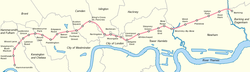
The line is 15.8 miles (25.5 km) long with 29 stations.[3] Almost all of its track is shared with the other London Underground sub-surface lines: from Hammersmith to Baker Street with the Circle line, from Baker Street to Aldgate with the Circle and Metropolitan lines, and from Aldgate East station to Barking with the District line.[32] All its stations are shared with other lines.
The line is electrified with a four-rail DC system: a central conductor rail is energised at −210 V and a rail outside the running rails at +420 V, giving a potential difference of 630 V.[33] Much of the 2-mile-35-chain (3.9 km) double-track railway from the Hammersmith terminus to Westbourne Park station is on a 20-foot (6.1 m) high brick viaduct.[7] After Westbourne Park the line passes beneath the Great Western main line re-surfacing at Royal Oak station and running alongside the main lines to Paddington station.[32] The line enters a cutting just west of the station and a cut-and-cover tunnel at the end of the platforms. It meets the Circle and District lines from Bayswater at Praed Street Junction before passing through Edgware Road station in a cutting. After King's Cross St Pancras the line is in cutting, passing under the Ray Street Gridiron that carries the City Widened Lines used for Thameslink services.[32][34] There are bay platforms at Moorgate. Just before Aldgate the line diverges from the Circle and Metropolitan lines to Aldgate East.[32] The line passes over the London Overground at Whitechapel station continuing on the 2-mile (3.2 km) former Whitechapel & Bow Railway to Bow Road where it surfaces, and then to Bromley-by-Bow, where it runs alongside the London, Tilbury and Southend line from Fenchurch Street. At the next station, West Ham, there is a transfer with the Jubilee line, the Docklands Light Railway and c2c. There is a bay platform at the next station, Plaistow, and the line terminates after two more stations at Barking.[32]
Services
As of December 2012 off-peak there are six trains per hour, calling at all stations,[35] and requiring 15 trains for the peak-hour service.[3] Together with the Circle line, over 114 million passenger journeys are made each year.[1] The journey from Hammersmith to Barking takes one hour during off-peak times. The central section from Paddington to Aldgate East is in Fare Zone 1; to the west to Hammersmith and east to Bromley-by-Bow is in Zones 2; East Ham is in both Zones 3 and 4, whilst Barking is in Zone 4 alone.[36]
Rolling stock
Services are provided by S7 Stock trains, part of Bombardier's Movia family, with air-conditioning as the sub-surface tunnels (unlike those on the deep-level tube lines) are able to disperse the exhausted hot air.[37] These trains have regenerative brakes, returning around 20 per cent of their energy to the network.[38] With a top speed of 62 mph (100 km/h),[37] a 7-car S Stock train has a capacity of 865 passengers, compared to 739 for the six-car C Stock train it replaced.[39][40] With a length of 384 feet (117 m), S Stock trains are 79 feet (24 m) longer than 305-foot (93 m) long C Stock trains and station platforms have been lengthened.[41] Traction voltage was increased in 2017, from the present nominal 630 V to 750 V to give better performance and allow the trains to return more energy to the network through their regenerative brakes.[40]
Depot
The line's depot is at Hammersmith,[lower-alpha 3] close to Hammersmith station, built by the Great Western Railway to be operated by the Metropolitan Railway when the joint railway was electrified in the early 20th century.[16] Sidings at Barking and near High Street Kensington (Triangle Sidings) stable trains overnight.[3] Sidings at Farringdon were used during the C stock era; due to the greater length of the new S stock trains, these are no longer in use.
Upgrade programme
Together with the introduction of S Stock trains, the track, electrical supply and signalling systems are being upgraded in a programme planned to increase peak-hour capacity on the Circle and Hammersmith & City lines by 65 per cent by the end of 2018.[42][43][44] A single control room for the sub-surface railway opened in Hammersmith on 6 May 2018 and an automatic train control (ATC) system will replace signalling equipment installed from the 1940s.[43][45] The cross-London Crossrail line, planned to open in 2019, is expected to reduce crowding between Paddington and Whitechapel.[46][47]
List of stations
| Station | Image | Opened[10] | Additional information | Position |
|---|---|---|---|---|
| Hammersmith | _station_building.JPG) | 13 June 1864 | Moved to current position 1 December 1868.[10] | 51°29′39″N 000°13′30″W |
| Goldhawk Road |  | 1 April 1914 | 51°30′07″N 000°13′37″W | |
| Shepherd's Bush Market | 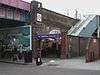 | 13 June 1864 | Moved to current position 1 April 1914.[10] Renamed from "Shepherd's Bush" in 2008.[48] | 51°30′21″N 000°13′35″W |
| Wood Lane | 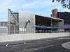 | 12 October 2008 | [49] | 51°30′35″N 000°13′27″W |
| Latimer Road | 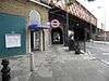 | 16 December 1868 | Closed between 17 January and 1 August 2011 for refurbishment and extension works[50] | 51°30′50″N 000°13′02″W |
| Ladbroke Grove |  | 13 June 1864 | Opened as Notting Hill, renamed Notting Hill & Ladbroke Grove in 1880, Ladbroke Grove (North Kensington) in 1919 and Ladbroke Grove in 1938.[10] | 51°31′02″N 000°12′38″W |
| Westbourne Park | 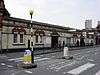 | 1 February 1866 | Moved to current position 1 November 1871,[10] and a Great Western main-line station until 1992.[lower-alpha 4][51][52] | 51°31′16″N 000°12′04″W |
| Royal Oak | 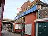 | 30 October 1871 | Also a Great Western main-line station until 1934.[53] | 51°31′09″N 000°11′17″W |
| Paddington | 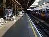 | 10 January 1863 | Opened as Paddington (Bishop's Road), renamed in 1948.[10] Connects with Bakerloo and District lines and Paddington main-line station. | 51°31′07″N 000°10′46″W |
| Edgware Road |  | 10 January 1863 | Connects with District and Circle lines. | 51°31′12″N 000°10′04″W |
| Baker Street |  | 10 January 1863 | Connects with Bakerloo, Jubilee and Metropolitan lines. | 51°31′19″N 000°09′25″W |
| Great Portland Street | 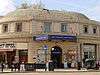 | 10 January 1863 | Opened as Portland Road, renamed Great Portland Street in 1917. Named Great Portland Street & Regent's Park 1923–33.[10] | 51°31′26″N 000°08′38″W |
| Euston Square |  | 10 January 1863 | Opened as Gower Street and renamed in 1909.[10] Closest Hammersmith & City line station to Euston main-line station. | 51°31′33″N 000°08′09″W |
| King's Cross St Pancras | 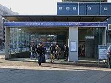 | 10 January 1863 | Opened as King's Cross, renamed King's Cross & St. Pancras in 1925 and King's Cross St. Pancras in 1933. Moved to current position in 1941.[10] Connects with Northern, Piccadilly and Victoria lines St Pancras and King's Cross main-line stations. | 51°31′49″N 000°07′27″W |
| Farringdon |  | 10 January 1863 | Opened as Farringdon Street, and moved to current position in 1865. Renamed Farringdon & High Holborn in 1922 and Farringdon in 1936.[10] Connects with Thameslink services. | 51°31′12″N 000°06′19″W |
| Barbican |  | 23 December 1865 | Opened as Aldersgate Street, then Aldersgate in 1910, Aldersgate & Barbican in 1923 and Barbican in 1968.[10] | 51°31′13″N 000°05′52″W |
| Moorgate | 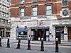 | 23 December 1865 | Opened as Moorgate Street, renamed in 1924.[10] Connects with Northern line and the main line. | 51°31′07″N 000°05′19″W |
| Liverpool Street |  | 11 July 1875 | From February to July 1875 trains used platforms in the mainline station.[54] Connects with Central and Circle lines and Liverpool Street mainline station. | 51°31′04″N 000°04′59″W |
| Aldgate East | 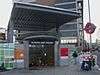 | 6 October 1884 | Connects with District line. Moved to current position in 1938.[10] | 51°30′55″N 000°04′20″W |
| Whitechapel |  | 6 October 1884 | Connects with London Overground services. Opened as Whitechapel (Mile End), renamed in 1901. Metropolitan service began in 1906, and withdrawn 1913–36.[10] | 51°31′08″N 000°03′40″W |
| Stepney Green |  | 23 June 1902 | Metropolitan service began in 1941.[10] | 51°31′19″N 000°02′47″W |
| Mile End | 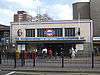 | 2 June 1902 | Cross platform interchange with Central line. Metropolitan service began in 1936.[10] | 51°31′30″N 000°01′59″W |
| Bow Road | 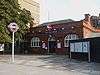 | 11 June 1902 | Main-line station opened in 1876 and moved in 1892.[55] Metropolitan service began in 1936,[10] main-line station closed in 1947.[55] | 51°31′38″N 000°01′29″W |
| Bromley-by-Bow | 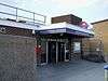 | 2 June 1902 | Opened as main-line station in 1894. First served as Bromley, Metropolitan service began in 1936, main-line station closed in 1940 and renamed in 1967.[10][56] | 51°31′26″N 000°00′41″W |
| West Ham |  | 2 June 1902 | Connects with Jubilee line, Docklands Light Railway and c2c services. Main-line station opened 1901, Named West Ham (Manor Road) from 1924–69, Metropolitan service began in 1941 and main-line station closed 1994.[10][57] | 51°31′41″N 000°00′14″E |
| Plaistow | 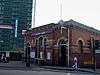 | 2 June 1902 | Main-line station opened in 1858.[58] Metropolitan service began in 1936.[10] | 51°31′53″N 000°01′02″E |
| Upton Park |  | 2 June 1902 | Main-line station opened in 1877.[59] Metropolitan service began in 1936.[10] | 51°32′06″N 000°02′04″E |
| East Ham |  | 2 June 1902 | Main-line station opened in 1858.[60] Metropolitan service began in 1936.[10] | 51°32′20″N 000°03′06″E |
| Barking |  | 2 June 1902 | Connects with c2c, London Overground, and District line services to Upminster. Main-line station opened in 1854.[61] District Railway service withdrawn 1905–8. Metropolitan service began in 1936.[10] | 51°32′21″N 000°04′54″E |
Notes and references
Notes
- combined figures for Circle and Hammersmith & City lines
- In August 1872, the Addison Road service became the Middle Circle when extended over the District Railway to Earl's Court and onto Mansion House. From 1 July 1900 the service was cut back to run from Earl's Court to Aldgate before being withdrawn in January 1905.[11]
- Position: 51°29′52″N 000°13′31″W
- Leboff (1994, p. 152) adds that the station opened as 'Westbourne Park & Kensal Green' and was served from the outset by the GWR, whereas Butt (1995, p. 244) gives the GWR serving from 1871.
References
- "Performance: LU Performance Data Almanac". Transport for London. 2011–2012. Retrieved 17 January 2013.
- "London Underground Key Facts". Transport for London. Retrieved 21 May 2008.
- "Hammersmith & City line: Key Facts". Transport for London. Retrieved 28 November 2012.
- Green 1987, pp. 3–5.
- Edwards, Dennis; Pigram, Ron (1988). The Golden Years of the Metropolitan Railway and the Metro-land Dream. Bloomsbury. p. 32. ISBN 1-870630-11-4.
- Wolmar 2004, pp. 66–67.
- Jackson 1986, p. 38.
- Jackson 1986, pp. 39–40.
- Jackson 1986, pp. 38–39.
- Rose 2007.
- Bruce 1983, p. 11.
- Green 1987, p. 11.
- Jackson 1986, pp. 69–71.
- Jackson 1986, p. 109.
- Horne 2006, pp. 28–29.
- Jackson 1986, p. 185.
- Jackson 1986, pp. 224, 349.
- Jackson 1986, p. 237.
- Horne 2003, p. 65.
- Bruce 1983, p. 93.
- Horne 2006, p. 73.
- Bruce 1983, p. 95.
- Bruce 1983, p. 114.
- Croome, Desmond F.; Jackson, Alan Arthur (1993). Rails Through the Clay: A History of London's Tube Railways. Capital Transport. p. 468. ISBN 978-1-85414-151-4.
- "London Underground map 1990". The London Tube map archive. Retrieved 21 November 2012.
- "PPP Performance Report" (PDF). Transport for London. 2009–2010. pp. 7–8. Retrieved 7 March 2012.
- "Review of the new SSR service pattern introduced in December 2009" (PDF). Transport for London. 8 February 2011. pp. 2, 8. Retrieved 31 December 2012.
- Bull, John; Moore, George (9 July 2012). "In Pictures: The S7 Stock In Passenger Service". London Reconnections. Retrieved 16 July 2012.
- Johnson, Marc (13 December 2012). "First S Stock train runs on Hammersmith & City line". Rail.co. Archived from the original on 16 January 2013. Retrieved 30 December 2012.
- Hendy, Peter (December 2013). "Commissioner's Report" (PDF). Transport for London. p. 5. Retrieved 21 December 2013.
- "Commissioner's Report" (PDF). Transport for London. 26 March 2014. pp. 3–4. Retrieved 2 April 2014.
- "Detailed London Transport Map". cartometro.com. Retrieved 23 November 2012.
- Martin, Andrew (26 April 2012). Underground, Overground: A Passenger's History of the Tube. Profile Books. pp. 137–138. ISBN 978-1-84765-807-4. Retrieved 7 December 2012.
- Jackson 1986, p. 48.
- "Hammersmith to Barking Hammersmith & City line timetable". Transport for London. Retrieved 9 December 2012. In the Tube timetable - Tube station box select "Hammersmith (H&C Line)" and press Get Timetable. Select Hammersmith & City line Barking timetable and then view timetable.
- "Standard Tube Map" (PDF). Transport for London. Retrieved 8 December 2012.
- "Metro — London, United Kingdom". Bombardier. Retrieved 27 January 2011.
- "Transforming the Tube" (PDF). Transport for London. July 2008. Retrieved 28 May 2009.
- "Rolling Stock: C Stock". Transport for London. Retrieved 25 November 2012.
- "Rolling Stock: S stock". Transport for London. Retrieved 10 January 2012.
- "'S' stock making its mark". Modern Railways. London. December 2010. p. 46.
- "Upgrade plan (leaflet)" (PDF). Transport for London. February 2013. p. 10. Retrieved 2 March 2013.
- Abbott, James. "Sub-surface renewal". Modern Railways (January 2013): 38–41.
- "Hammersmith & City line Upgrade Plan". Transport for London. Retrieved 8 December 2012.
- Stewart, Rob. "Cityflo 650 to control the SSR". Modern Railways (January 2013): 42–43.
- "A World-Class new railway for London and the South-East". Crossrail. Retrieved 6 February 2013.
- "Crossrail business case - Summary Report". Crossrail. July 2010. p. 6. Retrieved 6 February 2013.
- "Modernisation complete as Shepherd's Bush Tube station re-opens" (Press release). Transport for London. 7 October 2008. Retrieved 6 February 2013.
- "New Wood Lane Underground station opens" (Press release). Transport for London. 14 October 2008. Retrieved 8 December 2012.
- "Latimer Road station to close for three months for engineering works" (Press release). Transport for London. 14 January 2011. Retrieved 7 February 2013.
- Butt 1995, p. 244.
- Leboff 1994, p. 152.
- Leboff 1994, p. 116.
- Jackson 1986, p. 70.
- Butt 1995, p. 41.
- Butt 1995, p. 45.
- Butt 1995, p. 245.
- Butt 1995, p. 186.
- Butt 1995, p. 238.
- Butt 1995, p. 88.
- Butt 1995, p. 27.
Bibliography
- Bruce, J Graeme (1983). Steam to Silver. A history of London Transport Surface Rolling Stock. Capital Transport. ISBN 0-904711-45-5.CS1 maint: ref=harv (link)
- Butt, R. V. J. (1995). The Directory of Railway Stations: details every public and private passenger station, halt, platform and stopping place, past and present (1st ed.). Sparkford: Patrick Stephens Ltd. ISBN 978-1-85260-508-7. OCLC 60251199.
- Green, Oliver (1987). The London Underground: An illustrated history. Ian Allan. ISBN 0-7110-1720-4.CS1 maint: ref=harv (link)
- Horne, Mike (2003). The Metropolitan Line. Capital Transport. ISBN 1-85414-275-5.CS1 maint: ref=harv (link)
- Horne, Mike (2006). The District Line. Capital Transport. ISBN 1-85414-292-5.CS1 maint: ref=harv (link)
- Jackson, Alan (1986). London's Metropolitan Railway. David & Charles. ISBN 0-7153-8839-8.CS1 maint: ref=harv (link)
- Leboff, David (1994). London Underground Stations. Ian Allan. ISBN 978-0-7110-2226-3.CS1 maint: ref=harv (link)
- Rose, Douglas (December 2007) [1980]. The London Underground: A Diagrammatic History (8th ed.). Capital Transport. ISBN 978-1-85414-315-0.CS1 maint: ref=harv (link)
- Wolmar, Christian (2004). The Subterranean Railway: how the London Underground was built and how it changed the city forever. Atlantic. ISBN 1-84354-023-1.CS1 maint: ref=harv (link)
Further reading
External links
| Wikimedia Commons has media related to Hammersmith & City Line. |
- "Hammersmith & City Line". Clive's Underground Line Guides. 14 December 2007. Retrieved 11 July 2008.
- "Hammersmith & City Line Underground Stations – Facts, Trivia And Impressions". Randomly London. 8 August 2013. Retrieved 24 September 2013.
- Hammersmith & City line on Twitter

| Stations |
| ||||
|---|---|---|---|---|---|
| Rolling stock |
| ||||
| History |
| ||||
| See also | |||||
| |||||