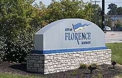
Florence, Kentucky
Florence is a home rule-class city[4] in Boone County, Kentucky, United States. Florence is one of the larger cities of Northern Kentucky, and part of the Greater Cincinnati Metropolitan Area. The population was 29,951 at the 2010 census.[5]
Florence, Kentucky | |
|---|---|
City | |
 | |
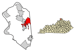 Location of Florence in Boone County, Kentucky. | |
| Coordinates: 38°59′36″N 84°38′33″W | |
| Country | United States |
| State | Kentucky |
| County | Boone |
| Established | 1830 |
| Incorporated | February 17, 1860 |
| Government | |
| • Type | Mayor–council[1] |
| • Mayor | Diane E. Whalen[2] |
| Area | |
| • Total | 10.3 sq mi (26.8 km2) |
| • Land | 10.3 sq mi (26.7 km2) |
| • Water | 0.04 sq mi (0.1 km2) |
| Elevation | 925 ft (282 m) |
| Population (2010) | |
| • Total | 29,951 |
| • Estimate (2018)[3] | 32,479 |
| • Density | 2,906/sq mi (1,122.0/km2) |
| Time zone | UTC−5 (Eastern (EST)) |
| • Summer (DST) | UTC−4 (EDT) |
| ZIP codes | 41022, 41042 |
| Area code(s) | 859 |
| FIPS code | 21-27982 |
| GNIS feature ID | 0492266 |
| Website | www |
History
The Florence area was originally known as Crossroads, because of the convergence of several roads from Burlington and Union at Ridge Road (now U.S. 25). By 1821, the area was known as Maddentown for Thomas Madden, a Covington attorney who owned a farm on the Burlington Pike. When Madden moved away, the area became known as Connersville in 1828 for Jacob Conner, a settler who assumed responsibility for the growing town. The town was finally renamed Florence because there was another Connersville in Harrison County. The name presumably is for Florence, Italy, but the specific etymology is unclear.[6][7] It was incorporated on January 27, 1830, and grew quickly after the completion of the Covington-Lexington Turnpike in 1836.[8]
Geography
Florence is located in eastern Boone County at 38°59′36″N 84°38′33″W (38.993225, -84.642602).[9] U.S. Routes 25, 42, and 127 pass through the center of Florence, leading northeast in a concurrency 11 miles (18 km) to downtown Cincinnati. Interstates 75 and 71 pass through the western part of Florence, with access from exits 178 through 182.
According to the United States Census Bureau, the city has a total area of 10.3 square miles (26.8 km2), of which 10.3 square miles (26.7 km2) is land and 0.04 square miles (0.1 km2), or 0.43%, is water.[5]
Demographics
As of the census[10] of 2000, there were 23,551 people, 9,640 households, and 6,073 families residing in the city. The population density was 2,385.6 per square mile (921.1/km2). There were 10,322 housing units at an average density of 1,045.6 per square mile (403.7/km2). Today the racial makeup of the city is 85% White, 6% African American, 0.14% Native American, 4% Asian, 0.06% Pacific Islander, 1% from other races, and 3% from two or more races. Hispanic or Latino of any race were 7% of the population.
There were 9,640 households, of which 32.1% had children under the age of 18 living with them, 46.2% were married couples living together, 12.8% had a female householder with no husband present, and 37.0% were non-families. 30.2% of all households were made up of individuals and 11.1% had someone living alone who was 65 years of age or older. The average household size was 2.41 and the average family size was 3.03.
| Historical population | |||
|---|---|---|---|
| Census | Pop. | %± | |
| 1830 | 62 | — | |
| 1850 | 251 | — | |
| 1870 | 374 | — | |
| 1880 | 309 | −17.4% | |
| 1900 | 258 | — | |
| 1910 | 250 | −3.1% | |
| 1920 | 268 | 7.2% | |
| 1930 | 450 | 67.9% | |
| 1940 | 776 | 72.4% | |
| 1950 | 1,325 | 70.7% | |
| 1960 | 5,837 | 340.5% | |
| 1970 | 11,661 | 99.8% | |
| 1980 | 15,586 | 33.7% | |
| 1990 | 18,624 | 19.5% | |
| 2000 | 23,551 | 26.5% | |
| 2010 | 29,951 | 27.2% | |
| Est. 2018 | 32,479 | [3] | 8.4% |
| U.S. Decennial Census[11] | |||
24.9% of the population was under the age of 18, 10.7% from 18 to 24, 33.0% from 25 to 44, 19.6% from 45 to 64, and 11.8% who were 65 years of age or older. The median age was 33 years. For every 100 females, there were 90.4 males. For every 100 females age 18 and over, there were 86.7 males.
The median income for a household in the city was $42,567, and the median income for a family was $52,160. Males had a median income of $36,677 versus $26,323 for females. The per capita income for the city was $20,451. About 8.1% of families and 9.5% of the population were below the poverty line, including 11.5% of those under age 18 and 14.0% of those age 65 or over.
In terms of population, Florence gained 2.2% over one year and gained 14.2% over the course of the decade. As of June 2008, the city's population was 27,745 citizens.[12] It is the sixth largest city in the Cincinnati/Northern Kentucky metropolitan area.
Landmarks
.jpg)
Florence is well known in surrounding cities for a water tower visible from I-71/I-75 that reads "Florence Y'all". Originally the tower advertised the up-and-coming Florence Mall, as part of an agreement by the mall developers who donated the land for the tower. However, because the mall was not built yet, the tower violated highway regulations, and the city was forced to change it within a short deadline. Rather than repaint the entire tower, they simply painted over the two vertical lines of the "M" to create a "Y". The intent was to change it back when the mall was built, but the local residents liked the tower's new proclamation, so the city decided to leave it as it was.
Culture
Education
Florence is served by Boone County Schools. Gateway Community and Technical College has a campus located south of town.
Florence has a public library, a branch of the Boone County Public Library.[14]
Economy
Major employers in Florence include St. Elizabeth Healthcare, Boone County Schools, Robert Bosch, SWECO, Meritor, Eagle Manufacturing, Walmart, Costco Wholesale, and the City of Florence.[15] Major employers in unincorporated areas with Florence addresses include Celanese, Citigroup, Crane Composites, DRS, Duro Bag Mfg, Givaudan, Kellogg's, Mubea, RR Donnelley, Schwan's, Staples., and Taylor & Francis[16] Companies based in Florence include Southern Air and Kona Ice.
Notable people
- Shaun Alexander, former NFL player
- Kenny Price, country music singer, made appearances on Hee Haw
References
- "City Council Members". City of Florence, Kentucky. Retrieved December 19, 2019.
- Whalen, Diane (Jun 10, 2018). "Florence mayor to grads: 'There's more to the world than Instagram, Snapchat'". Cincinnati Enquirer. Retrieved December 19, 2019.
- "Population and Housing Unit Estimates". Retrieved June 4, 2019.
- "Summary and Reference Guide to House Bill 331 City Classification Reform" (PDF). Kentucky League of Cities. Retrieved December 30, 2014.
- "Geographic Identifiers: 2010 Demographic Profile Data (G001): Florence city, Kentucky". U.S. Census Bureau, American Factfinder. Archived from the original on February 12, 2020. Retrieved November 20, 2013.
- Kleber, John (ed.) The Kentucky Encyclopedia. "Florence". University Press of Kentucky (Lexington), 1992.
- Rennick, Robert M. (1987). Kentucky Place Names. University Press of Kentucky. p. 104. Retrieved 28 April 2013.
- Boone County Historical Society. "Florence, Boone County, Kentucky". B.C.H.S. (Florence), 1958.
- "US Gazetteer files: 2010, 2000, and 1990". United States Census Bureau. 2011-02-12. Retrieved 2011-04-23.
- "U.S. Census website". United States Census Bureau. Retrieved 2008-01-31.
- "Census of Population and Housing". Census.gov. Retrieved June 4, 2015.
- Information obtained from Rutledge, Mike. "Census Finds Growth Spurts in N.Ky." The Cincinnati Enquirer, 28th June 2007.
- Florence Freedom at flhistory.com, URL accessed January 1, 2010. Archived 12/31/09
- "Kentucky Public Library Directory". Kentucky Department for Libraries and Archives. Archived from the original on 11 January 2019. Retrieved 5 June 2019.
- 2015 City of Florence CAFR
- 2015 NKY 200
External links
Municipalities and communities of Boone County, Kentucky, United States | ||
|---|---|---|
County seat: Burlington | ||
| Cities |
|  Location of Boone County, Kentucky |
| CDPs |
| |
| Unincorporated Communities |
| |
| Ghost town | Sugartit | |
| Footnotes | ‡This populated place also has portions in an adjacent county or counties. | |
Frankfort (capital) | ||
| Topics |  Seal of Kentucky | |
| Society |
| |
| Regions |
| |
| 25 largest cities |
| |
| Metropolitan areas |
| |
| Counties |
| |
| Authority control |
|
|---|