Aspen, Colorado
Aspen is the home rule municipality that is the county seat and the most populous municipality of Pitkin County, Colorado, United States.[3][4] Its population was 6,658 at the 2010 United States Census. Aspen is in a remote area of the Rocky Mountains' Sawatch Range and Elk Mountains, along the Roaring Fork River at an elevation just below 8,000 feet (2,400 m) above sea level on the Western Slope, 11 miles (18 km) west of the Continental Divide.
Aspen, Colorado | |
|---|---|
Town | |
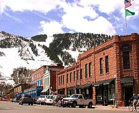 Downtown Aspen | |
| Etymology: From trees around the city | |
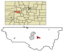 Location of Aspen in Pitkin County, Colorado. | |
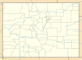 Aspen Location of Aspen in Colorado  Aspen Aspen (the United States) 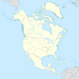 Aspen Aspen (North America) | |
| Coordinates (39.1911° N, 106.8175° W): | |
| Country | |
| State | |
| County | Pitkin |
| Settled | 1879 |
| Incorporation | 1881 |
| Government | |
| • Type | Home Rule Municipality, council-manager |
| • City manager | Sarah Ott |
| • Mayor | Torre |
| Area | |
| • Total | 3.88 sq mi (10.05 km2) |
| • Land | 3.88 sq mi (10.05 km2) |
| • Water | 0 sq mi (0 km2) |
| Elevation (average) | 8,000 ft (2,438.4 m) |
| Highest elevation (At SW corner of city boundary) | 8,460 ft (2,580 m) |
| Lowest elevation (Roaring Fork at N corner of city) | 7,660 ft (2,330 m) |
| Population (2010) | |
| • Total | 6,658 |
| • Estimate (2018)[2] | 7,365 |
| • Density | 1,770.88/sq mi (683.81/km2) |
| Time zone | UTC−7 (MST) |
| • Summer (DST) | UTC−6 (Mountain Daylight Time) |
| ZIP Code | 81611, 81612 (PO Boxes) |
| Area code(s) | 970 |
| FIPS code | 08-03620 |
| INCITS place code | 0803620 |
| GNIS feature ID | 0204686 |
| Wikimedia Commons | Aspen, Colorado |
| Website | cityofaspen |
Founded as a mining camp during the Colorado Silver Boom and later named "Aspen" because of the abundance of aspen trees in the area, the city boomed during the 1880s, its first decade of existence. The boom ended when the Panic of 1893 led to a collapse in the silver market, and the city began a half-century known as "the quiet years" during which its population steadily declined, reaching a nadir of fewer than a thousand by 1930. Aspen's fortunes reversed in the mid-20th century when neighboring Aspen Mountain was developed into a ski resort, and industrialist Walter Paepcke bought many properties in the city in the 1950s and redeveloped them. Today it is home to three institutions, two of which Paepcke helped found, that have international importance: the Aspen Music Festival and School, the Aspen Institute, and the Aspen Center for Physics.[5]
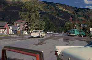
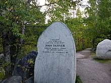
In the late 20th century, the city became a popular retreat for celebrities. Gonzo journalist Hunter S. Thompson worked out of a downtown hotel and ran unsuccessfully for county sheriff. Singer John Denver wrote two songs about Aspen after settling there. Both of them popularized Aspen among the counter-cultural youth of the 1970s as an ideal place to live, and the city continued to grow even as it gained notoriety for some of the era's hedonistic excesses (particularly its drug culture).
Aspen has some of the most expensive real estate in the United States. It remains a popular tourist destination, with outdoor recreation in the surrounding White River National Forest serving as a summertime complement to the four ski areas in the vicinity.
History
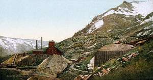
_from_the_Mollie_Gibson_Mine_near_Aspen%2C_central_Pitkin_County%2C_west-central_Colorado%2C_USA.jpg)
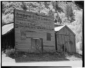
The city's roots are traced to the winter of 1879, when a group of miners ignored pleas by Frederick Pitkin, Governor of Colorado, to return across the Continental Divide to avoid a Ute uprising. The Utes were fighting to maintain possession of their land and communities. Originally named Ute City, the small community was renamed Aspen in 1880, and, in its peak production years of 1891 and 1892, surpassed Leadville as the United States' most productive silver-mining district.[6] Production expanded due to the passage of the Sherman Silver Purchase Act of 1890, which doubled the government's purchase of silver. By 1893, Aspen had banks, a hospital, a police department, two theaters, an opera house, and electric lights. Economic collapse came with the Panic of 1893, when President Cleveland called a special session of congress and repealed the act. Within weeks, many of the Aspen mines were closed and thousands of miners were put out of work. It was proposed that silver be recognized as legal tender and the People's Party (populists) adopted that as one of its main issues. Davis H. Waite, an Aspen newspaperman and agitator, was elected governor of Colorado on the Democratic ticket, but in time the movement failed.
Eventually, after wage cuts, mining revived somewhat, but production declined and by the 1930 census only 705 residents remained. Remaining, however, were stocks of old commercial buildings and residences, along with excellent snow. Aspen's development as a ski resort began in the 1930s when investors conceived of a ski area, but the project was interrupted by World War II. Friedl Pfeifer, a member of the 10th Mountain Division who had trained in the area, returned to the area and linked up with industrialist Walter Paepcke and his wife Elizabeth. The Aspen Skiing Corporation was founded in 1946 and the city quickly became a well-known resort, hosting the FIS World Championships in 1950. Paepcke also played an important role in bringing the Goethe Bicentennial Convocation to Aspen in 1949, an event held in a newly designed tent by the architect Eero Saarinen. Aspen was then on the path to becoming an internationally known ski resort and cultural center, home of the Aspen Music Festival and School. The area would continue to grow with the development of three additional ski areas, Buttermilk (1958), Aspen Highlands (1958), and Snowmass (1967).
In 1978, Aspen was thoroughly photographed for the Aspen Movie Map project funded by the U.S. Department of Defense. The Movie Map is one of the earliest examples of virtual reality software.[7]
In 1999, the city council passed a resolution to petition the US Congress and President Clinton to restrict US immigration. Aspen residents cited concerns about the environmental impacts of increased immigration on their community, including urban and suburban sprawl, pollution from the older automobiles typically driven by immigrants, and litter accumulating in the mountains attributable to the increasing population. The impetus for the resolution was the increasing number of trailer parks that housed the migrant workers employed locally in the service sector and ski industry. The parks were perceived to be degrading to the town's image, property values, and environment. The move was led by Terry Paulson, an Aspen City Council member, and supported and guided by national groups such as the Carrying Capacity Network, and the Center for Immigration Studies. The resolution was discussed on the American Patrol Report website, contributing to a controversy over whether or not the resolution was racially motivated. Councilman Terry Paulson and some Aspen citizens insisted that it was motivated entirely by environmental concerns.[8]
Aspen is notable as the smallest radio market tracked by Arbitron, ranked number 302.
Local media in Aspen include three radio stations, KSNO, KTND, and KSPN; two daily newspapers, The Aspen Times and The Aspen Daily News; three local lifestyle magazines: Aspen Sojourner,[9] Aspen Magazine[10] and the biannual Aspen Peak; and a local, live, lifestyle television channel, Aspen 82.[11]
Government
Aspen is a home rule municipality[12] under Colorado law. It has a council-manager government. An elected council of four members and the mayor supervise the city's operations, managed on a day-to-day basis by the city manager, an appointed official who serves at their pleasure. Steve Barwick has been city manager since 1999; Steve Skadron is the mayor.
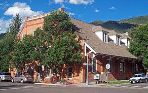
The city's main office is at City Hall, the former Armory Hall listed on the National Register of Historic Places at the intersection of South Galena Street and East Hopkins Avenue. Because of its expansion in the late-20th century, it has outgrown that space. Several city departments are housed in satellite offices around the city.
Image
The city's character has transformed dramatically in recent decades by skyrocketing property values and the proliferation of second homes, increasingly shutting low- and middle-income workers out of the city and creating a large pool of commuters from nearby bedroom communities such as Snowmass, Basalt, Carbondale, and Glenwood Springs. At the same time, in stark contrast to its historic character, the city has emerged into international fame as a glitzy playground of the wealthy and famous. Aspen has become a second and third home to many international jet-setters. Many people from the U.S. and abroad vacation in Aspen, especially during the winter.[13]
The downtown has been largely transformed into an upscale shopping district that includes high-end restaurants, salons, and boutiques. Aspen boasts Ralph Lauren, Dior, Louis Vuitton, Prada, Gucci, Moncler, Van Cleef & Arpels, Valentino, Theory and Ermenegildo Zegna shops.[14]
Real estate market
Aspen was the most expensive place to buy real estate in the US in 2011.[15] Aspen is a mixture of high-end luxury estates and condos and single-family homes and mobile home parks. As of March 2011, the lowest-priced single-family home on the market was a trailer for $559,000.[16] As of June 2015, the median listing price for homes or condos for sale in Aspen is $5,081,388, or $897 per square foot, according to Trulia.[17] It is not uncommon to see listing prices of higher-end homes reach the mid-eight figures.[17] In a 2015 survey of U.S. ski resort towns, Aspen had the second most expensive rentals, with a one-bedroom averaging $1,750.[18] The City of Aspen, along with Pitkin County, operates an extensive affordable housing program, known locally as 'employee housing.' It is administered by the Aspen Pitkin County Housing Authority, which oversees over 4,000 units in the city and county.
In 2018, Stephane de Baets facilitated the first major commercial real estate transaction using blockchain technology to sell ownership stakes in the Aspen St. Regis Resort.[19]
Geography
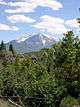
The city sits along the southeast (upper) end of the Roaring Fork Valley, along the Roaring Fork River, a tributary of the Colorado River about 40 miles (64 km) south of Glenwood Springs, Colorado. It is surrounded by mountain and wilderness areas on three sides: Red Mountain to the north, Smuggler Mountain to the east, and Aspen Mountain to the south.
Aspen is located at 39°11′32″N 106°49′28″W,[20] along State Highway 82.
According to the United States Census Bureau, the city has a total area of 3.5 square miles (9.1 km2), all land.
Climate
Under the Köppen climate classification, Aspen has a humid continental climate (Köppen: Dfb) owing to its high elevation. There is a large diurnal temperature variation between daytime and nighttime temperatures, rendering summer days moderately warm and winter nights very cold for the latitude. Summer lows and winter highs are relatively moderate, with frosts being rare in summer and winter days often averaging above freezing.
| Climate data for Aspen (1981–2010 normals, extremes 1914-1919 and 1935-present) | |||||||||||||
|---|---|---|---|---|---|---|---|---|---|---|---|---|---|
| Month | Jan | Feb | Mar | Apr | May | Jun | Jul | Aug | Sep | Oct | Nov | Dec | Year |
| Record high °F (°C) | 58 (14) |
60 (16) |
70 (21) |
79 (26) |
87 (31) |
93 (34) |
94 (34) |
92 (33) |
89 (32) |
85 (29) |
70 (21) |
62 (17) |
94 (34) |
| Mean maximum °F (°C) | 48.1 (8.9) |
51.3 (10.7) |
57.4 (14.1) |
67.3 (19.6) |
76.0 (24.4) |
84.1 (28.9) |
87.1 (30.6) |
85.4 (29.7) |
81.5 (27.5) |
72.7 (22.6) |
60.5 (15.8) |
50.2 (10.1) |
87.7 (30.9) |
| Average high °F (°C) | 35.6 (2.0) |
39.3 (4.1) |
45.6 (7.6) |
52.8 (11.6) |
63.1 (17.3) |
72.8 (22.7) |
78.4 (25.8) |
76.0 (24.4) |
69.2 (20.7) |
57.9 (14.4) |
43.9 (6.6) |
34.7 (1.5) |
55.9 (13.3) |
| Daily mean °F (°C) | 22.5 (−5.3) |
25.6 (−3.6) |
32.7 (0.4) |
39.9 (4.4) |
49.3 (9.6) |
57.6 (14.2) |
63.3 (17.4) |
61.7 (16.5) |
54.4 (12.4) |
44.0 (6.7) |
31.6 (−0.2) |
22.4 (−5.3) |
42.2 (5.7) |
| Average low °F (°C) | 9.4 (−12.6) |
12.0 (−11.1) |
19.8 (−6.8) |
27.0 (−2.8) |
35.4 (1.9) |
42.3 (5.7) |
48.1 (8.9) |
47.4 (8.6) |
39.6 (4.2) |
30.1 (−1.1) |
19.3 (−7.1) |
10.2 (−12.1) |
28.5 (−1.9) |
| Mean minimum °F (°C) | −15.6 (−26.4) |
−11.7 (−24.3) |
−4.2 (−20.1) |
8.8 (−12.9) |
20.8 (−6.2) |
27.9 (−2.3) |
36.9 (2.7) |
34.9 (1.6) |
24.7 (−4.1) |
14.1 (−9.9) |
−2.7 (−19.3) |
−10.1 (−23.4) |
−17.8 (−27.7) |
| Record low °F (°C) | −37 (−38) |
−30 (−34) |
−26 (−32) |
−10 (−23) |
14 (−10) |
15 (−9) |
29 (−2) |
27 (−3) |
15 (−9) |
3 (−16) |
−19 (−28) |
−23 (−31) |
−37 (−38) |
| Average precipitation inches (mm) | 1.70 (43) |
2.21 (56) |
2.66 (68) |
2.57 (65) |
2.10 (53) |
1.31 (33) |
1.91 (49) |
1.67 (42) |
2.05 (52) |
2.17 (55) |
2.45 (62) |
2.13 (54) |
24.93 (633) |
| Average snowfall inches (cm) | 25.2 (64) |
22.2 (56) |
24.2 (61) |
12.5 (32) |
3.2 (8.1) |
0.7 (1.8) |
0 (0) |
0 (0) |
1.5 (3.8) |
6.7 (17) |
17.6 (45) |
23.1 (59) |
136.9 (348) |
| Average precipitation days (≥ 0.01 in) | 12 | 12 | 12 | 12 | 11 | 7 | 11 | 12 | 10 | 9 | 10 | 12 | 130 |
| Average relative humidity (%) | 62.9 | 60.0 | 54.1 | 50.1 | 46.9 | 42.8 | 47.4 | 52.3 | 50.6 | 52.3 | 59.7 | 64.5 | 53.6 |
| Mean daily sunshine hours | 7 | 8 | 8 | 9 | 10 | 11 | 10 | 9 | 9 | 8 | 6 | 6 | 8 |
| Average ultraviolet index | 2 | 4 | 6 | 8 | 10 | 11 | 11 | 10 | 8 | 5 | 3 | 2 | 7 |
| Source: WRCC (temperature and precipitation data 1981–2010, snowfall 1899–1979),[21][22] Weatherbase (humidity)[23] and Weather Atlas (daily sunshine hours and UV index)[24] | |||||||||||||
Demographics
| Historical population | |||
|---|---|---|---|
| Census | Pop. | %± | |
| 1890 | 5,108 | — | |
| 1900 | 3,303 | −35.3% | |
| 1910 | 1,834 | −44.5% | |
| 1920 | 1,265 | −31.0% | |
| 1930 | 705 | −44.3% | |
| 1940 | 777 | 10.2% | |
| 1950 | 916 | 17.9% | |
| 1960 | 1,101 | 20.2% | |
| 1970 | 2,437 | 121.3% | |
| 1980 | 3,678 | 50.9% | |
| 1990 | 5,049 | 37.3% | |
| 2000 | 5,914 | 17.1% | |
| 2010 | 6,658 | 12.6% | |
| Est. 2018 | 7,365 | [2] | 10.6% |
| U.S. Decennial Census[25] | |||
As of the census[26] of 2003, there were 5,914 people, 2,903 households, and 1,082 families residing in the city. The population density was 1,675.4 people per square mile (646.9/km²). There were 4,354 housing units at an average density of 1,233.5 per square mile (476.2 per km2). The racial makeup of the city was 94.94 percent White, 0.44 percent Black or African American, 0.24 percent Native American, 1.45 percent Asian, 0.08 percent Pacific Islander, 1.64 percent from other races, and 1.2 percent from two or more races. Hispanic or Latino of any race were 6.14 percent of the population.
There were 2,903 households, of which 16.5 percent had children under the age of 18 living with them, 28.8 percent were married couples living together, 5.6 percent had a female householder with no husband present, and 62.7 percent were non-families. Single individuals composed 43.8 percent of all households and 4.8 percent had someone living alone who was 65 years of age or older. The average household size was 1.94 and the average family size was 2.67.
The ages of the population were 13.1 percent under the age of 18, 9.8 percent from 18 to 24, 42.1 percent from 25 to 44, 27.6 percent from 45 to 64, and 7.4 percent who were 65 years of age or older. The median age was 37 years. For every 100 females, there were 115.1 males. For every 100 females age 18 and over, there were 117.5 males.
The median income for a household in the city was $53,750, and the median income for a family was $70,300. Males had a median income of $41,011 versus $32,023 for females. The per capita income for the city was $40,680. About 3.6 percent of families and 8.2 percent of the population were below the poverty line, including 4.4 percent of those under age 18 and 2.6 percent of those age 65 or over.
Transportation
- Roaring Fork Transportation Authority, or RFTA, provides free bus service within Aspen and Snowmass Village, and pay service to the surrounding communities of Basalt, El Jebel, Carbondale, Glenwood Springs, and Rifle. Local RFTA bus service within Aspen and to Snowmass Village is free. Amtrak serves Glenwood Springs, offering in conjunction with RFTA an environmentally friendly way to travel to Aspen.
- Aspen's airport is Aspen-Pitkin County Airport, also known as Sardy Field. The airport is an FAA Class 1 airport and has one asphalt runway, 100 ft (30 m) wide and 8,006 ft (2,440 m) long. The airport is commercially serviced by American Airlines, Delta Airlines, and United Airlines.
- State Highway 82 is the only major road that provides access to Aspen. There are some mountain pass roads that lead to the city, but those require all-terrain vehicles and are typically impassable during the winter. Highway 82 east of Aspen is also impassable due to snow on Independence Pass, leaving Highway 82 west of Aspen as the only means of motor vehicle access during the winter. Highway 82 east of Aspen is typically closed from approximately the end of October to Memorial Day, depending on snow conditions.
- The bike-sharing system WE-CYCLE serves Aspen and Basalt with 16 stations and 200 bikes. Docking stations and bikes are built by PBSC Urban Solutions.[27]
Education
As of 2012, based on data from the 2009–10 school year, according to U.S. News & World Report, Aspen High School, the only high school in the Aspen School District, is the top ranked high school in Colorado and ranked 59th in the United States. The high school has grades 9 to 12, 540 students, and 41 teachers. Olympic cross-country skier Noah Hoffman is a 2007 graduate.
Minorities, mostly Hispanic, make up 13 percent of the school's enrollment. Four percent of the students are economically disadvantaged. The school has a high rate of participation in the International Baccalaureate program.[28]
Sports
The Winter X Games sports event has been held in Aspen at Buttermilk (ski area) since 2002. Aspen natives Torin Yater-Wallace and Alex Ferreira are both freestyle skiers who compete in the Winter X Games and have very successful careers. Both Torin and Alex have represented the United States of America in Men's Ski SuperPipe at the Olympic Games.
The Gentlemen of Aspen is the local rugby team. The Gentlemen of Aspen won the Rugby Super League several times: 1997, 2001, 2002.
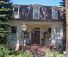
Historic buildings
 Aspen Community Church
 Wheeler Opera House
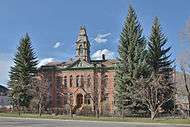 Pitkin County Courthouse
 Armory Hall or Fraternal Hall (Aspen City Hall)
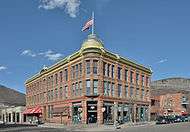 Elks building
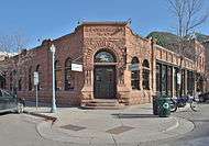 Cowenhaven Ute City Banque building
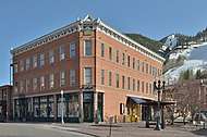 Independence building
 Hotel Jerome
Sister cities
Aspen has seven sister cities,[29] as designated by Sister Cities International: [30][31][32]


See also
- Aspen anomaly
- Aspen Skiing Company
- Aspen Mountain
- Aspen Highlands
- Aspen/Snowmass
- Buttermilk
- Smuggler Mine
- Colorado Silver Boom
- Aspen Center for Physics
- KUUR radio
- KSNO radio
- TV Aspen
- Aspen dollar, a local currency
References
- "2016 U.S. Gazetteer Files". United States Census Bureau. Retrieved July 25, 2017.
- https://www.census.gov/quickfacts/fact/table/aspencitycolorado/PST045218
- "Find a County". National Association of Counties. Archived from the original on May 31, 2011. Retrieved June 7, 2011.
- "Colorado County Seats". State of Colorado, Department of Public Health and Environment.
- "Aspen Center for Physics". Aspen Center for Physics. Retrieved July 12, 2017.
- Charles W. Henderson, 1926, Mining in Colorado, U.S. Geological Survey, Professional Paper 138, p.176, 201.
- SM '07, Erica Naone. "Déjà View". MIT Technology Review. Retrieved December 14, 2019.
- Park, Lisa Sun-Hee; Pellow, David Naguib (2011). The Slums of Aspen. New York University Press. ISBN 978-0-8147-6803-7.
- Aspen Sojourner
- Aspen Magazine
- "Aspen 82, About us". Aspen82. Retrieved December 14, 2019.
- "Active Colorado Municipalities". State of Colorado, Department of Local Affairs. Archived from the original on December 12, 2009. Retrieved 2007-09-01.
- "How Aspen became the billionaire's retreat".
- "Shopping Aspen CO Colorado + Outlet Mall - City Guide".
- "Aspen Named Most Expensive Town in America". Fox News. Fox. March 4, 2011. Retrieved November 4, 2011.
- "The town where a trailer costs $559,000: By the numbers". The Week. March 8, 2011. Retrieved November 4, 2011.
- "Aspen Real Estate Market Overview". Trulia. June 3, 2015. Retrieved June 15, 2015.
- Osberger, Madeleine (June 15, 2015). "Local salaries recovering from economic downturn". Aspen Daily News. Retrieved June 15, 2015.
- Malviya, Hitesh (2017). "Blockchain for Commercial Real Estate". doi:10.2139/ssrn.2922695. ISSN 1556-5068. Cite journal requires
|journal=(help) - "US Gazetteer files: 2010, 2000, and 1990". United States Census Bureau. February 12, 2011. Retrieved April 23, 2011.
- "General Climate Summary Tables - Aspen 1 SW, Colorado". Western Regional Climate Center. Retrieved December 6, 2012.
- "General Climate Summary Tables - Aspen Colorado". Western Regional Climate Center. Retrieved December 6, 2012.
- "Aspen, Colorado Travel Weather Averages (Weatherbase)". Weatherbase. Retrieved July 5, 2019.
- d.o.o, Yu Media Group. "Aspen, CO - Detailed climate information and monthly weather forecast". Weather Atlas. Retrieved July 5, 2019.
- "Census of Population and Housing". Census.gov. Retrieved June 4, 2015.
- "U.S. Census website". United States Census Bureau. Retrieved 2008-01-31.
- "Bike sharing comes to Aspen | AspenTimes.com". The Aspen Times. Retrieved August 1, 2016.
- "Aspen High School Overview". US News & World Report. Retrieved June 4, 2012.
- Robbie, Erica (October 8, 2015). "Aspen adds Abetone, Italy as seventh Sister City". Aspen Times. Swift Communications. Retrieved January 21, 2016.
- "Aspen Sister Cities". City of Aspen, Colorado Website. January 21, 2016. Archived from the original on January 26, 2016. Retrieved January 21, 2016.
- "Aspen Sister Cities". Aspen Chamber of Commerce. Retrieved January 21, 2016.
- "Sister Cities International Membership Directory". Sister Cities International. 2015. Retrieved January 21, 2016.
Further reading
- Berger, Bruce. The Complete Half-Aspenite WHO Press, 2005, ISBN 1-882426-22-3
- Berger, Bruce. Music in the Mountains: The First Fifty Years of the Aspen Music Festival Johnson Books, 2001, ISBN 1-55566-311-7
- Rohrbough, Malcolm. Aspen: The History of a Silver Mining Town 1879–1893 Oxford University Press, 1988, ISBN 0-19-505428-8
- Wentworth, Frank L. Aspen on the Roaring Fork, Sundance Publication, hardcover, ISBN 0-913582-15-8 (earlier editions exist), Wentworth lived in Aspen (1866–1942),
External links
| Wikimedia Commons has media related to Aspen, Colorado. |
| Wikivoyage has a travel guide for Aspen. |
- City of Aspen website
- CDOT map of the City of Aspen
- Aspen Chamber of Commerce
- Aspen Pitkin County Housing Authority
- Aspen Fire Protection District
Roaring Fork Valley | ||
|---|---|---|
| Major cities |
|  |
| Other communities |
| |
| Near valley |
| |
| Ski resorts |
| |
| Bodies of water |
| |
Municipalities and communities of Pitkin County, Colorado, United States | ||
|---|---|---|
| City |  Map of Colorado highlighting Pitkin County | |
| Towns |
| |
| CDPs |
| |
| Unincorporated communities |
| |
| Ghost towns |
| |
| Footnotes | ‡This populated place also has portions in an adjacent county or counties | |
Denver (capital) | ||
| Topics |
|  Seal of Colorado |
| Society |
| |
| Regions |
| |
| Municipalities |
| |
| Counties |
| |
| Authority control |
|
|---|