Zigi River
Zigi River, in literature also often Sigi River (Swahili: Sigi Mto), is a river in the Tanga Region in Tanzania.
| Zigi River | |
|---|---|
 | |
| Location | |
| Country | Tanzania |
| Physical characteristics | |
| Mouth | |
⁃ location | 40 km (25 mi) north of Tanga in the Indian Ocean |
| Length | 100 km (62 mi) |
| Basin features | |
| Tributaries | |
| ⁃ left | Musi |
| ⁃ right | Kihuhui |
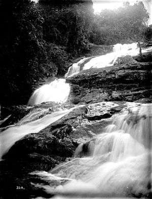
The river rises in the Amani Nature Reserve in the Usambara Mountains, more precisely in Handei Mountains, at an altitude of 1130 meters and flows for 100 km long course and multiple changes of direction 40 km north of the town of Tanga in the Indian Ocean. Its tributaries are the Kihuhui (from south) and the Musi (from North).
Hydrometrie
Average monthly flow of Zigi measured at the hydrological station in Lanconi Estate, about 10 km above the Mabayani Dam in m³ / s (1957 - 1990).[1] The Zigi flows stimulate time-dependent, like most rivers in the region.

References
- "Temporal Flow Variations: A Challenge for Water Management in Tanzania" (PDF). Department of Water Resources Engineering, Dar Es Salaam. Retrieved 7 December 2011.
This article is issued from Wikipedia. The text is licensed under Creative Commons - Attribution - Sharealike. Additional terms may apply for the media files.