Yamba, New South Wales
Yamba is a locality in northern New South Wales, Australia at the mouth of the Clarence River. The first European to visit the area was Matthew Flinders, who stopped in Yamba Bay for six days in July 1799.[2]
| Yamba New South Wales | |||||||||
|---|---|---|---|---|---|---|---|---|---|
 Clarence Head lighthouse, Yamba | |||||||||
Yamba | |||||||||
| Coordinates | 29°26′S 153°21′E | ||||||||
| Population | 6,043 (2016)[1] | ||||||||
| Established | 1854 | ||||||||
| Postcode(s) | 2464 | ||||||||
| Elevation | 29 m (95 ft) | ||||||||
| Location | |||||||||
| LGA(s) | Clarence Valley Council | ||||||||
| State electorate(s) | Clarence | ||||||||
| Federal Division(s) | Page | ||||||||
| |||||||||
The town economy is strongly based on fishing and tourism, but has a diverse range of influences, due to the 'Sea Change' phenomena and the large number of baby boomers who are starting to retire to the warmer climates.[3]
At the 2016 census, Yamba had a population of 6,043,[1] but as a popular tourist destination, it can triple its population in the holiday period. In 2009 Yamba was voted the number 1 town in Australia by Australian Traveller Magazine.[4]
Yamba is known to have experienced the natural phenomenon known as sea foam.[5][6][7][8]
History
The Yaegl and Bundjalung people are the traditional custodians of the coastal areas around Yamba, Iluka and Maclean.[9] The ancestors of the present day Yaegl people lived around the mouth of the Clarence River and spoke Yaygirr which was closely related to Gumbaynggirr.[10] There is evidence the Yaygirr had permanent settlements and a developed material culture. Matthew Flinders (1799) described large bark huts with rounded passageway entrances to protect dwellers from wind and rain. Similarly Captain Perry (1839) described canoes of a superior construction. (See Eleanor H McSwan’s ‘A history of Yamba and Iluka’)
In 1799 Matthew Flinders landed on the present southern headland at Yamba. He’d been despatched from Sydney to find a new Eden, but from his vantage point atop a craggy promontory, now Pilot Head, he dismissed the turbulent estuary as dangerous and unworthy of further examination, and then sailed away. In the 1830s, timber harvesting commenced. In 1861, the townsite was surveyed, and by October 1862 construction of the breakwater Clarence River Heads Post Office was completed. Originally named Shoal Bay in 1885, it was renamed Yamba with a population of approx 340.[11]
In 1908 the Yamba Surf Lifesaving Club was formed and is one of the oldest surf clubs in the world.[12] Yamba began to develop as a tourist destination in the 1930s following the arrival of the railway line at nearby Grafton. Guesthouses were replaced by motels and holiday apartments following the sealing of the main road in 1958, with visitors now able to use bridges rather than punts and ferries.
Fishing and oyster industries were established in the 1880s, with prawn trawling pioneered in the 1940s. Sugar cane farming is now the major cropping industry in the region following full mechanisation of the cane cutting process in 1978.[13] Riverboats and steamers that plied between Grafton and Sydney were gradually replaced by rail and better road connections from the 1970s.
Etymology
There are two theories as to the meaning of Yamba, one being that it is the local Aboriginal word for "headland". However, J.S. Ryan, following R.L. Dawson's early Recollections and Records of the Clarence Aborigines, believes the most likely derivation is an Aboriginal word yumbah meaning a rough edible shellfish the size of a man's hand that clings to rocks and is similar to an oyster.[14]
Port of Yamba
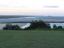
Since 1 December 2011, the Port of Yamba has been managed by the Sydney Ports Corporation,[15] which on 1 July 2014 became the Port Authority of New South Wales,[16] a corporation owned by the Government of New South Wales. The major export from the port is timber. There are regular general cargo services from Yamba to Lord Howe Island, Norfolk Island, and New Zealand.[17]
In year ended 30 June 2012, the port handled approximately 6,000 tonnes (5,900 long tons) of cargo and vessels up to 120 metres (390 ft) in length. In addition to the Port wharf, Yamba has privately owned slipway and repair wharves.[18]
Surrounds
Yamba is surrounded by Yuraygir National Park, the Clarence River, Pacific Ocean and rural land. The town is within reach of Ballina, Lismore and Grafton. Yamba is only an hour from Byron Bay, two hours from Coffs Harbour and the Gold Coast and three hours from Brisbane. It is also a two-hour flight from Sydney.
Beaches
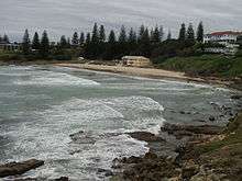
Yamba boasts eleven beaches[19] within the 2464 postcode: Whiting, Turners, Yamba (Main), Convent/McKittricks, Pippi, Flat Rock (Barri Point), and Barri (known locally as Dump Beach). Nearby beaches to the north include Woody Head, Iluka Bluff, Back Beach (Iluka), and to the south Green Point, Spooky, Angourie Bay, Angourie Point, Back Beach (Angourie), Shelley, Caves, and Plumbago.[20]
Climate
Yamba has a humid subtropical climate (Cfa according to the Köppen climate classification system).
| Climate data for Yamba (Yamba Pilot Station, 1877–2016) | |||||||||||||
|---|---|---|---|---|---|---|---|---|---|---|---|---|---|
| Month | Jan | Feb | Mar | Apr | May | Jun | Jul | Aug | Sep | Oct | Nov | Dec | Year |
| Record high °C (°F) | 42.5 (108.5) |
41.5 (106.7) |
34.7 (94.5) |
33.1 (91.6) |
29.4 (84.9) |
28.1 (82.6) |
29.6 (85.3) |
36.1 (97.0) |
35.7 (96.3) |
38.6 (101.5) |
41.9 (107.4) |
39.9 (103.8) |
42.5 (108.5) |
| Average high °C (°F) | 26.7 (80.1) |
26.8 (80.2) |
26.1 (79.0) |
24.3 (75.7) |
21.8 (71.2) |
19.6 (67.3) |
19.0 (66.2) |
20.1 (68.2) |
22.0 (71.6) |
23.4 (74.1) |
24.7 (76.5) |
26.0 (78.8) |
23.4 (74.1) |
| Average low °C (°F) | 20.2 (68.4) |
20.3 (68.5) |
19.3 (66.7) |
16.5 (61.7) |
13.3 (55.9) |
10.8 (51.4) |
9.7 (49.5) |
10.5 (50.9) |
13.0 (55.4) |
15.4 (59.7) |
17.4 (63.3) |
19.1 (66.4) |
15.5 (59.9) |
| Record low °C (°F) | 14.4 (57.9) |
14.5 (58.1) |
8.7 (47.7) |
7.2 (45.0) |
5.7 (42.3) |
2.7 (36.9) |
2.8 (37.0) |
3.1 (37.6) |
6.2 (43.2) |
6.7 (44.1) |
10.0 (50.0) |
10.9 (51.6) |
2.7 (36.9) |
| Average rainfall mm (inches) | 139.9 (5.51) |
158.5 (6.24) |
183.0 (7.20) |
162.8 (6.41) |
156.5 (6.16) |
134.4 (5.29) |
101.5 (4.00) |
75.3 (2.96) |
59.1 (2.33) |
78.5 (3.09) |
94.1 (3.70) |
116.9 (4.60) |
1,466.4 (57.73) |
| Average precipitation days | 12.6 | 13.7 | 15.8 | 13.4 | 12.4 | 10.6 | 9.2 | 8.1 | 8.4 | 9.7 | 10.2 | 11.3 | 135.4 |
| Average relative humidity (%) | 75 | 75 | 74 | 71 | 67 | 65 | 61 | 60 | 64 | 70 | 72 | 75 | 69 |
| Source: Bureau of Meteorology[21] | |||||||||||||
Culture
The town has a relaxed lifestyle with access to two pubs and two clubs, The Pacific Hotel and Yamba Shores Tavern, a golf Club and a bowling club all with regular live performances. Yamba also has sporting and recreation groups such as the Yamba Buccaneers rugby union club and the Yamba Breakers football club, the Yamba Community Heated Pool[22] and Raymond Laurie Sports Centre,[23] plus restaurants, a YHA, eateries, cafes, internet facilities, cinema, primary schools, churches, golf course, library, post office, banks, bowling greens and a large deep-water marina.
Peak tourist seasons are Dec/Jan, Easter, mid year and October. Yamba is also home to the Lower Clarence and Surrounds FM Community Radio Station TLC FM 100.3.[24]
Attractions
At the northern tip of Pippi beach is "Lovers Point Rock Wall". Between May - October whales can be seen passing by.[25] Dolphins are plentiful all around Yamba and can be observed swimming, surfing and fishing quite close to shore. Other attractions include Yamba Lighthouse also known as Clarence River Light, Story House museum, the ferry to Iluka on the northern banks, Yuraygir and Bundjalung National Parks and the surf beach at Angourie. There are also a number of local restaurants and boast cruises available. Popular activities include fishing, surfing, kayaking, bike riding and camping.[26]
Located at Ford Park on the 4th Sunday of every month, the Yamba River Markets showcases local musicians, fresh produce from local farmers, food stalls, and arts and craft tents. Once a year Yamba hosts "Surfing The Coldstream Festival", delivering an outdoor community stage with predominately root based music that is broad enough to excite the demographic spread of residents and visitors. The performers share their acts, drumming, dancing, cultural art exhibitions, food and amusement rides.
Transport
Buses run through Yamba. The nearest airport is Grafton Airport (YGFN) and there is a private airstrip on Palmers Island, just outside Yamba. Alternatively Yamba is serviced by Lismore Regional Airport located 92 km to the north and offering several daily flights to Sydney.[27]
Schools
Note: There is no high school in Yamba. Most Yamba high school students attend Maclean High School.
Notable people
- Kay Cottee,[3] sailor who circumnavigated the world
- Ry Cuming, musician best known as the lead singer of electro-psych outfit The Acid
- Peter Cousens AM Actor singer director. Best known for Musical Theatre. Les Miserables Phantom of the Opera and Miss Saigon
- Kane Douglas, New South Wales Waratahs Rugby Union player
- Luke Douglas, Cronulla-Sutherland Sharks and Gold Coast Titans NRL player
- Cameron Pilley, professional squash player
- Morgan Pilley, professional endurance mountain bike rider living in Italy
- Tony Priddle, St. George Dragons NRL player
- Laurie Towner, big-wave surfer
- Donna Urquhart, professional squash player
Newspapers
- The Daily Examiner
- Coastal Views
- The Clarence Valley Review
- The Independent
External links
References
- Australian Bureau of Statistics (27 June 2017). "Yamba (Urban Centre/Locality)". 2016 Census QuickStats. Retrieved 22 June 2020.

- The Port of Yamba Historical Society (1996). "Historical Walk around Yamba" (PDF). Clarence River Tourism. Archived from the original (pdf) on 22 August 2006. Retrieved 21 December 2006.
- "God's country prepares for invasion". 25 March 2009.
- Lee Atkinson, Fleur Bainger, Ken Boundy, Matt Cleary, Kerry van der Jagt, Sally Obermeder, Peter Robinson, Peter Russell-Clarke, Inger Vandyke, Justin Wastnage, Allan Whiting, The MyPOWER Team,100 Best Towns in Australia - Australian Traveller Magazine, 25 March 2009.
- Samantha Williams, Yamba hit by foam lather, The Daily Telegraph, 27 August 2007. Accessed 5 November 2010
- Eric Shackle, Australia Foams at the Mouth, OhmyNews, 26 January 2008. Accessed 5 November 2010
- Brett M.Christensen, Whipped Ocean – Beach Foam at Yamba New South Wales, Hoax-Slayer.com, August 2008. Accessed 5 November 2010
- Ana Vlastaras, BBC films in Yamba - DailyExaminer, 18 July 2011.
- "First Peoples". Yamba Museum. Port of Yamba Historical Society. 9 April 2014. Retrieved 22 August 2016.
- "Yaygirr Language Revitalisation « Muurrbay Aboriginal Language and Culture Co-operative". www.muurrbay.org.au. Retrieved 22 August 2016.
- Premier Postal History. "Post Office List". Premier Postal Auctions. Retrieved 26 May 2011.
- "Yamba Surf Lifesaving Club". Retrieved 22 August 2016.
- "Development and Growth". Yamba Museum. Port of Yamba Historical Society. 2 July 2014. Retrieved 22 August 2016.
- "History of the Yamba Area". Keith Howland and Stuart Lee: "Yamba Yesterday; A Retrospective View: 1885-1985". (first ed.). Yamba Centenary Committee. 1985. ISBN 0958969108. Retrieved 21 June 2008.
- "Annual Report 2011/2012" (PDF). Sydney Ports Corporation. 28 September 2012. p. 3. Retrieved 4 January 2019.
- Annual Report 2014/15 page 11 Port Authority of NSW
- "Port of Yamba". New South Wales Regional Ports. New South Wales Maritime Authority. 2006. Retrieved 14 December 2006.
- "Annual Report 2011/2012" (PDF). Sydney Ports Corporation. 28 September 2012. p. 28. Retrieved 1 June 2013.
- http://beachsafe.org.au/#q=Yamba&latitude=-29.437827&longitude=153.3602722&page= beachsafe.org.au. Retrieved 3 July 2016
- Yuraygir National Park environment.nsw.gov.au. Retrieved 3 July 2016
- "Yamba Pilot Station". Climate statistics for Australian locations. Bureau of Meteorology. Retrieved 23 April 2016.
- "Yamba Community Heated Pool – Welcome".
- "The Raymond Laurie Sports Centre".
- "Welcome to TLC FM 100.3 | TLC FM 100.3". tlcfm.com.au. Retrieved 22 August 2016.
- Rodney Stevens, Whale of a day for special kids - DailyExaminer, 15 August 2011.
- "what to see & do". Site. Clarence River Tourism. Retrieved 14 October 2011.
- "Lismore Regional Airport". Lismore City Council. Retrieved 22 August 2016.