Winnipeg Route 70
Route 70 is a city route in Winnipeg, Manitoba, Canada. It runs from Route 57 (Notre Dame Avenue) to Route 42 (Pembina Highway).[2]
| ||||
|---|---|---|---|---|
| Sherbook Street / Maryland Avenue Academy Road Stafford Street | ||||
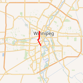
Route 70 highlighted in red | ||||
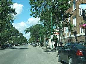 Maryland Street heading north | ||||
| Route information | ||||
| Maintained by City of Winnipeg | ||||
| Length | 5.5 km[1] (3.4 mi) | |||
| Existed | 1966–present | |||
| Major junctions | ||||
| South end | Route 42 (Pembina Hwy) | |||
| ||||
| North end | Route 57 (Notre Dame Ave) | |||
| Highway system | ||||
| Manitoba provincial highways Winnipeg City Routes
| ||||

Route Description
The route has many street names along its length, listed as follows, north to south:
| Street Name | Speed limit | From | To |
|---|---|---|---|
| Stafford Street | 50 km/h | Academy Road | |
| Academy Road | 50 km/h | Stafford Street | Maryland Bridge |
| Sherbrook Street (one-way northbound) | 50 km/h | Maryland Bridge | |
| Maryland Street (one-way southbound) | 50 km/h | Maryland Bridge |
Street Names
Both Maryland and Sherbrook Streets were originally named Boundary and Milligan Streets. Boundary Street ran along the original western boundary of Winnipeg before the city expanded westward to St. James Street in 1882. Maryland Street is named after the Maryland estate that was formerly located on that road, which was owned by James Milligan, the namesake of Milligan Street.[3][4]
Stafford Street is named after Ralph de Stafford, 1st Earl of Stafford. [3]
Major intersections
From south to north:[2]
| Street Name | Location | km[1] | mi | Destinations | Notes |
|---|---|---|---|---|---|
| Stafford Street | Fort Rouge | 0.0 | 0.0 | No access to Route 42 north; Route 70 southern terminus | |
| 0.7 | 0.43 | ||||
| 1.4 | 0.87 | ||||
| 2.3 | 1.4 | Academy Road | Route 70 branches east onto Academy Road | ||
| Academy Road | 2.7 | 1.7 | Wellington Crescent | ||
| Assiniboine River | 2.9 | 1.8 | Maryland Bridge Academy Road east end • Maryland Street / Sherbrook Street south end (one-way transition) | ||
| Sherbrook Street (northbound) Maryland Street (southbound) | Downtown | 3.8 | 2.4 | ||
| 4.1 | 2.5 | ||||
| 5.4– 5.5 | 3.4– 3.4 | Route 57 one-way transition; Route 70 northern terminus | |||
| Sherbrook Street | Maryland Street north end (one-way transition) | ||||
| 6.3 | 3.9 | ||||
1.000 mi = 1.609 km; 1.000 km = 0.621 mi
| |||||
References
- Google (January 16, 2019). "Route 42 in Winnipeg, Manitoba" (Map). Google Maps. Google. Retrieved January 16, 2019.
- Sherlock Publishing (2016). Sherlock's Map of Winnipeg (Map) (20th ed.). Winnipeg: Sherlock Publishing. pp. 16, 24. ISBN 1-895229-84-7.
- History in Winnipeg Streets
- James Milligan
This article is issued from Wikipedia. The text is licensed under Creative Commons - Attribution - Sharealike. Additional terms may apply for the media files.