Winnipeg Route 150
Route 150, locally known as St. Anne's Road (French: Chemin Ste. Anne), is a major arterial route in Winnipeg, Manitoba, Canada.
| ||||
|---|---|---|---|---|
| St. Anne's Road | ||||
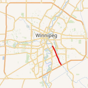
Route 150 highlighted in red | ||||
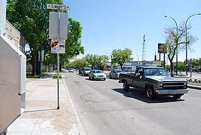 St. Anne's Road looking southward, at its junction with St. Mary's Road in north St. Vital. | ||||
| Route information | ||||
| Maintained by City of Winnipeg | ||||
| Length | 7.0 km[1] (4.3 mi) | |||
| Existed | 1966–present | |||
| Component highways | PTH 1 (Trans-Canada Highway) | |||
| Major junctions | ||||
| North end | PTH 1 west / Route 52 (St. Mary's Rd) | |||
| Route 165 (Bishop Grandin Blvd) PTH 1 east / Route 135 (Fermor Ave) | ||||
| South end | PTH 100 (TCH) (Perimeter Hwy) | |||
| Highway system | ||||
| Manitoba provincial highways Winnipeg City Routes
| ||||

It branches off from St. Mary's Road in north St. Vital and runs southeastward through central and southern St. Vital to the Perimeter Highway. It is a collector road for traffic between south St. Boniface, central and south St. Vital, and downtown. St. Anne's Road from St. Mary's Road to Fermor Avenue is part of the Trans-Canada Highway.[2]
St. Anne's Road continues south of the Perimeter Highway and ends at the Red River Floodway. This part of the road was formerly signed as Provincial Road 300.
The speed limit on Route 150 is 60 km/h (40 mph), except for the section directly north of the Perimeter Highway, where it increases to 70 km/h (45 mph).
History
Prior to the construction of the Red River Floodway and Highway 59, St. Anne's Road was a heavily used road connecting Winnipeg with the community of Ste. Anne, Manitoba and much of southeastern Manitoba, including the town of Steinbach. Sections of the original country road still exist in the Rural Municipalities of Taché and Ste. Anne, but is no longer a continuous road.[3]
Outside of Winnipeg, the road is generally spelled Ste. Anne's Road (French: Chemin Sainte-Anne).
Future
In 2013, the Manitoba government unveiled future plans to construct an interchange at the junction of the Perimeter and St. Anne's Road, to replace the at-grade intersection and traffic lights that currently exist. This plan has since been withdrawn.[4]
Major intersections
From north to south:[2] The entire route is in Winnipeg.
| km[1] | mi | Destinations | Notes | ||
|---|---|---|---|---|---|
| 0.0 | 0.0 | North end of PTH 1 concurrency | |||
| 1.1 | 0.68 | South end of PTH 1 concurrency | |||
| 3.2 | 2.0 | ||||
| 7.0 | 4.3 | ||||
1.000 mi = 1.609 km; 1.000 km = 0.621 mi
| |||||
References
- Google (January 25, 2018). "Route 150 in Winnipeg" (Map). Google Maps. Google. Retrieved January 25, 2018.
- Sherlock Publishing (2016). Sherlock's Map of Winnipeg (Map) (20th ed.). Winnipeg: Sherlock Publishing. pp. 26, 32. ISBN 1-895229-84-7.
- "The Heritage Landscape of the Crow Wing Study Region of Southeastern Manitoba". Manitoba Government Historical Resources Branch. Retrieved November 6, 2014.
- Chura, Peter (November 26, 2013). "Province plans new interchanges on south Perimeter". Global News. Shaw Media.