Hoye-Crest
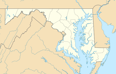
Hoye-Crest is a summit along Backbone Mountain just inside of Garrett County, Maryland. It is the highest natural point in Maryland at an elevation of 3,360 feet (1,020 m).[3]
| Hoye-Crest | |
|---|---|
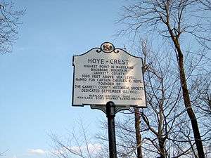 Marker at Hoye-Crest, the high point of Maryland | |
| Highest point | |
| Elevation | 3360+ ft (1024+ m) NGVD 29[1] |
| Prominence | 80 ft (24 m) [1] |
| Parent peak | Backbone Mountain |
| Listing | U.S. state high point 32nd |
| Coordinates | 39°14′14″N 79°29′07″W [2] |
| Geography | |
 Hoye-Crest | |
| Parent range | Allegheny Mountains |
| Topo map | USGS Davis |
The location, named for Captain Charles E. Hoye (1876-1951), founder of the Garrett County Historical Society, offers a view of the North Branch Potomac River valley to the east. The Maryland Historical Society placed a historical marker at the summit during a dedication ceremony in September 1952.
Accessing Hoye-Crest
There is no vehicular access to Hoye-Crest. The best route by foot is a hike along the Maryland High Point Trail, from a point along U.S. Route 219 just south of Silver Lake, West Virginia at 39°14′43″N 79°29′30″W. The trail ascends Backbone Mountain along an old logging road on Monongahela National Forest property to the West Virginia-Maryland state line. The distance is about one mile each way. The trail then heads north along the state line to the high point. Hoye-Crest sits on private property (Western Pocahontas Properties), though access is permitted.
See also
- List of U.S. states by elevation
- Backbone Mountain
- Monongahela National Forest
- Meshach Browning
References
- "Backbone Mountain, Maryland". Peakbagger.com. Retrieved 2012-11-08.
- "Hoye-Crest". Geographic Names Information System. United States Geological Survey. Retrieved 2012-11-08.
- "Backbone Mountain". SummitPost.org. Retrieved 2008-06-02.
External links
- "Backbone Mountain". SummitPost.org.
Highest natural points of U.S. states and additional U.S. areas | ||
|---|---|---|
| ||
| Additional U.S. areas | ||